Article category: Science & Technology
Accelerating Research with the Impact Science Program
Descartes Labs aims to improve science around the world with free Platform API access for...
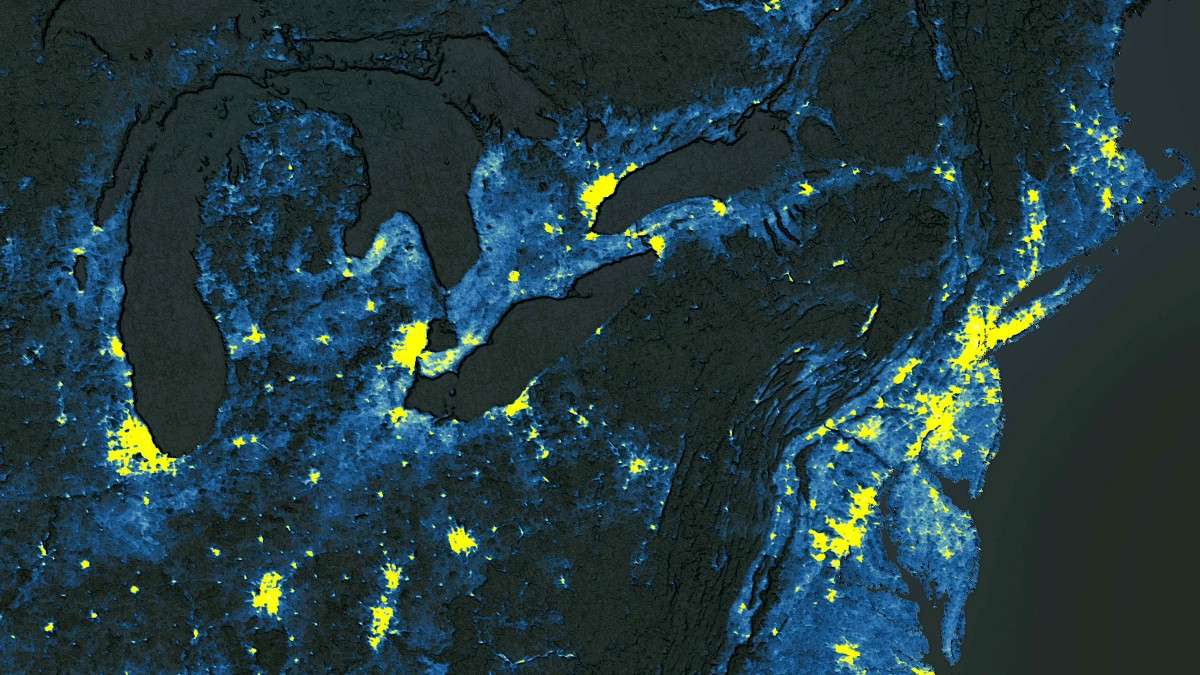
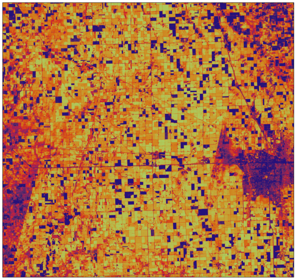
It’s widely known that lower-income urban communities are disproportionally affected by heat-related natural hazards. As a whole, fewer resources exist for vulnerable populations to take shelter from the dangerous summer heat and its negative effects are magnified when concrete is ubiquitous, driving up temperatures to levels distinguishable from satellites in space.
Our partners at The Trust for Public Land have been working to provide relief from heat islands and related environmental issues in urban communities since 1972, securing and protecting access to 3.3 million acres and creating 5,400 parks and natural places to allow urban residents to escape the built-up world and recharge within native environments. The Trust for Public Land’s website captures its mission concisely below.
Our mission is to create parks and protect land for people, ensuring healthy, livable communities for generations to come. Every park, playground, and public space we create is an open invitation to explore, wonder, discover, and play. We’re proud to say that we’ve been connecting communities to the outdoors—and to each other—since 1972. Today, millions of Americans live within a 10-minute walk of a park or natural area we helped create, and countless more visit every year.
Descartes Labs is proud to contribute to these efforts by supporting The Trust for Public Land’s Climate-Smart Cities™ program. Our Platform and Python API, with 15 petabytes of geospatial data, are helping scale the production of critical urban heat island raster data and maps behind ParkScore® and ParkServe™, two key components that help improve access to parks in cities, towns, and communities nationwide.
Through Climate-Smart Cities, The Trust for Public Land partners with city leaders and residents to design, fund, and build climate-smart parks and green spaces where they’re needed most, making lower-income neighborhoods more equitable, livable, and resilient to the effects of climate change.
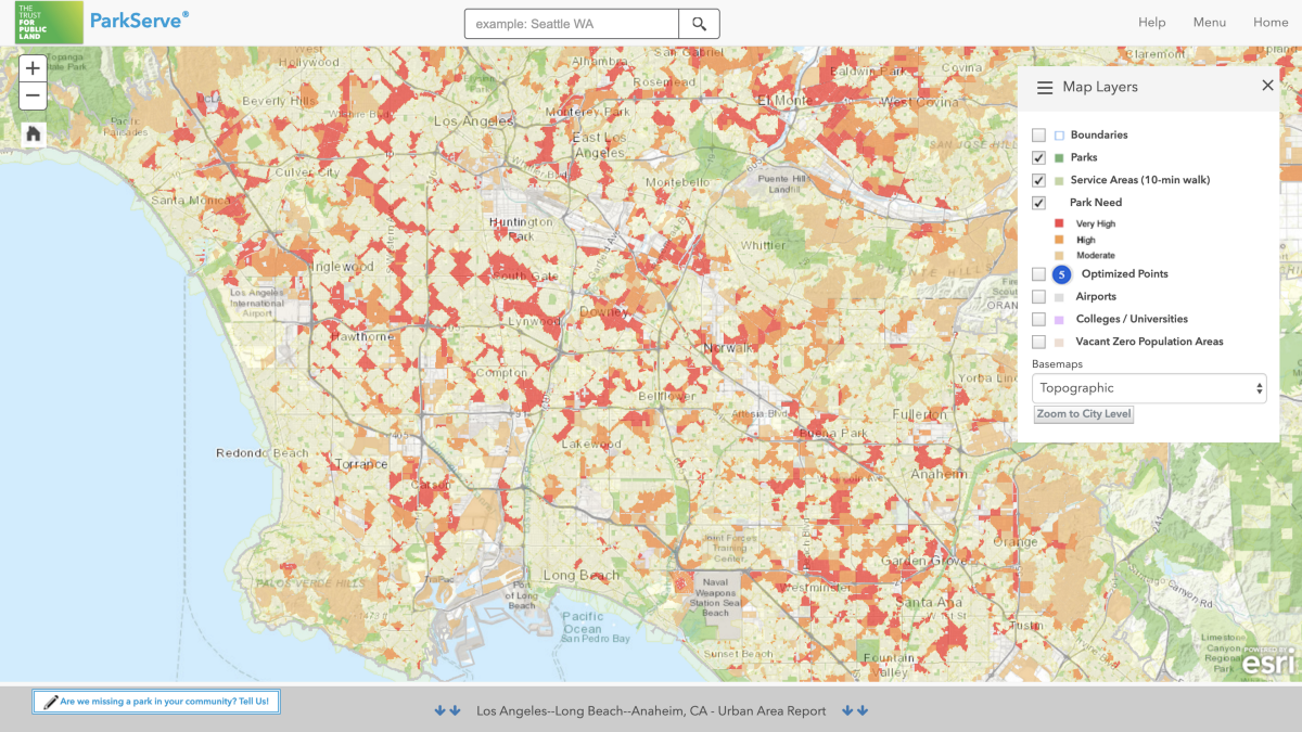
The data behind The Trust for Public Land’s funding decisions are derived from ParkScore, the most comprehensive evaluation of park access and quality in the 100 largest U.S. cities, and ParkServe, an interactive platform that tracks urban park access nationwide. ParkServe includes data from 13,931 cities and towns, covering more than 80% of the U.S. population.
These freely available web-based tools let people locate the park nearest to them, determine the percentage of residents who live within a 10-minute walk of a local park, and identify the neighborhoods most in need of new parks.
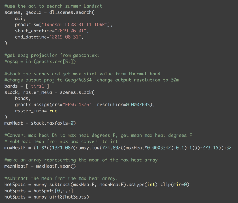
Prior to working with Descartes Labs Platform and Python API, The Trust For Public Land performed a handful of time-consuming steps to produce urban heat island raster data. Since it took about a week to process just the 100 largest US urban areas, their initial goal was to limit the build-out of the data to only those 100 large metros. The production steps they followed are listed below.
The overall development process was slow to work with, and after seeing a demo of the Descartes Labs Platform, they decided to port their code and give it a shot. What they found was a more streamlined solution that allowed them to process each city in seconds instead of hours. The time savings were so significant that it allowed The Trust for Public Land to process all 14,000 cities in the US, rather than just the 100 largest urban areas. As a result, in the coming weeks, TPL plans to add the heat island data to all 14,000 cities and towns in the ParkServe database.
The Descartes Labs Platform helped scale analysis in a number of ways:
“Where the Descartes Labs API really helped us out is by eliminating the front-end QA work, and by speeding up the processing. And processing the data using the Descartes Labs system is much faster…We’re not even using our Data Science Machine for this, we’re just running Python code from one of our Citrix servers. What was taking a week (assuming it didn’t crash) using our old process now takes a few hours.”—Pete Aniello, Senior Manager—Science and Analytics, The Trust for Public Land
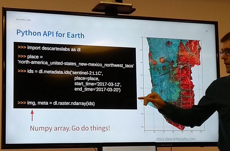
With over 15 petabytes of imagery and growing, the Descartes Labs Platform exposes satellite imagery and other geospatial data by means of Python APIs, enabling quick access to analysis-ready data. Our cross-sensor atmospheric compensation algorithms and cloud-masks significantly improve the experience of working with various satellite datasets and we’ve also developed scalable compute capabilities that let users run and scale custom Python code on our cloud infrastructure without any need to understand cloud engineering. This allows global-scale analyses to be run in hours instead of days or weeks.
With the recent release of The Trust for Public Land’s urban heat islands data as an image service and mapping application within Esri’s ArcGIS Living Atlas of the World, TPL’s efforts demonstrate its growing acknowledgment within the GIS community and its widespread availability for use by practitioners and stakeholders nationwide.
In the future, one way The Trust for Public Land is considering using the data would be to go back multiple years and see how effective their parks were at actually mitigating heat islands. Were former heat islands still present, or did the addition of a little bit of nature and tree cover mitigate the most severe effects? The impact may not be noticeable immediately, but by using the Descartes Labs platform, it’s possible to perform these analyses and go back in time as many years as necessary to see the result of the change.
Descartes Labs is proud to contribute the significant data and computing resources of our platform to the important social benefit developed by The Trust for Public Land. We look forward to partnering with TPL and others on similar geospatial processing challenges in the future.
Descartes Labs is building a digital twin of our planet. Our Python platform and API continuously ingests global satellite data from across constellations, spectrums, and modalities, cleans it, and prepares it for analysis. Contact us to learn more about how our platform can be applied to your unique situation.