Article category: Mining, Science & Technology
Hyperspectral Imaging for Mining: EnMAP Satellite Data...
Impact on Mineral Mapping Accuracy with Increased Spatial Resolution: A Case Study of EnMap versus...
Authors: Samuel Casement, Spectral Geologist; Lori Wickert, Principal Remote Sensing Geologist
In this study, we will be comparing field and in-scene derived spectral responses between Descartes Labs’ proprietary Fused Bare Earth Composite data and the German Space Agency’s EnMAP data, contrasting mineralogical interpretations that can be made between regional-scale multispectral (MS) and hyperspectral (HSI) data over Cuprite, Nevada. All mapping outputs shown here were generated on Descartes Labs’ Marigold software using our latest hyperspectral tools.
Descartes Labs' (DL) Fused Bare Earth Composite (BEC) data is a unique, combined-sensor dataset which has proven to be an excellent source of data for multispectral compositional mapping. Combining the visible-to-near infrared (VNIR) data from Sentinel-2 (9 spectral bands at 10 or 20 meter spatial resolution), and shortwave infrared (SWIR) data from the ASTER sensor (6 spectral bands at a 30 meter spatial resolution), the Bare Earth Composite was created by running a machine learning algorithm over global archives from each dataset to identify the pixel with the best exposure (least vegetation, snow, cloud and surface cover), maximizing the coverage for mineral mapping at the regional scale. Pixels were corrected for bi-directional reflectance (BRDF), sensor look-angles and corrected to surface reflectance, then mosaiced and spectrally balanced to create a multispectral 15 band dataset optimized for mineral alteration and lithologically mapping across the globe. With a total of 15 bands across the VNIR - SWIR, this Fused multispectral data is routinely used for mineral group alteration mapping in mineral exploration. As part of the process of generating the Fused BEC, DL also produced both a Sentinel-2 and ASTER BEC.
EnMAP is a hyperspectral sensor, launched by the German Space Agency (DLR) on 1st April, 2022, which made its archival data commercially available in December, 2023. The EnMAP sensor has 246 bands across VNIR and SWIR wavelengths, at the same 30 m spatial resolution as ASTER (see Figure 1). The increased number of narrow bands across the VNIR - SWIR means that each band has a much smaller width, hence narrower spectral resolution. Furthermore, the focus on high data quality (i.e. smile, keystone and signal-to-noise) in the design of this sensor have resulted in excellent on-orbit data quality, both radiometrically and geometrically. Consequently, mapping with this sensor has proven to be excellent, with the higher spectral resolution of this sensor allowing for enhanced compositional discrimination over the same wavelength range, providing the capability of mineral species mapping with this data with a high degree of confidence.

Figure 1: Graphical representation comparing DL’s Fused Multispectral dataset against the DLR’s EnMAP Hyperspectral Datasets, showing spectral ranges and resolutions.
The Cuprite mineral occurrence is a well-known, spectral reference site commonly used by the mineral exploration community to test new sensors. It is characterized as a Low Sulphidation system with High Sulphidation overprinting that has a well-developed suite of characteristic alteration minerals over mappable extents, as well as a number of unique alteration minerals that have been studied extensively and characterized both in the field and using remote sensing data by the scientific community (Ashley and Abrams, 1980; Goetz and Srivastava, 1985; Rowan et al., 1985 and Swayze et al., 2014). Figure 2 provides an overview of the site, identifying a number of well-known locations that have been previously well-characterized by Swayze et al. (2014) as a part of the USGS.

Figure 2: True Color Composite from DL’s Fused BEC over Cuprite, Nevada. Key sites of interest for spectral verification have been labeled.
With multispectral data, there are a large number of band ratios and mineral indices that are commonly used to target alteration minerals. The KLI index is often used to highlight hydrothermal alteration minerals, primarily kaolinite group minerals (kaolinite, dickite, halloysite), although it may also give a strong response for other minerals with strong Al-OH stoichiometry. Another index, the AlOH B5 index is often used to target alunite, pyrophyllite and kaolinite group minerals.
Both of these outputs highlight hydrothermal alteration at surface. However, they have very similar outputs with multispectral data such as DL’s BEC (see Figure 3), and we are not able to differentiate compositional variability for this type of alteration with these indices. This is both a function of the spectral resolution of the data (the measure of being able to discriminate spectral absorption features with a sensor, typically described by the number and width of spectral bands), as well as spectral mixing, which arises because multiple minerals will typically all occur within a relatively large 30 meter pixel and result in a mixed spectral signal.

Figure 3: Two commonly used mineral indices over Cuprite, Nevada, showing very similar product outputs relating to the mixture of spectral and spatial responses from the suite of minerals mapped by this multispectral data.
To better differentiate and identify spectral responses and potential composition, spectral signatures can be collected from the field or from the imagery (in-scene spectra) to allow for more in-depth interpretations to be made. Over Cuprite, we have both options available to us over an area named Alunite Hill (see Figure 2), named due to the area being almost solely composed of its namesake mineral (Swayze, 2014).
In laboratory spectra, alunite has a characteristic spectral signature, with a broad and wide feature around 2165 nm that differentiates it from pyrophyllite (which has a sharp signature at approximately the same central location. (Figure 4).
 Figure 4: Comparison of spectral signatures for select minerals from the USGS spectral library data.
Using ASTER multispectral imagery alone, the SWIR bands are broad with a 70 nm spectral width, which does not allow you to differentiate alunite from other potential minerals (e.g. pyrophyllite) or within mineral mixtures, whereas the narrow spectral resolution (10 nm in SWIR) from EnMAP hyperspectral data makes it possible to be able to discriminate and identify the characteristic absorption feature for alunite at this position (see Figure 5). This is further confirmed by confirming the shape of the other spectral bands at 1400, 1900 nm, etc. for each mineral. Greater confidence can be gained when comparing the in-scene spectral signature from EnMap to the spectral radiometer output collected directly by Swayze et al. over Alunite Hill. The shape of the two spectral signatures are very similar, highlighting the quality of EnMAP data.

Figure 5: Spectral graph plotting alunite spectral response from Fused, EnMAP and field spectral signatures (field spectrum from Swayze et al., 2014).
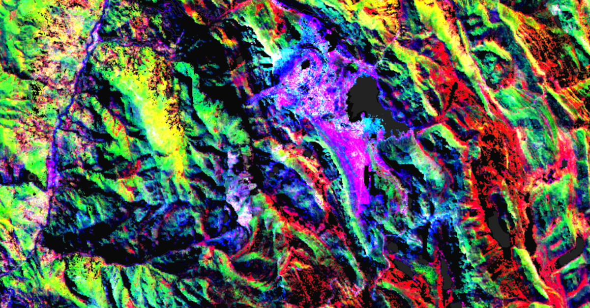
Spectral Angle Mapper (SAM) is a supervised classification technique that uses the angle between the endmember spectrum vector and each pixel vector in n-dimensional space to map the spectral similarity between a selected spectral signature and each pixel in the imagery. Comparing SAM outputs between the EnMAP and ASTER outputs (Figure 6), shows an improvement in classifying areas with alunite mineralization from hyperspectral data, compared to the multispectral classification. Between them, there are minimal differences between outputs, however we have much greater confidence that EnMAP results are targeting alunite, and not other minerals (e.g. pyrophyllite) or mineral mixtures that occur at the same spectral location.

Figure 6: Comparing SAM Classification outputs for alunite between the Fused and EnMAP spectral signatures.
Dickite Ridge and Kaolinite Hill are two more locations at Cuprite (see Figure 2) that have been named after the high proportion of their namesake minerals. As kaolinite and dickite are polymorphs, it can be challenging to differentiate them. They both share a characteristic doublet feature at 2165 nm and 2200 nm (Figure 4). With multispectral imagery, the spectral difference between the two locations over Cuprite is minimal, you are unable to differentiate the two minerals from each other. The same signature could also be caused from spectral mixing caused by minerals like alunite, pyrophyllite, sericite, illite, montmorillonite, kaolinite, dickite and other minerals. However, with EnMAP data, this characteristic doublet signature can clearly be seen. Beyond this, the two signatures can be further differentiated. An 8 nm shift can be seen between the position of the left spectral absorption for kaolinite and dickite at ~2165 nm. This same shift in spectral position was observed from the spectral signatures for kaolinite and dickite collected in the field (see Figure 7; Swayze et al., 2014).

Figure 7: Comparing in-scene Fused, EnMAP and field spectral signatures for kaolinite and dickite collected over Cuprite.
SAM classifications for the Fused and EnMap in-scene spectral signatures collected over Kaolinite Hill and Dickite Ridge show similar spatial outputs, but show differentiation in the highest classification response over key areas (Figure 8). There will be some similarity in outputs due to how similar these signatures are, as well as effects of spatial mixing at the common 30 meter resolution. The polymorphs only express a subtle change spectrally, but enough of a difference is visible within the EnMAP data to differentiate these mineral species.

Figure 8: Comparing SAM classifications using EnMAP data from in-scene spectral signatures collected over Kaolinite Hill and Dickite Ridge.
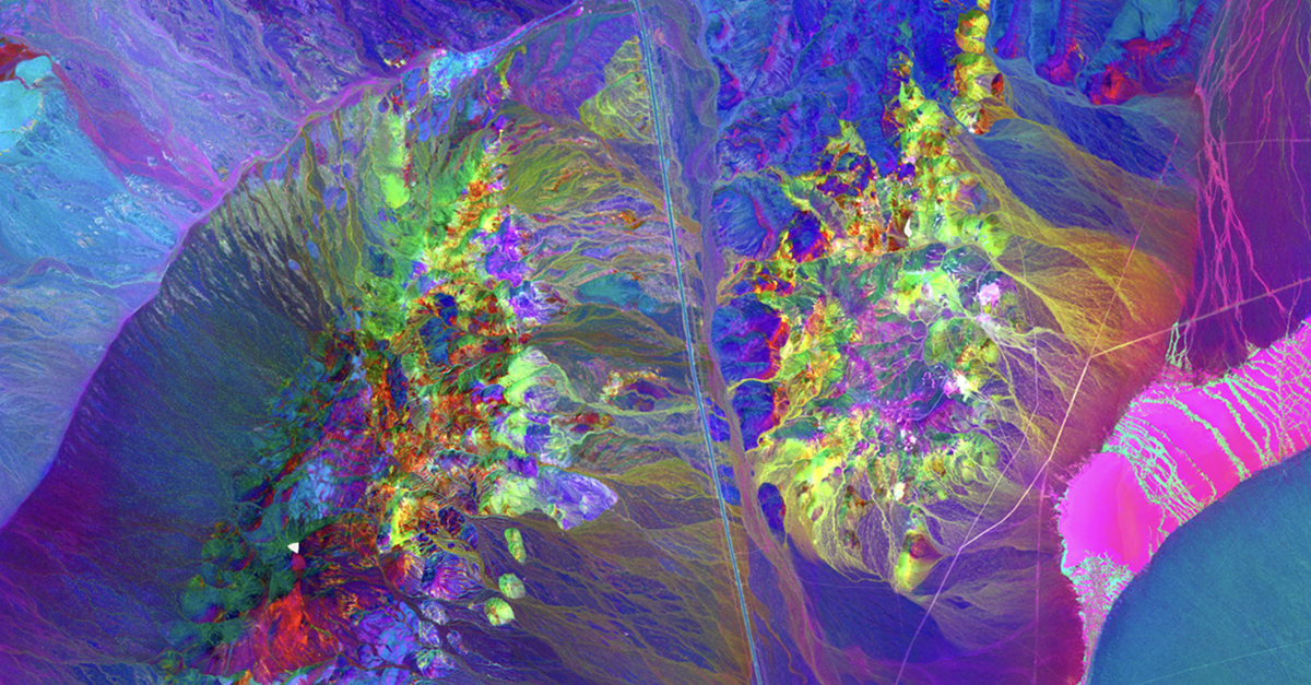
Bringing all of this spectral information together from EnMAP allows greater confidence in the mapping of specific minerals together. The three minerals discussed here are mapped in the imagery on the right. Distinct zones of alunite can be identified compared to areas of overlap between kaolinite and dickite (see Figure 9).
Having a gradational change between dickite and kaolinite at the surface makes sense due to the nature of formation of these minerals, as they are defined based on temperature and pressure gradients (as well as spatial mixing at 30 meters). EnMAP hyperspectral imagery now allows the viewer to start making interpretations about these regimes, as mineral species are now identifiable and mappable rather than just mineral groups from the multispectral datasets.
As users, it is important that the impacts of spectral mixing are taken into consideration when interpreting outputs. The high likelihood of compositional variability within the 30 meter pixel size means that it is important to factor in the potential for mixed signal responses across our imagery, creating lower confidence in our ability to identify mineral species, however the results shown here demonstrate that we still have the ability to differentiate compositional variability. The depth of analysis already done at Cuprite, both in remote sensing and in the field, allows us to go beyond this and assess the full potential of these sensors. Field spectra and compositional mapping allows us to perform sub-pixel unmixing, allowing for the interpretation of mineral signatures collected from the in-scene spectra, with the capability of identifying the presence of a mineral, even when we cannot collect a unique spectrum from this mineral from the EnMap 30 m pixels directly.

Figure 9: EnMAP Ternary Plot showing SAM Classifications of EnMAP in-scene spectra for alunite, kaolinite and dickite, mapping as shown in legend to the right.
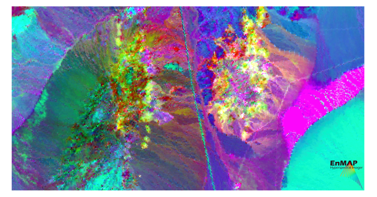
In addition to this spectral analysis, the improved spectral resolution with EnMap allows the user to differentiate more subtle or greater compositional variability over the same area. One way of demonstrating this is through unsupervised classification. A Principal Components Analysis (PCA) transformation was run over the exact same area for all bands in the VNIR and SWIR for both the Fused and EnMAP data. The first three principal components for each are displayed in Figure 10. The EnMAP data differentiates more areas of unique composition within the imagery which allows for greater compositional variability to be discerned from the data, which has positive applications in exploration for lithological and mineralogical identification, and alteration characterization from the data.

Figure 10: PCA Transformations for Fused and EnMAP datasets. Statistics calculated over the same area over Cuprite, Nevada using all spectral bands.
Having free access to EnMAP data, a dataset which will eventually have global coverage, means surface compositional mapping at the mineral species level from satellite data is achievable for the first time, despite the 30 meter resolution. With additional governmental and commercial hyperspectral satellites (many at a higher spatial resolution) launching in the near future, such mineral species mapping capabilities will continue to grow and improve, with commensurate positive impacts on the detail of information that will be available from remote sensing data to the mineral exploration community in the future.
All mapping outputs shown here were generated on Descartes Labs’ Marigold software using our latest hyperspectral tools. Please reach out if you would like more information on how hyperspectral remote sensing could benefit your exploration workflows.
Ashley, R. P., and Abrams, M.J. (1980). Alteration mapping using multispectral images: Cuprite mining district, Esmeralda County, Nevada. No. 80-367. US Geological Survey, 17p.
Goetz, A.F.H, and Srivastava, V. (1985). Mineralogical mapping in the Cuprite mining district, Nevada. Proc. of the Airborne Imaging Spectrometer Data Anal. Workshop. 31p.
Rowan, L.C., Hook, S.J., Abrams, M.J., Mars, J.C. (2003). Mapping Hydrothermally Altered Rocks at Cuprite, Nevada, Using the Advanced Spaceborne Thermal Emission and Reflection Radiometer (ASTER), a New Satellite-Imaging System. Economic Geology 98(5), pp. 1019–1027. doi: https://doi.org/10.2113/gsecongeo.98.5.1019
Swayze, G.A., Clark, R.N., Goetz, A.F.H., Livo, K.E., Breit, G.N., Kruse, F.A., Sutley, S.J., Snee, L.W., Lowers, H.A., Post, J.L., Stoffregen, R.E. and Ashley, R.P. (2014). Mapping Advanced Argillic Alteration at Cuprite, Nevada, Using Imaging Spectroscopy. Economic Geology, 109(5), pp. 1179–1221. doi: https://doi.org/10.2113/econgeo.109.5.1179