Article category: Mining, Science & Technology
Advancements in Mineral Exploration: Remote Sensing and the...
Watch video for an engaging discussion around the advancements in remote sensing, specifically,...
“Covid is ushering in a new era of policies aimed at social need instead of financial stability which will likely create cyclically stronger, more commodity-intensive economic growth, that should create the elusive cyclical upswing in demand.” — Goldman Sachs, Commodities Outlook 2021, Nov. 18, 2020
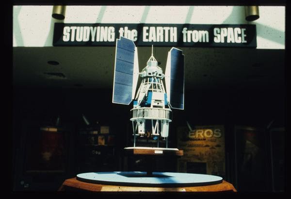
Ever since the launch of Landsat 1 in 1972, remote sensing has been used by the mining industry to map surface geology and alteration minerals associated with ore deposits of interest. Despite its usefulness, mineral targeting workflows have struggled to scale beyond individual project areas. The repetitive pre-processing steps necessary to generate each image and the massive computing power required to map across large areas have been persistent bottlenecks to exploration.
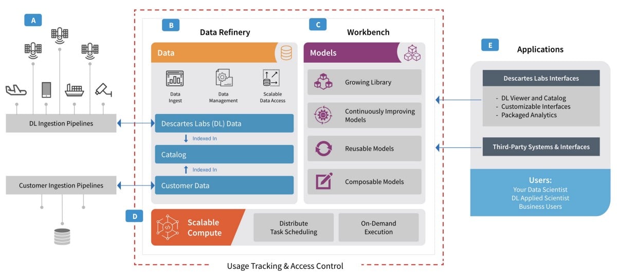
A solution to this scaling challenge is the Descartes Labs Platform, a cloud-based data refinery and geospatial processing environment. Containing over 15 petabytes of analysis-ready data, the platform empowers remote sensing specialists to build global-scale data products and processing workflows that put the interpretation tools directly into the hands of exploration geologists.
By leveraging these scalable remote sensing data and tools, they accelerate their hypothesis formulation and exploration strategies to find new deposits in days instead of months.
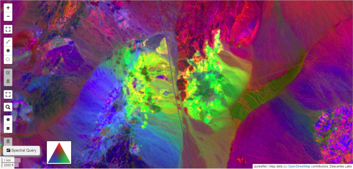
Faster mineral targeting capabilities are finally possible with our Advanced Mineral Exploration Package (AME), a mining-focused platform extension that adds specially-processed remote sensing datasets and pre-built workflows to accelerate exploration timelines.
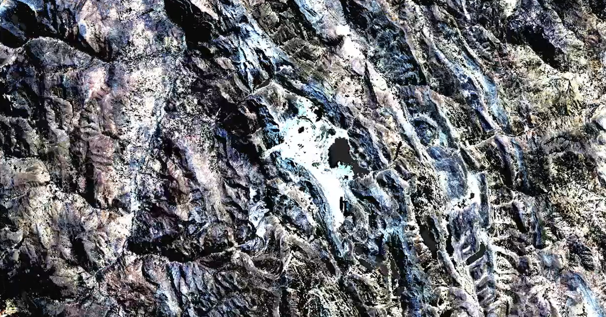
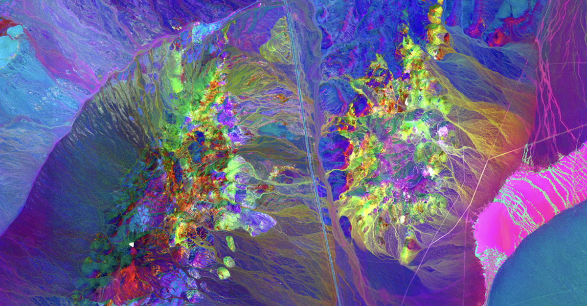
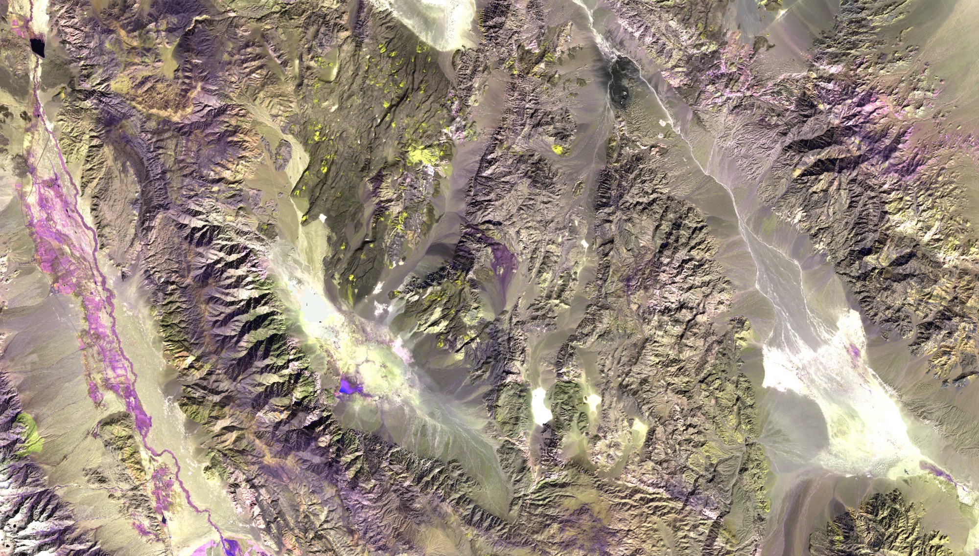
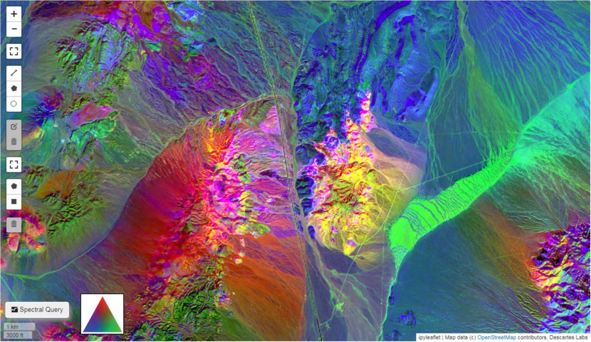
Highlights include the world’s most comprehensive “bare earth” mosaics, which surface the clearest pixel everywhere on the planet by masking out clouds, snow, vegetation, and selecting for ideal atmospheric conditions. For the first time, geoscientists can easily access the cleanest available data set for multispectral imagery anywhere on the planet.
This methodology, which is unique to Descartes Labs, results in:
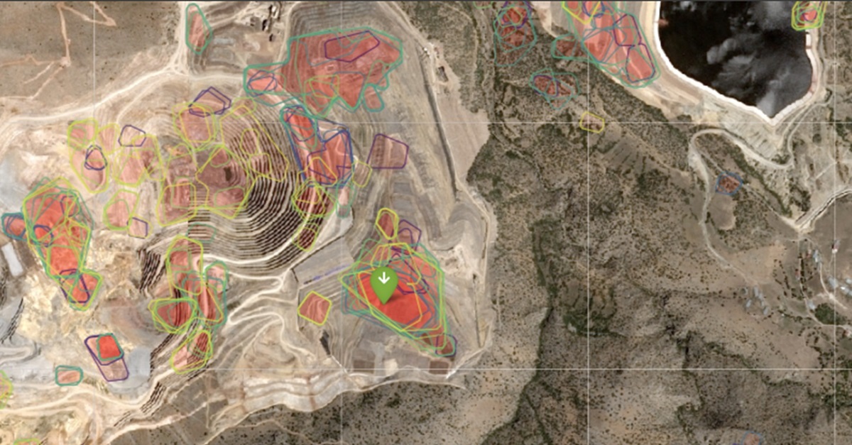
Also included in AME are pre-configured brownfield and greenfield software packages for mineral exploration. They provide a fast and easy way for geoscience teams to get started with petabytes of remote sensing data from both satellite and aerial sources.
These packages are extensible, allowing our clients to integrate their private data collections and create feedback loops by incorporating the results of ongoing drilling and exploratory operations to make mineral exploration faster and more accurate.
Finally, the AME package also includes additional support from our Geoscience Engagement Team, a group of experts with experience in remote sensing, geology, geophysics, geochemistry, GIS, data science, software development, and scalable computing. This team ensures the system produces meaningful outputs that can quickly be operationalized.
To summarize, our Advanced Mineral Exploration package allows geologists to train exploration models using known deposits and instantly scale to an entire region, country, or continent.
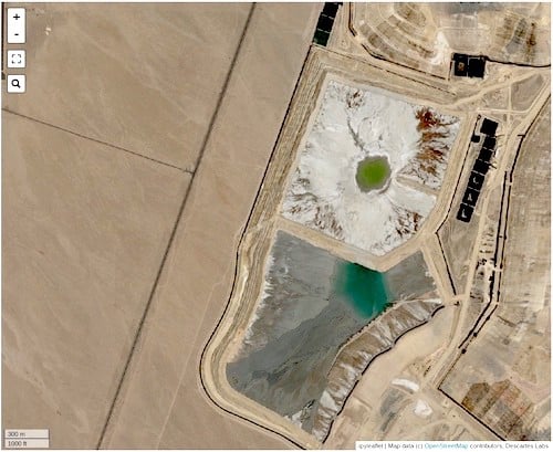
Moving beyond exploration and into mine operations and closure, Tailings Storage Facilities (TSF) are mine assets that present significant safety challenges due to the inherent risk involved with storing large volumes of water and mining waste over long periods of time. Because TSFs are globally distributed and sometimes inaccessible, monitoring them closely for signs of failure is difficult.
Descartes Labs is uniquely situated to help mining companies mitigate tailings dam risks with advanced satellite remote sensing methodologies that implement the latest deformation research at scale. Our Tailings Dam Deformation Monitoring package (TDDM) provides a global monitoring system and dashboard with customized reporting that allows clients to test, validate, automate, and deliver deformation insights for any geotechnical target of interest on the planet.
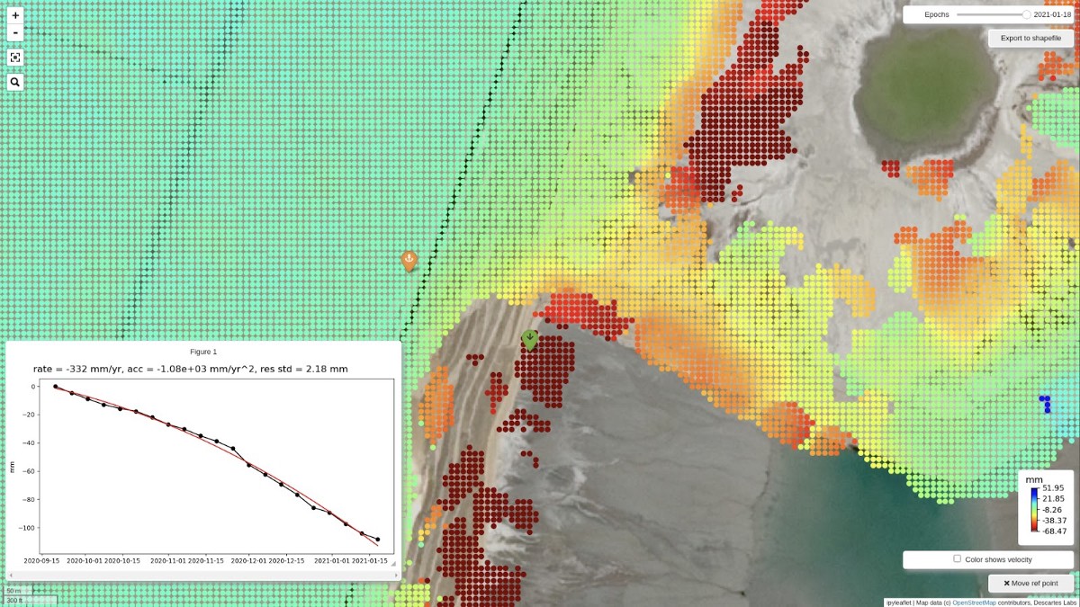
The system offers the world’s first fully-automated orbital radar and InSAR-based subsidence monitoring program at a 60% lower cost compared to higher-resolution satellite tasking or ground-level alternatives.
Our approach combines automated Sentinel-1 satellite monitoring, measurement, and visualization using our world-leading InSAR processing pipeline, updated globally every 6 to 12 days. Optional customizations include the addition of sub-meter high-resolution imagery, LiDAR, or data from ground-based sensors such as accelerometers and piezometers.
The integration of these data sources allows for rapid prototyping and hypothesis testing in remote locations using precise methods of measurement.

These new datasets, tools, and workflows bring previously inaccessible analysis to the fingertips of mining users, allowing them to harness the high-speed compute power of the Descartes Labs Platform to scale-up remote sensing workflows.
Get in touch to maximize the ability to make new discoveries and build a better understanding of physical risk across your mine site.
Learn more: Visit our platform, mining, resource library, and API documentation on our website.