Article category: Mining
Planetary Scale Intelligence for the Mining Super Cycle
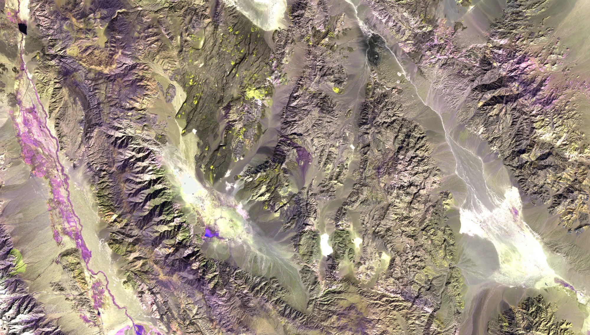
Sentinel-2 false color image of an area near Death Valley National Park, CA.Enhancing mineral...
On February 13th, 2024, a large slip on the heap leach pad at the Çöpler Gold Mine in eastern Turkey occurred around 2:30 p.m. local time (6:30 a.m. EST). An estimated 10 million cubic meters of material gave way and traveled almost a kilometer as the flow of crushed rock and mud was channeled through an inclined valley.
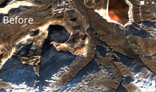 Above: Sentinel-2 L2A images of before and after the event.
Following the announcement of the failure, Descartes Labs immediately ran its InSAR pipeline over the area to look for any signals that may have indicated ground movement prior to the slide. The results of the analysis are presented below as Descartes Labs’ “out-of-the-box” solution; no hand-tuning was done to this data or the tools used for analysis.
Mine operations are inherently dangerous, and companies invest significant time and resources in planning and policy-making to ensure their operations meet the highest safety standards. As we look at the ramifications such incidents have on the industry, we encourage mining companies to take proactive measures by working alongside technology providers to reassess their safety monitoring and preventive solutions.
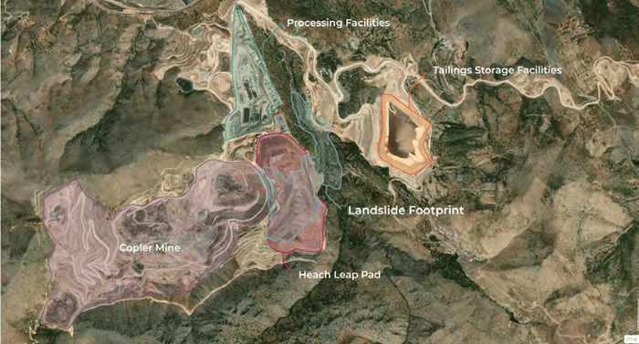
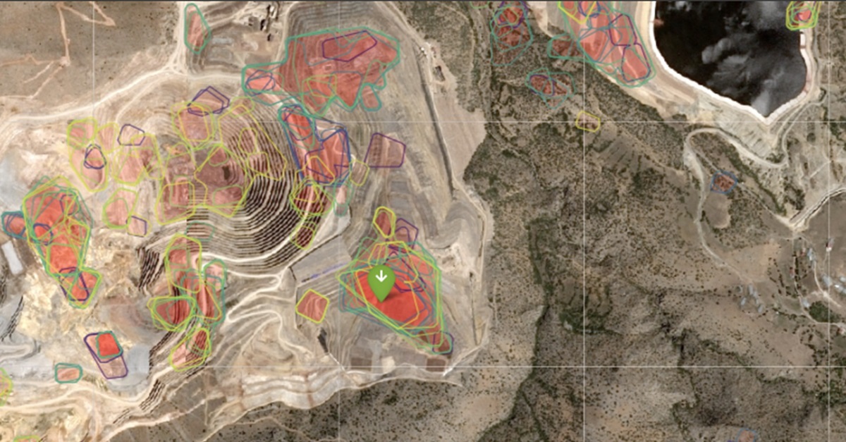
A site map of the mine indicating the location of the Heap Leach Pad, where articles suggest the failure occurred.
Qualifying Statements
Descartes Labs recognizes the sensitive nature of this topic due to both the loss of human life and the legal and financial implications of this significant event. Descartes Labs presents the findings below as an unrelated 3rd party and implies no relationship to SSR Mining or the local operators of the Çöpler mine. In no way do these results intend to infer guilt or responsibility to any party or infer that the use of Descartes Labs services could have necessarily identified, indicated, or prevented this event or any similar events from occurring. This article presents a backwards looking observation that utilizes freely available remote sensing data from Sentinel-1 and Descartes Labs’ proprietary InSAR processing pipeline and Ground Deformation System (GDS), including an anomaly detection algorithm currently in beta-release.
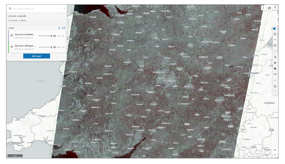
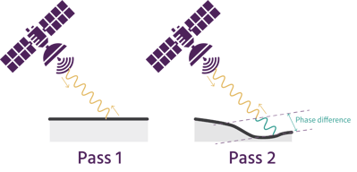
Descartes Labs’ technology includes powerful tools for deformation monitoring using the data from radar satellites, like Sentinel-1, a mission from the European Space Agency launched in 2014. Descartes Labs’ InSAR pipeline is able to identify ground motion utilizing repeat measurements from space-based Synthetic Aperture Radar sensors. These data provide information about ground deformation that could affect infrastructure stability, aiding in risk assessment and proactive maintenance. Descartes Labs has the first automated, globally-scalable InSAR pipeline, allowing us to provide fast, repeatable deformation measurements over any AOI on the planet. Find out more information about our InSAR products in our blog series here.
The Çöpler mine site has coverage by both ascending and descending Sentinel-1 orbit tracks in the year preceding the failure. Descartes Labs has calculated deformation using SAR data collected from each orbital track, as well as combined them to compute east-west and vertical components of motion by utilizing their orbit geometry.
In this article, we will present the ascending and descending track analyses, but east-west and vertical analyses, as well as an analysis using our anomaly alerting tool (in beta) can be viewed in the full Çöpler Mine case study, available here.
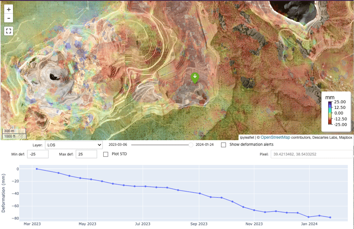
Cumulative deformation over the past year is shown as a point cloud overlaid on the map. The plot shown below each image displays the time-series history over the past year corresponding to the green marker on the map. Deformation results are reported relative to the average deformation within a kilometer. Deformation in all cases is shown in millimeters, at a spatial posting of 10m.
The type of motion (sliding, compaction of material, addition of material, etc.) cannot be inferred and Descartes Labs does not attempt to make any interpretations of the cause of motion.
The area of failure shows subsiding deformation around the heap leach pad. There are gaps in point coverage due to low coherence in the area, which may be caused by movement from human activity or due to sensitivity of slope orientation to the imaging geometry.
In the red area in the images below, we observe little to no motion from 02/23/2023 to approximately 09/03/2023 followed by an onset of motion away from the satellite that remains relatively constant until the failure. The maximum deformation recording in the heap leach pile during this period reaches ~80mm. Motion in the southwest corner of the heap shows the sharpest inflection point in motion, where other areas within the heap show more consistent motion over the past year, though a sharp increase in velocity is detected throughout the area.
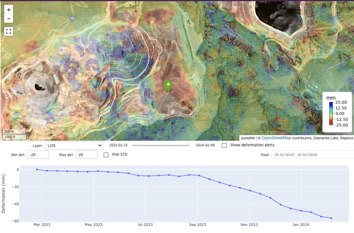 The southwest corner of the heap demonstrates the highest degree of movement, with a sharp inflection in September of 2023, five months prior to the collapse.
The descending plot shows a similar magnitude of motion, but appears to be more constant over time. There appears to be more deformation in the surrounding area detected by the descending orbit track, although the magnitude of the motion is lower than on the Heap Leach Pad (<20 mm in most areas). Similar to the ascending track, magnitude of motion is highest in the southwest corner of the leach heap, and the magnitude decreases within the interior of the leach heap.
 In concurrence with the ascending track, the southwest corner of the heap demonstrates the most significant level of deformation.
The recent event was devastating, and while we can't claim that Descartes Labs' Ground Deformation System (GDS) could have prevented it, we can certainly learn from it. The Çöpler Mine collapse is just one event in a long list of mining disasters throughout history, and as remote sensing technology continues to advance, it is prudent that mining companies adopt these advanced solutions to drive operational safety into the future.
Through more granular insights, we can detect signals that may indicate major incoming subsidence events. This early-warning could contribute to faster decision-making and additional safety measures being put in place.
![]() Download the Çöpler Mine Case Study for a more in depth analysis.
Download the Çöpler Mine Case Study for a more in depth analysis.