Article category: Science & Technology, Climate Solutions
Fighting Wildfires Using a Cloud-based Supercomputer
In the wake of yet another season of significant wildfire activity across the US and in particular...
In 2018, approximately 360,500 acres burned across our headquarters’ state of New Mexico. After a winter without snow, the wildfire season brought 1,334 fire starts in the state that year. With the effects of climate change and the present-day consequences of historical forest management policies hitting us so close to home, we set out to build an automated, early-warning wildfire detector using satellite data.
Today, we’re excited to announce that Descartes Labs will utilize our wildfire detector to alert the state’s Energy, Minerals, and Natural Resources Department’s Forestry Division of wildfires in real-time. The wildfire detector will provide alerts to State Forester Laura McCarthy and her two deputies for fires that start in the state and to the district rangers for any fires that start in their district—within minutes of ignition.
Get the details behind our wildfire detector in our previous post, The Satellites Hunting for Megafires.
Megafires—defined by the US Forest Service as wildfires that burn over 100,000 acres—are occurring with increased frequency, not only in New Mexico, but around the world. Traditionally, fires in New Mexico are detected via planes or lookout towers, or reported by civilians, which can be an unreliable and slow process. The earlier a potential megafire is identified, the more options fire managers have to choose the most prudent course of action.
Laura McCarthy, State Forester explained, “Rapid detection can make all the difference in our ability to respond to wildfire safely and effectively. Descartes Labs’ new tool is an innovation that harnesses technology to alert wildfire responders to new fire starts earlier than ever.”
This use of the Descartes Labs Platform signifies the beginning of a digital transformation in how officials identify wildfires, suppress them, and evacuate people at risk. It allows for continuous and complete monitoring for wildfires, which Descartes Labs is thrilled to provide to augment New Mexico’s current detection systems.
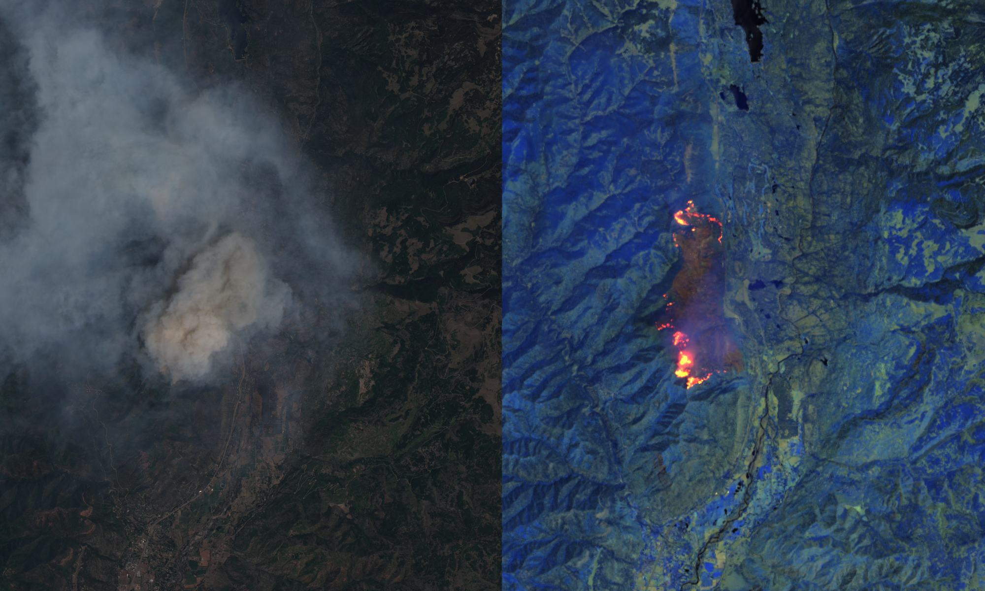
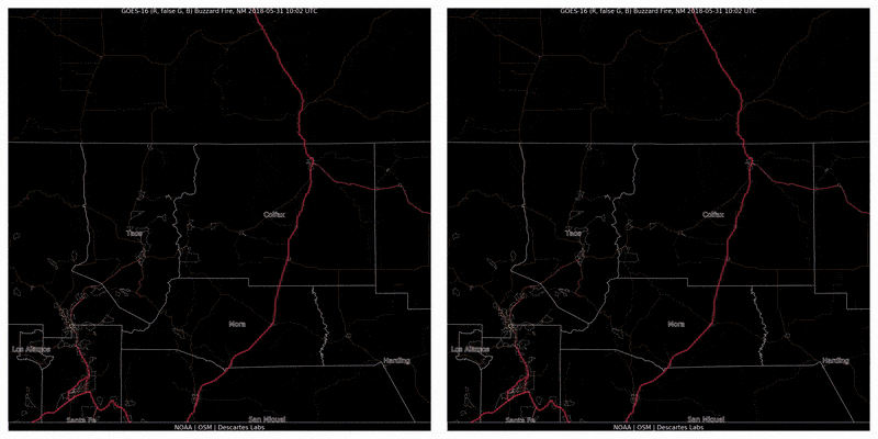
The Descartes Labs wildfire detector, created by applied scientist Clyde Wheeler, is based on data from GOES-16 and GOES-17, two recently operational geostationary satellites from the National Oceanic and Atmospheric Administration (NOAA) that are primarily used for forecasting weather, but also have special spectral bands and capture thermal information.
These satellites view the earth in near real-time, capturing images of the continental United States every five minutes.
First, data and images from satellites GOES-16 and GOES-17 are ingested into the Descartes Labs Platform. Since the images are captured in the thermal infrared spectrum, we can measure the temperature of the earth at the time an image is taken.
From there, several algorithms are run to determine if a fire is present. Each algorithm looks for different properties of a wildfire. If there’s a consensus among the algorithms, Descartes Labs can determine with high confidence that there’s a fire.
For example, one algorithm looks at the spatial context, checking to see if the fire is hotter than its surroundings. Another algorithm looks back in time to see what the area normally looks like without a fire, to see if there have been changes. A third algorithm looks for areas that are unexpectedly hot, compared to historical temperatures.
If the algorithm determines there’s a wildfire, the information is sent to the New Mexico Forestry Department. The full process takes about nine minutes from the time the data is captured to the time it’s reported.
As we harness the latest advancements in sensor data and AI technologies, our goal is to prevent small natural disasters from becoming big ones. We look forward to working with other agencies and businesses that would benefit from our early wildfire detection technology. Learn more at DescartesLabs.com.