Article category: Mining, Science & Technology
Sentinel-1 Technical Series Part 2 | SAR Geocoding: Working...
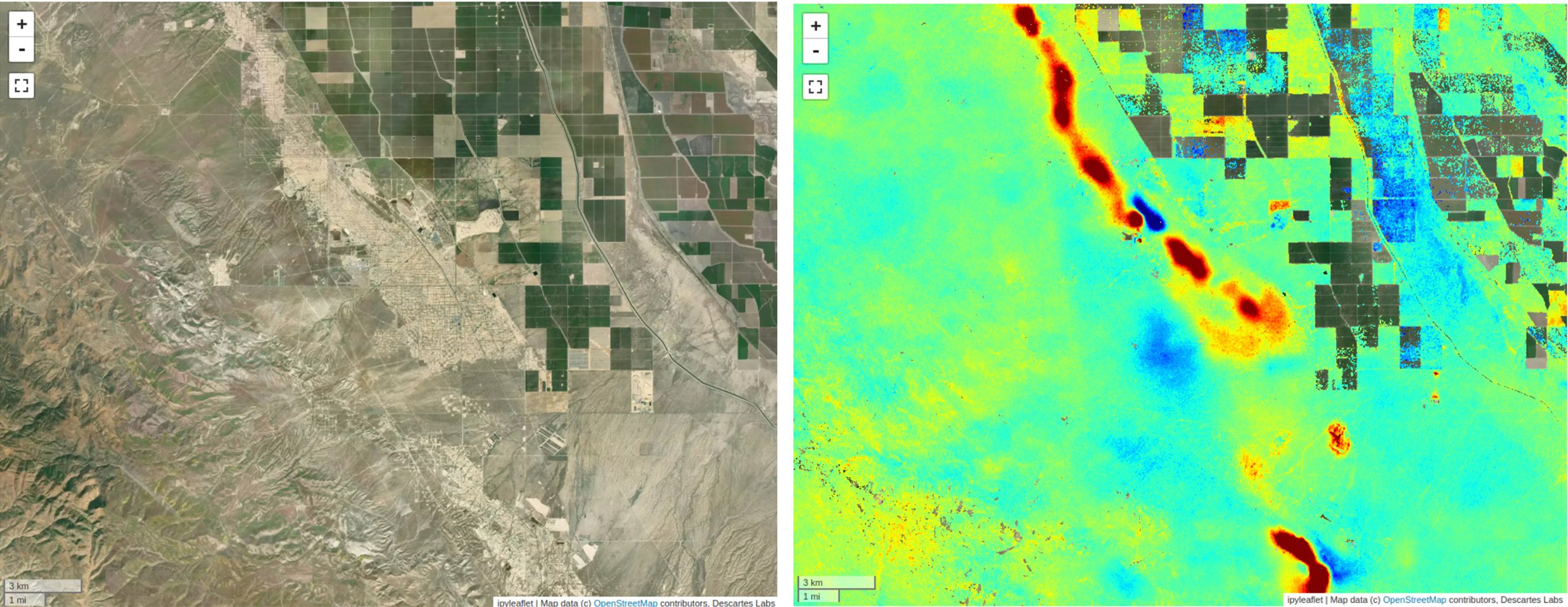
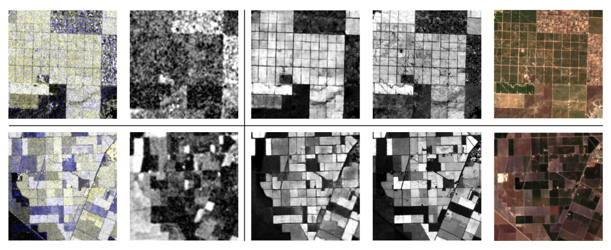
In this post, we will describe Descartes Labs' SAR geocoding approach, which powers our global...
Article category: Mining, Science & Technology
In this post, we will describe Descartes Labs' SAR geocoding approach, which powers our global...
Article category: Mining, Science & Technology
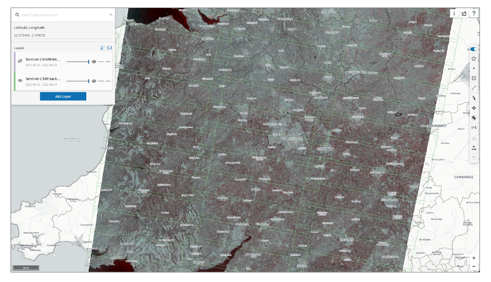
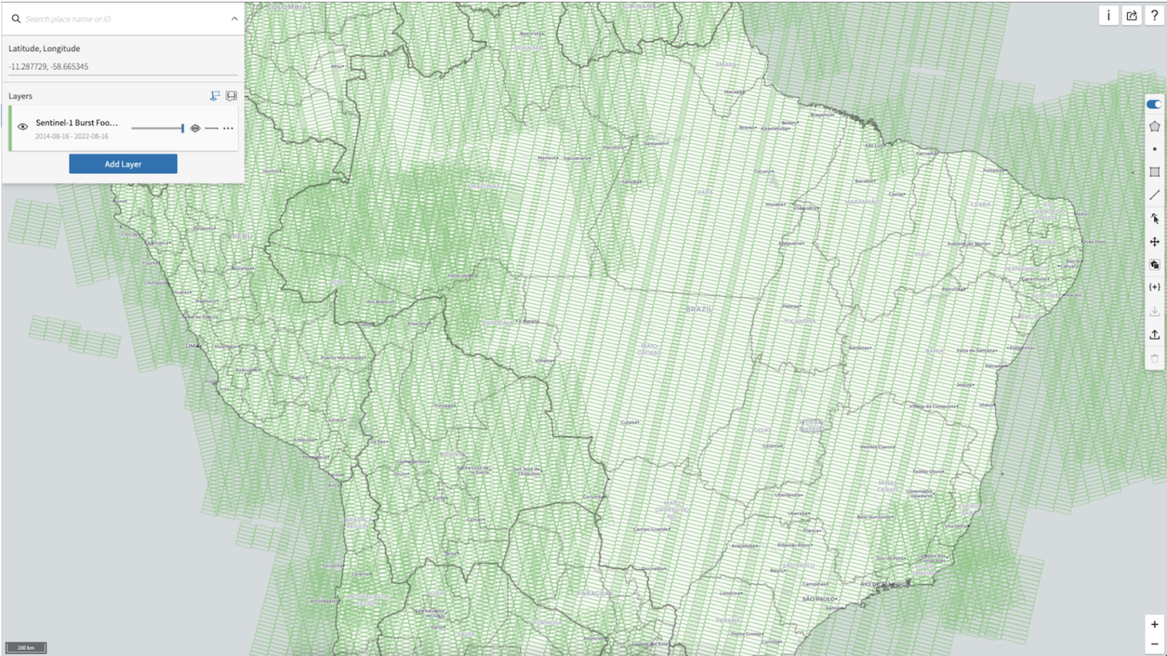
Descartes Labs fast data access mechanisms for Sentinel-1 (SAR) data enable rapid global scale...
Article category: Mining, Science & Technology
Synthetic Aperture Radar (SAR) provides a valuable remote sensing tool, and this blog post will...
Article category: Science & Technology, Climate Solutions
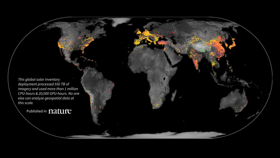
A first-of-its-kind global inventory of photovoltaic solar facilities built using satellite imagery...
Article category: Science & Technology
The basics of understanding raster data, vector data, and coordinate systems.
Article category: Science & Technology
In this article, we get back to the basics, to the fundamentals of remote sensing.
Article category: Science & Technology
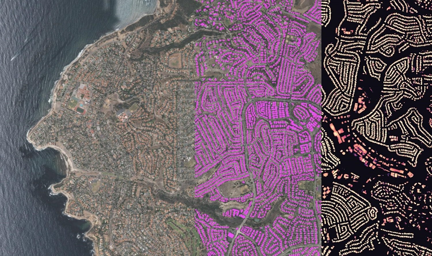
In this blog, we will show how you can go from zero data to thousands of annotated satellite images...

Article category: Science & Technology
We’re excited to announce a new partnership with Satellogic that brings sub-meter, high-frequency...
Article category: Science & Technology, Company News
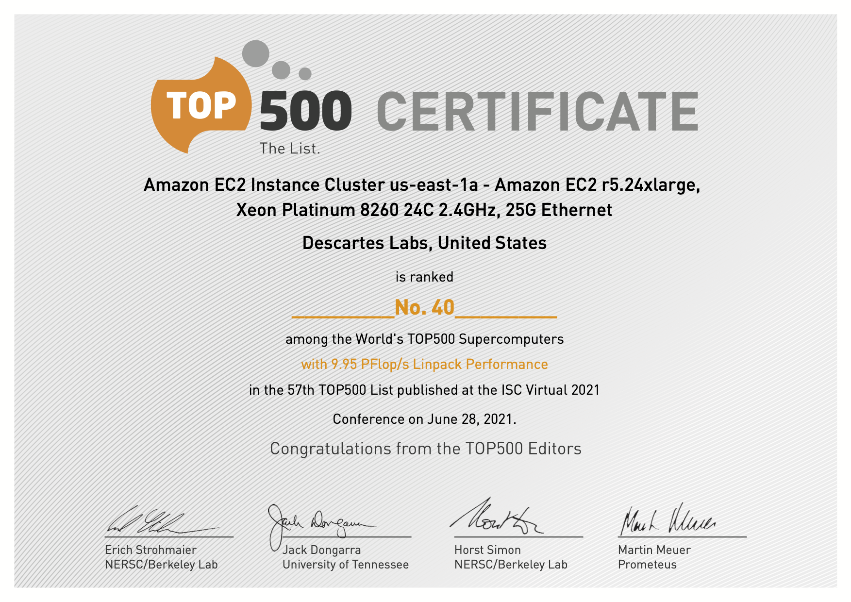
Descartes Labs Achieves #41in TOP500 with Cloud-based Supercomputing Demonstration Powered by AWS,...
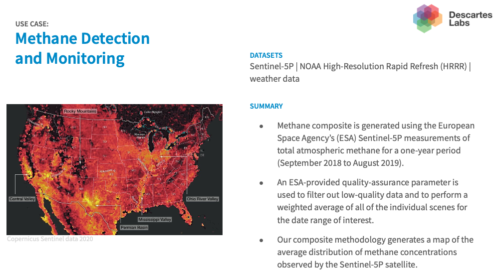
Article category: Science & Technology, Climate Solutions
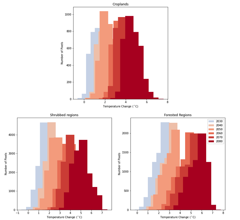
The combination of global climate models and land cover data can be used to estimate the regional...
Article category: Science & Technology
Terry completed the following work as a Descartes Labs intern this summer, where he worked with...
Article category: Science & Technology
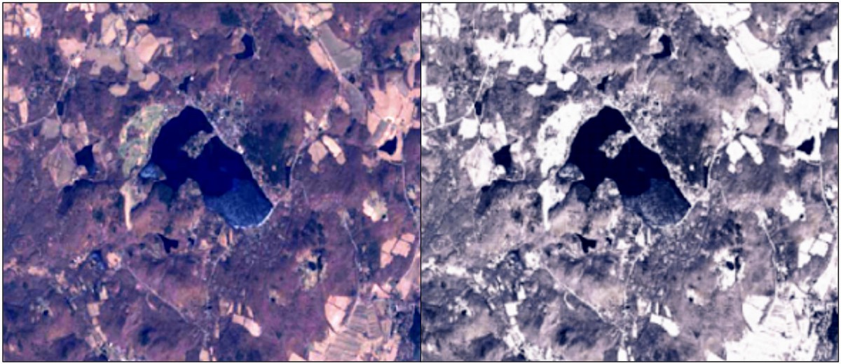
Non-snowy summertime imagery at left compared to synthetic snowy imagery over the same location at...