Article category: Company News
Descartes Labs Goes All-in on AWS to Help Organizations...
Descartes Labs migrates to AWS infrastructure to rapidly analyze geospatial data for timely...
Article category: Company News
Descartes Labs migrates to AWS infrastructure to rapidly analyze geospatial data for timely...
Article category: Consumer Goods
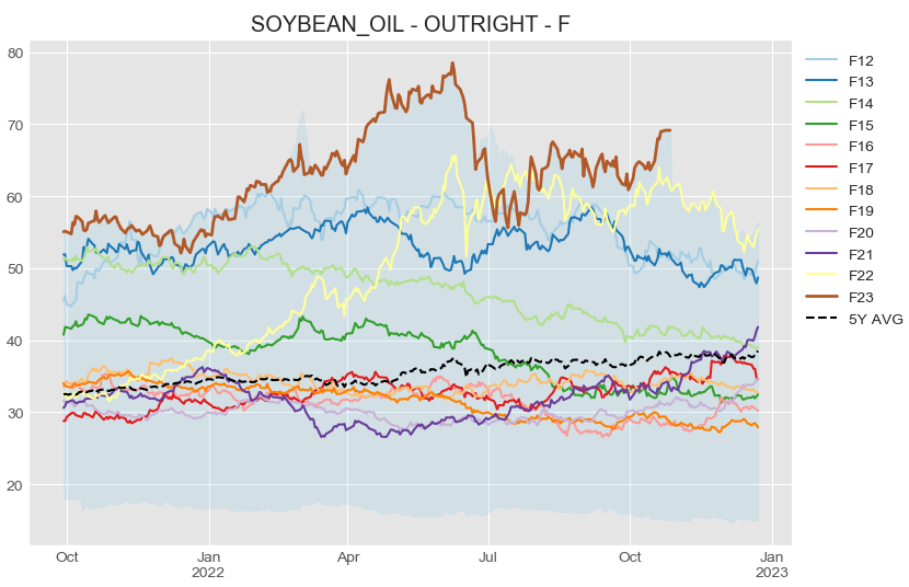
Descartes Labs Vegetable Oils market insights package helps procurement managers reduce input costs...
Article category: Mining, Science & Technology
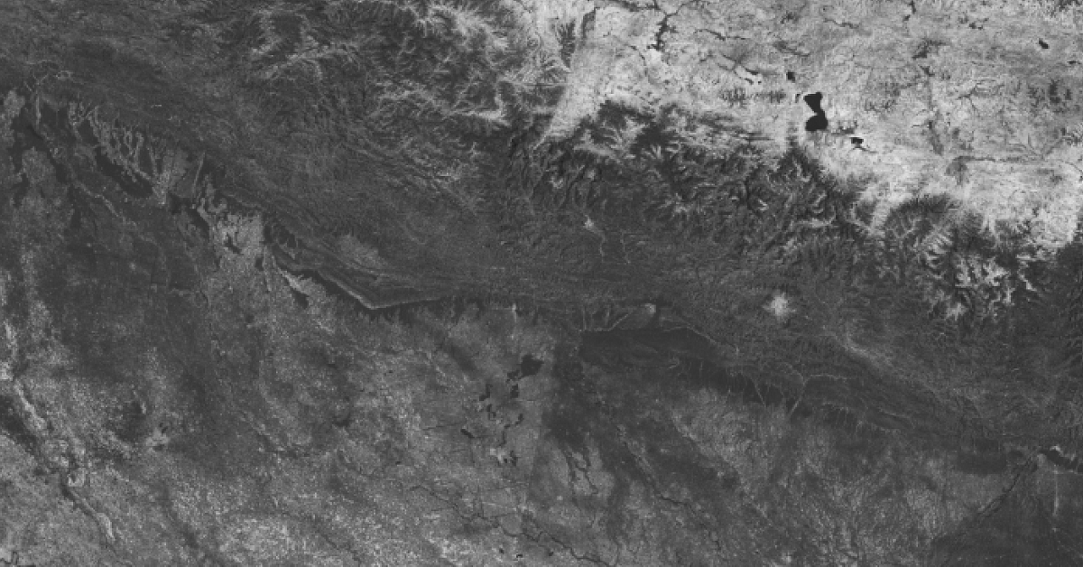
Descartes Labs combines automated Sentinel-1 satellite ingest, monitoring, and measurement using...
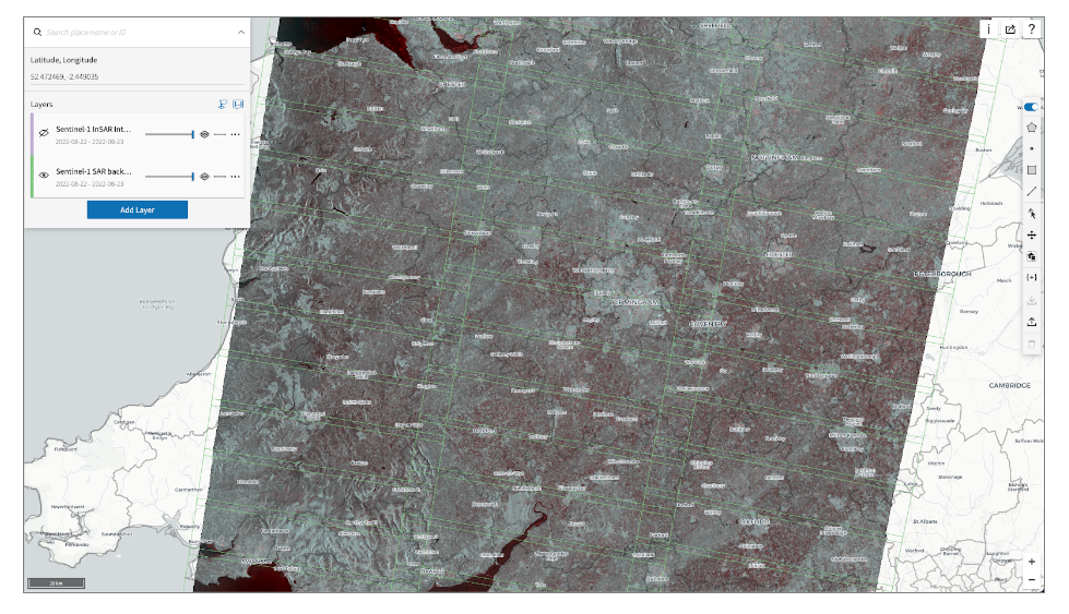
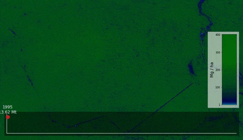
Article category: Mining, Science & Technology
Descartes Labs uses interferometric products to a build global geospatial data product that detects...
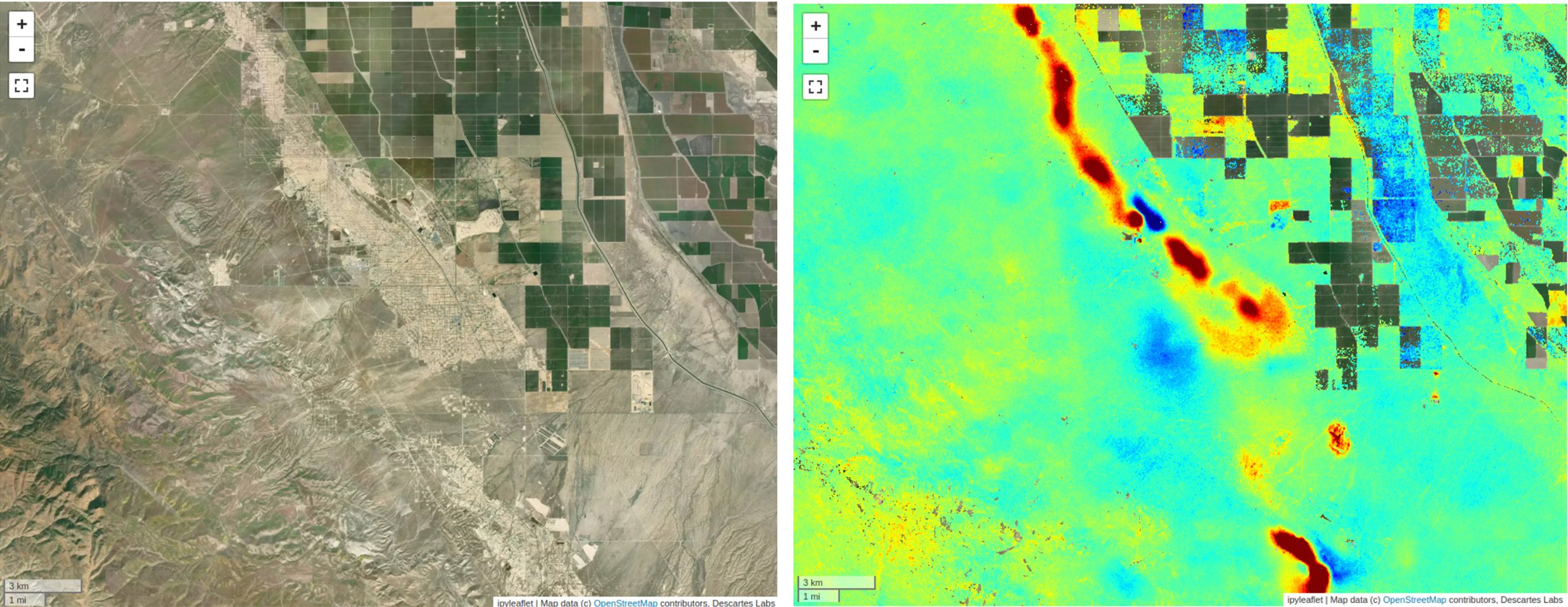
Article category: Mining, Science & Technology
Discover salient features of our global InSAR product — ready to use for coherent change detection...
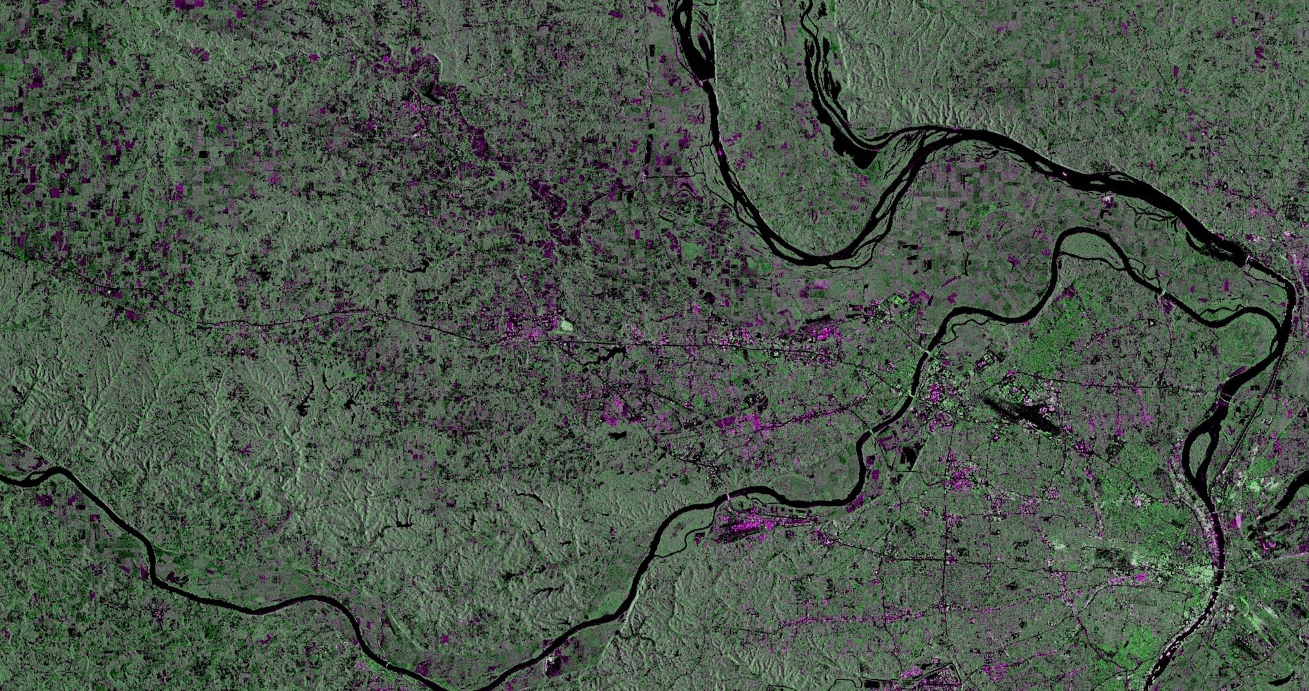
Article category: Mining, Science & Technology
In this post, we will describe Descartes Labs' SAR geocoding approach, which powers our global...
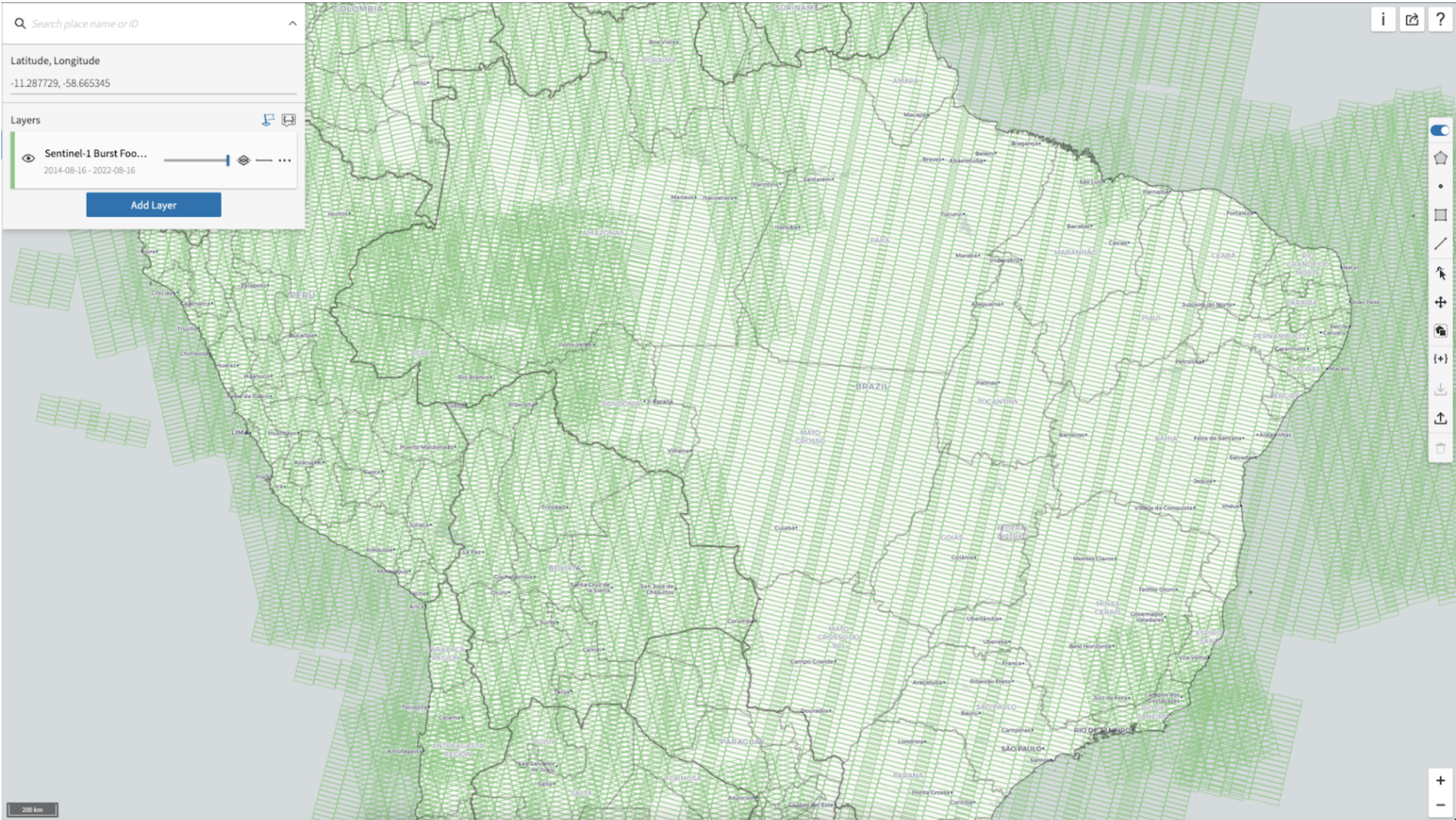
Article category: Mining, Science & Technology
Descartes Labs fast data access mechanisms for Sentinel-1 (SAR) data enable rapid global scale...
Article category: Mining, Science & Technology
Synthetic Aperture Radar (SAR) provides a valuable remote sensing tool, and this blog post will...
Article category: Consumer Goods
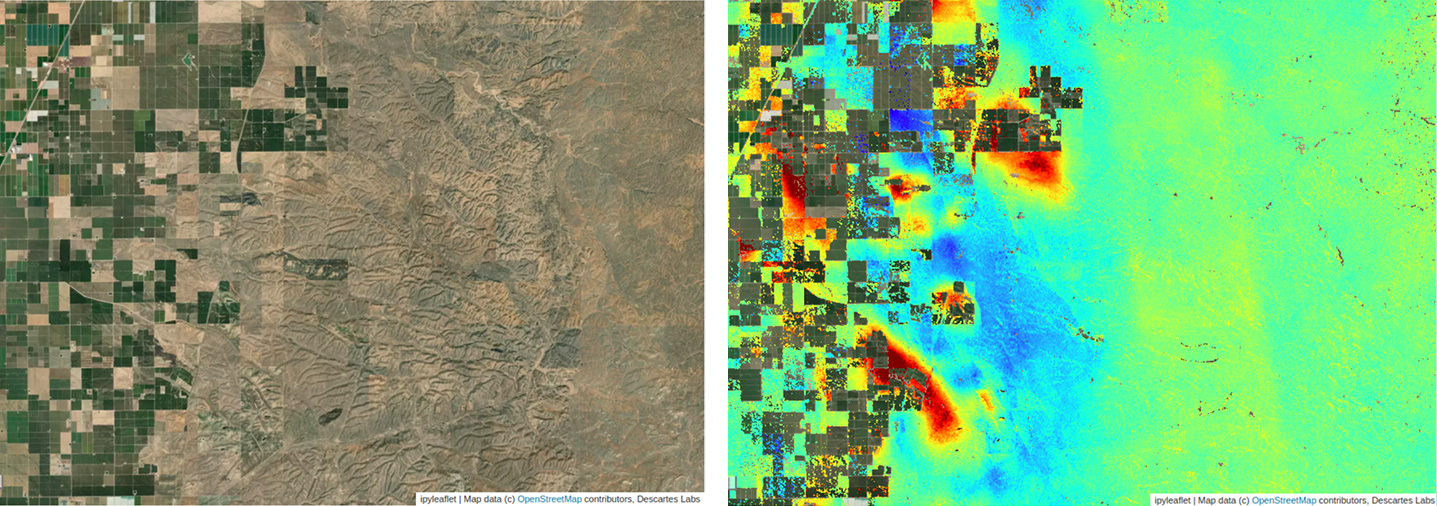
Learn how to use Sentinel-1 and data products within the Descartes Labs Platform for agricultural...
Article category: Consumer Goods, Company News
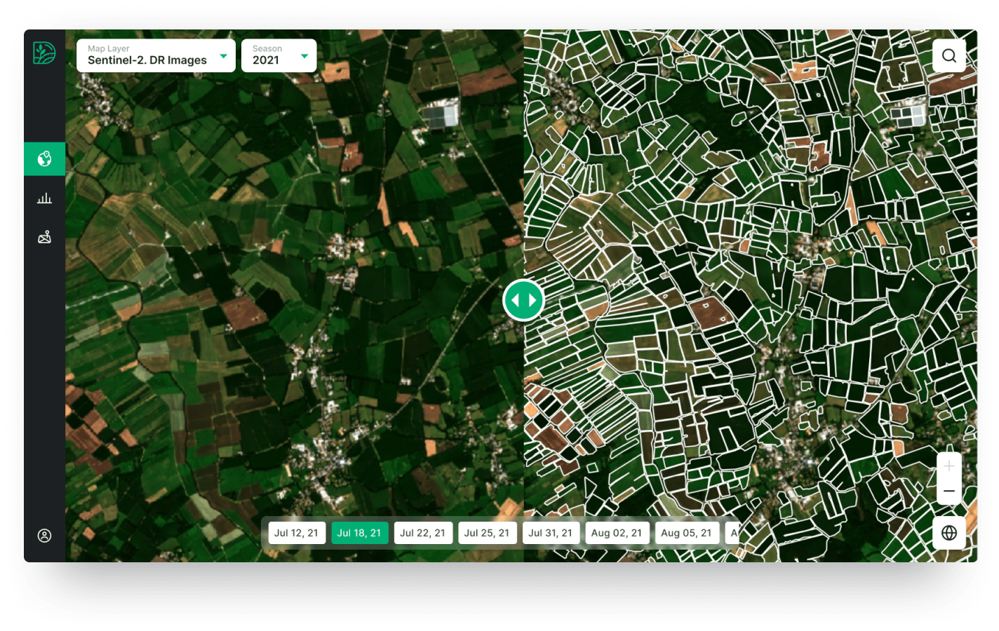
A new partnership with Digifarm, who uses neural networks & super resolved Sentinel-2 imagery to...
Article category: Consumer Goods, Climate Solutions
Descartes Labs' Applied Scientist Rose Rustowicz shares insights with members of The Sustainability...
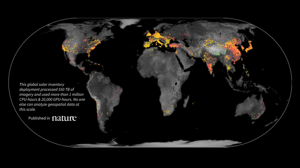
Article category: Science & Technology, Climate Solutions
A first-of-its-kind global inventory of photovoltaic solar facilities built using satellite imagery...