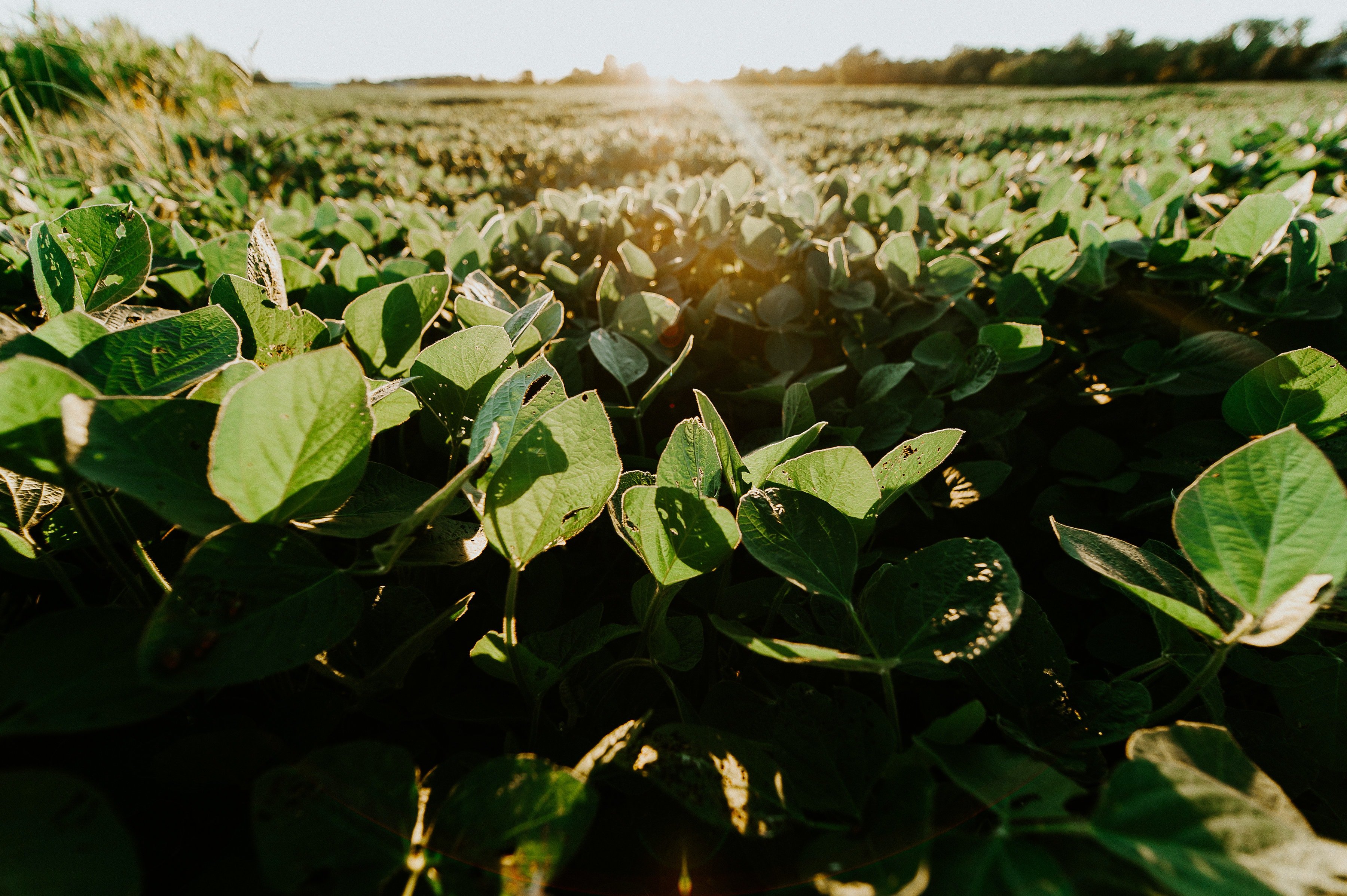
Article category: Consumer Goods
Quantifying the Intuitive: How Geospatial Data Helps...
Event-driven forecasting is helping to improve trading and procurement performance through...
Article category: Consumer Goods
Event-driven forecasting is helping to improve trading and procurement performance through...
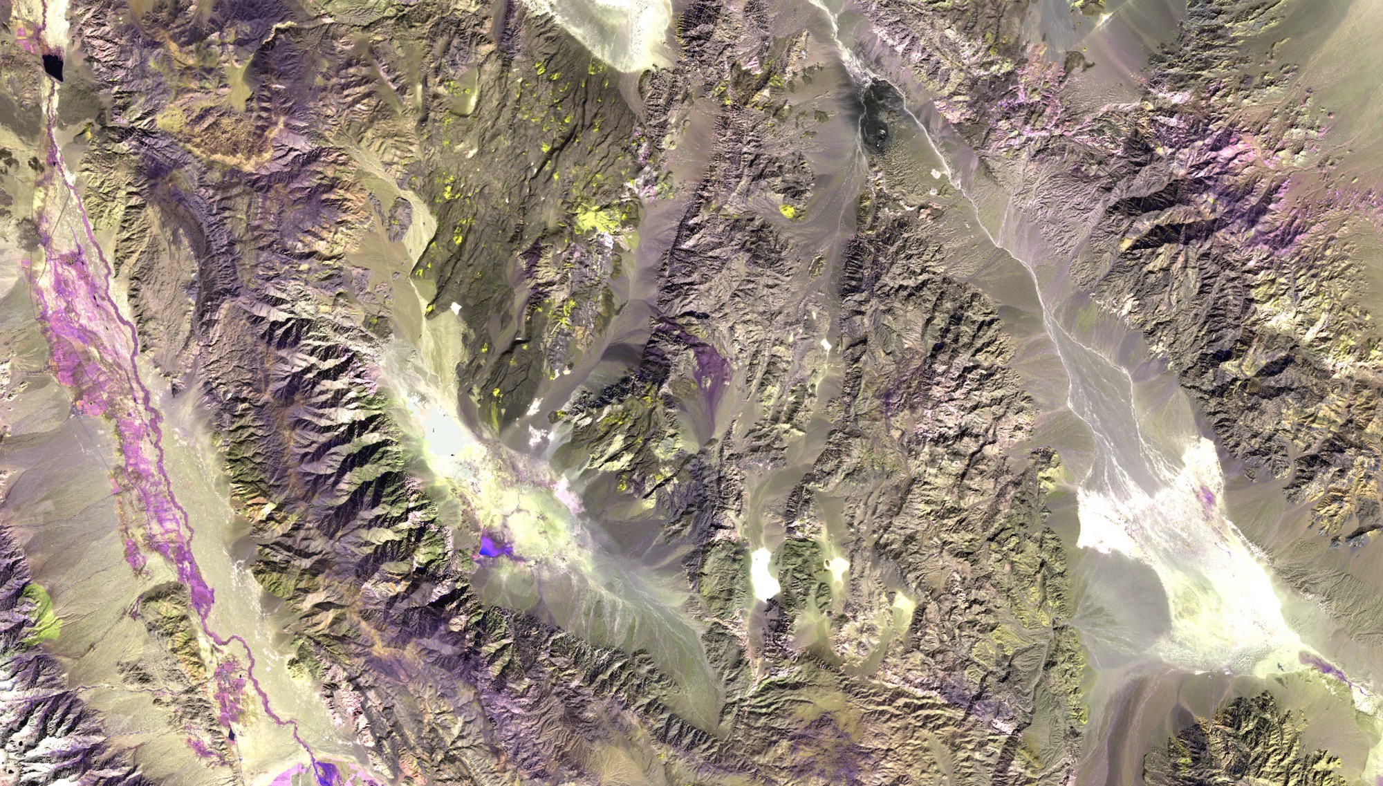
Article category: Mining
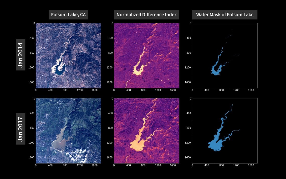
Sentinel-2 false color image of an area near Death Valley National Park, CA.Enhancing mineral...
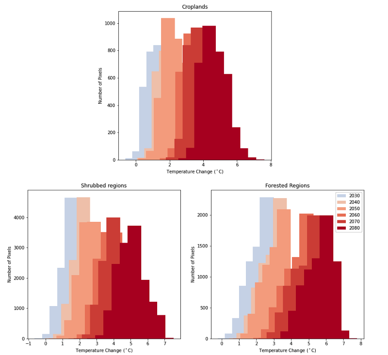
Article category: Science & Technology, Climate Solutions
The combination of global climate models and land cover data can be used to estimate the regional...
Article category: Science & Technology
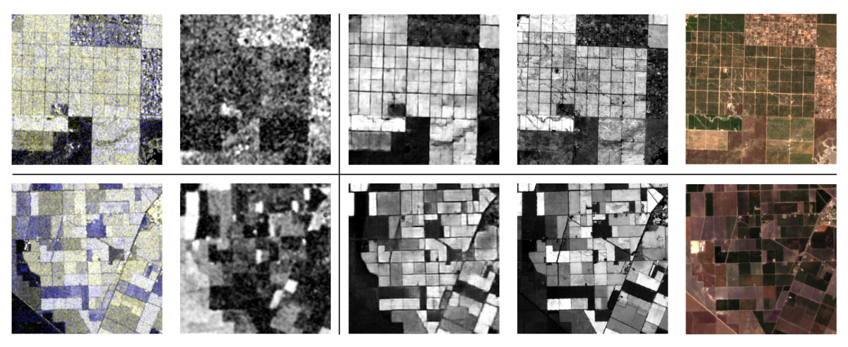
Terry completed the following work as a Descartes Labs intern this summer, where he worked with...
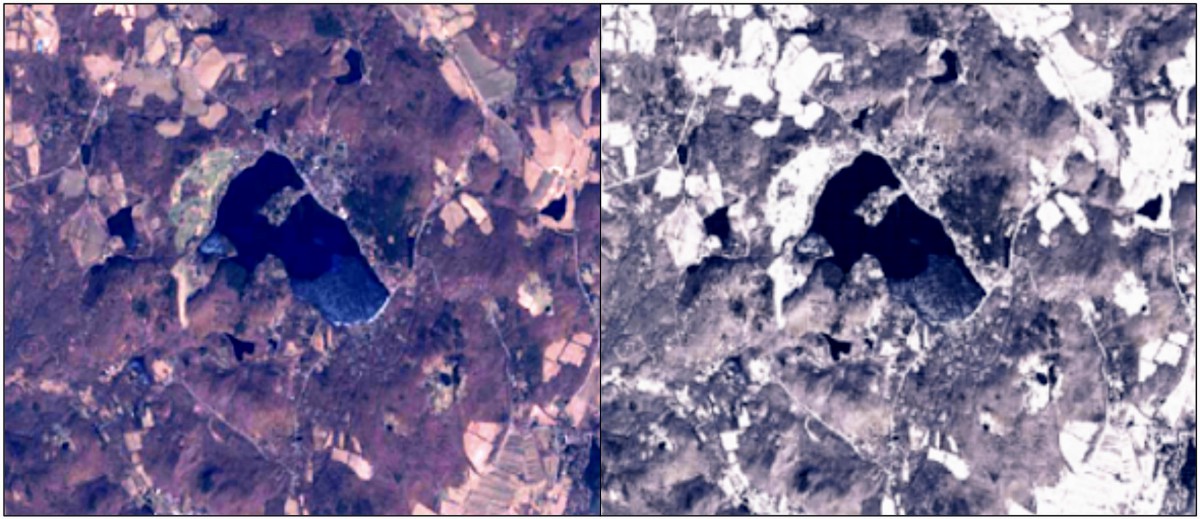
Article category: Science & Technology
Non-snowy summertime imagery at left compared to synthetic snowy imagery over the same location at...
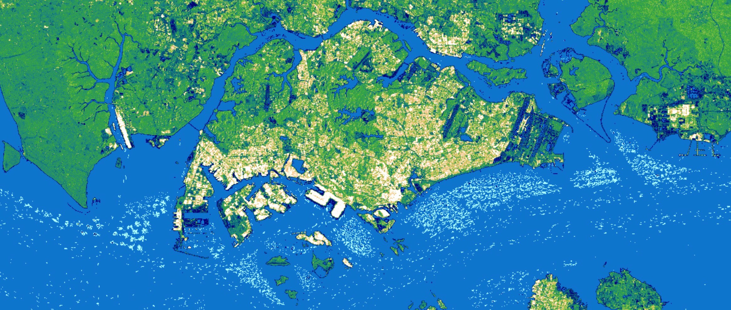
Article category: Consumer Goods
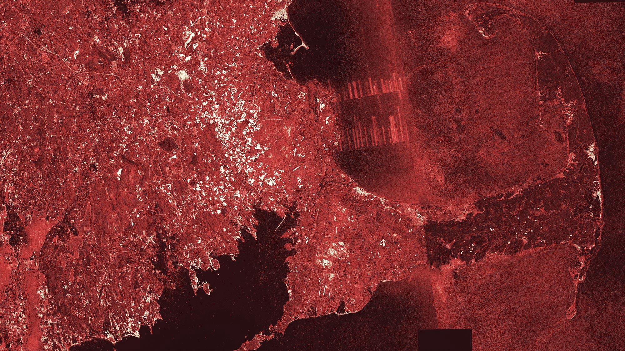
A three month Sentinel-1 SAR composite over Singapore with lighter colors capturing economic...
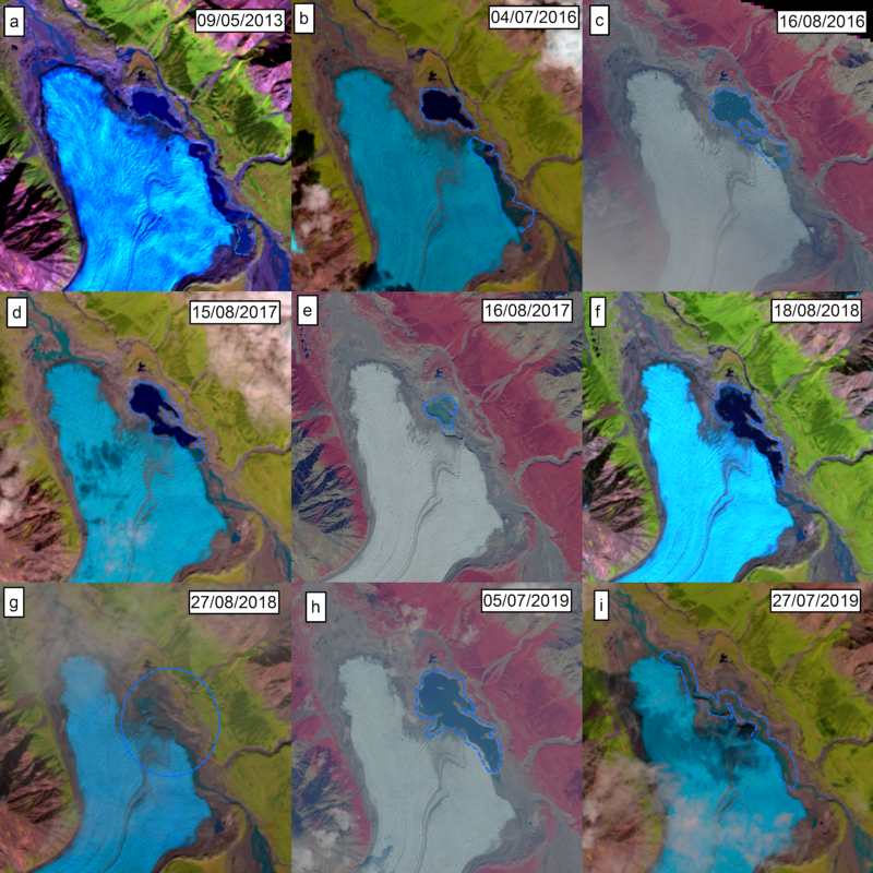
Article category: Science & Technology, Company News
The Donjek Glacier has temporarily dammed the Donjek River multiple times during the last few...
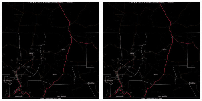
Article category: Climate Solutions
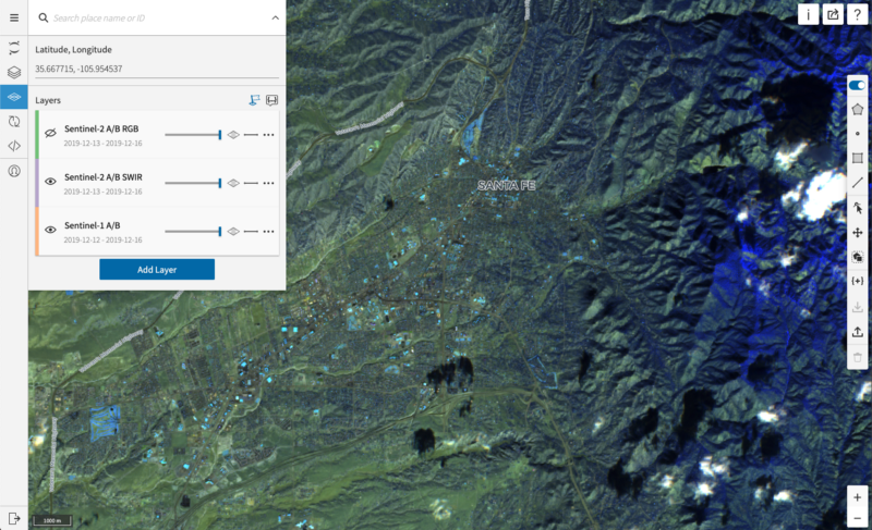
In 2018, approximately 360,500 acres burned across our headquarters’ state of New Mexico. After a...
Article category: Science & Technology
Review our aggregated mobility tracking methodology in our technical paper: Mobility Changes in...
Article category: Science & Technology
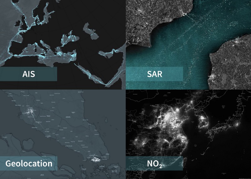
At Descartes Labs, we’ve been working at scale for years to solve some of the world’s hardest and...
Article category: Science & Technology
From a technological standpoint, the adoption of artificial intelligence (AI) into organizations’...
Article category: Science & Technology
National Geographic asked Descartes Labs if we could figure out a way to map every cranberry bog in...