Article category: Mining, Science & Technology
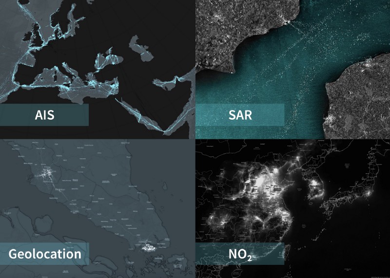
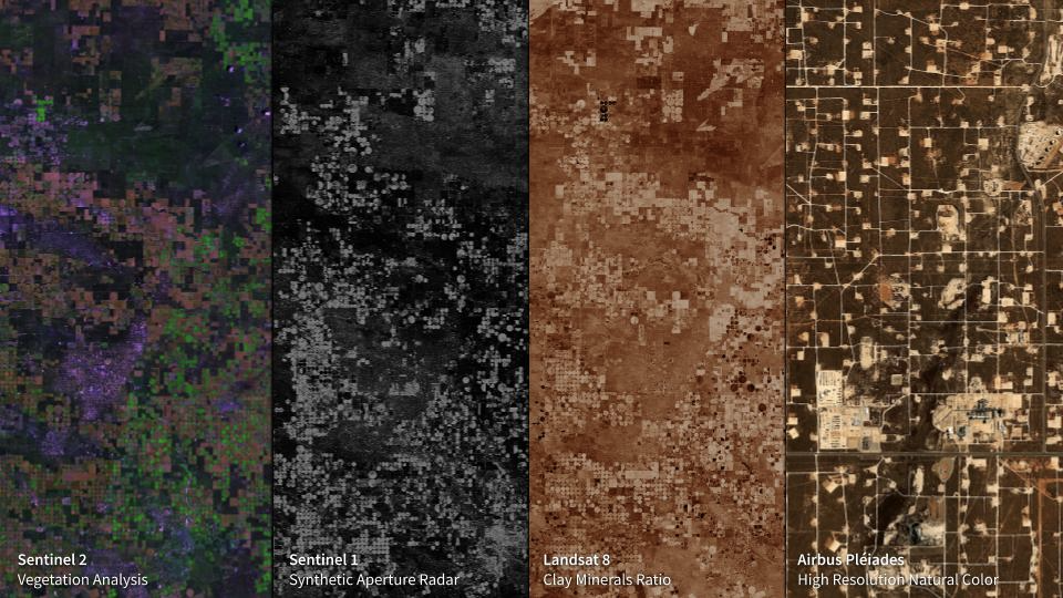
Making Sense of the Geospatial and Remote Sensing...
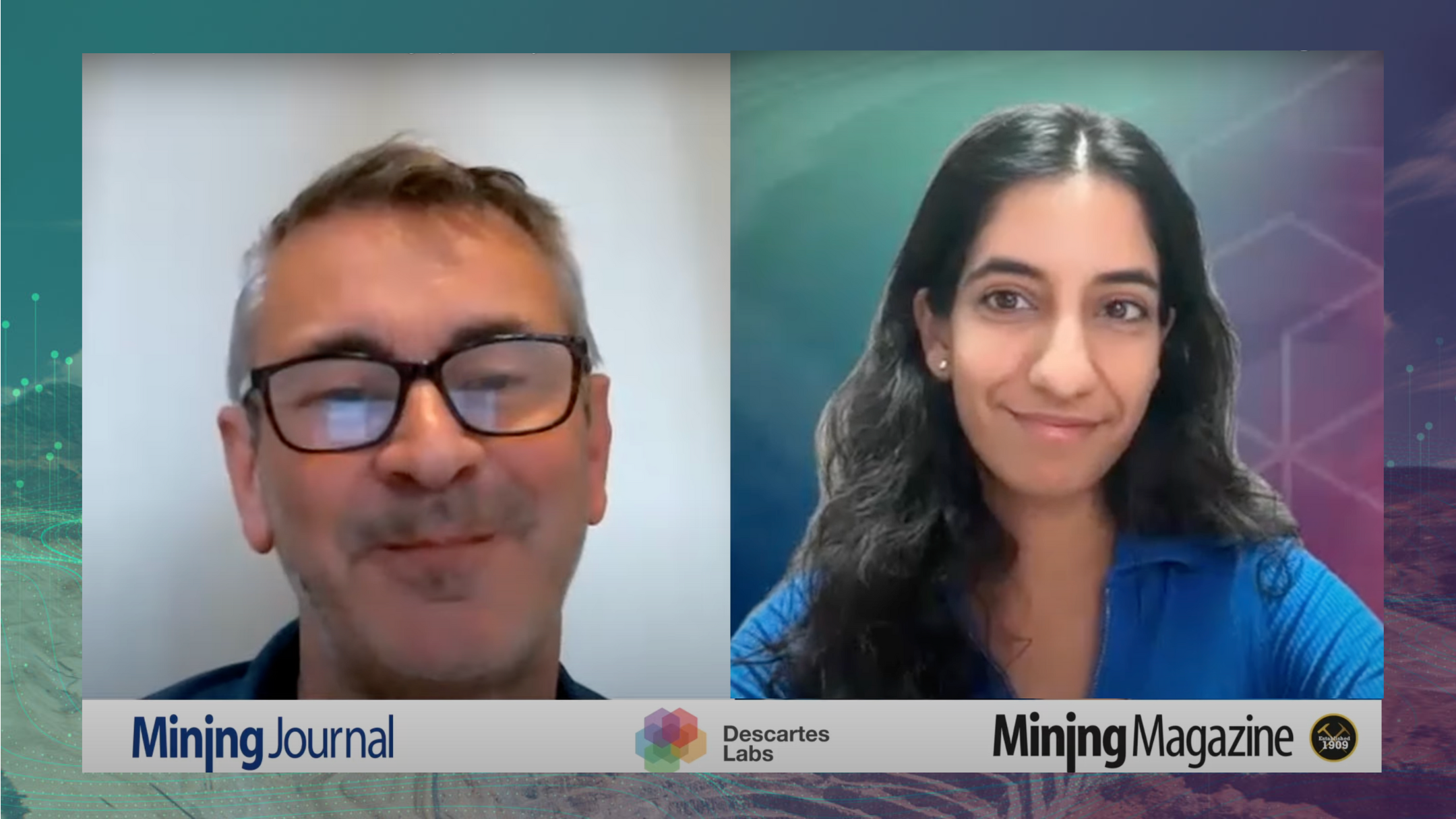
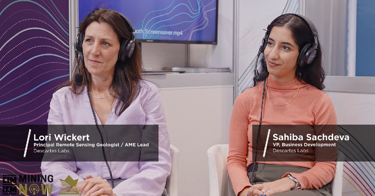
Remote Sensing for Mining Applications with Sahiba Sachdeva for Mining Journal.
Article category: Mining, Science & Technology
Remote Sensing for Mining Applications with Sahiba Sachdeva for Mining Journal.
Article category: Company News
The acquisition of Descartes Labs strengthens EarthDaily’s core geospatial AI capabilities.
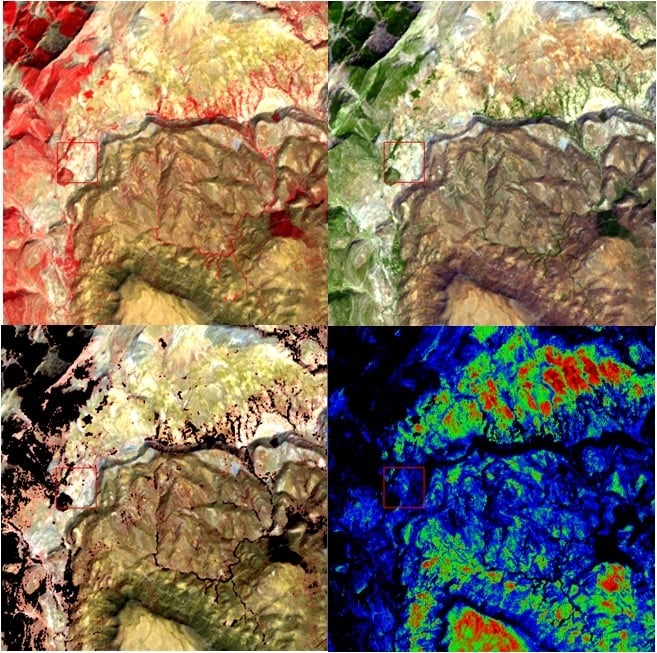
Article category: Mining
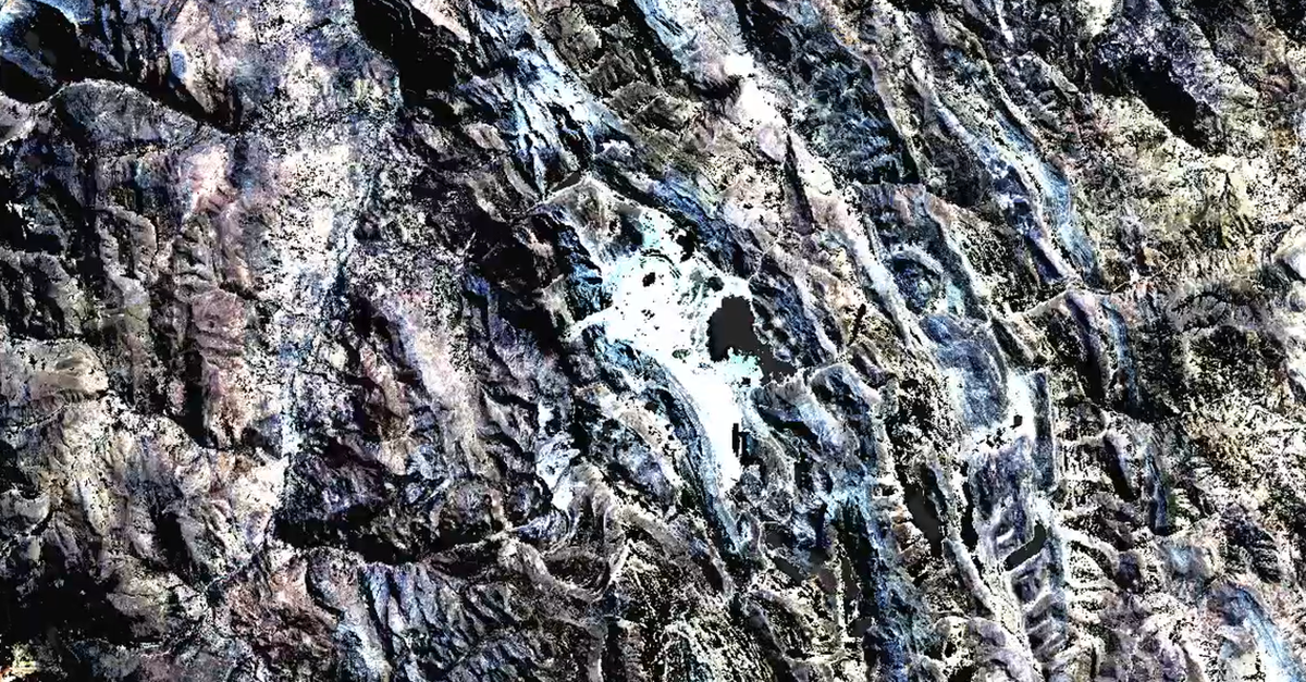
In the conclusion to our Get to Know Marigold series, we compute a Principal Component Analysis,...
Article category: Mining
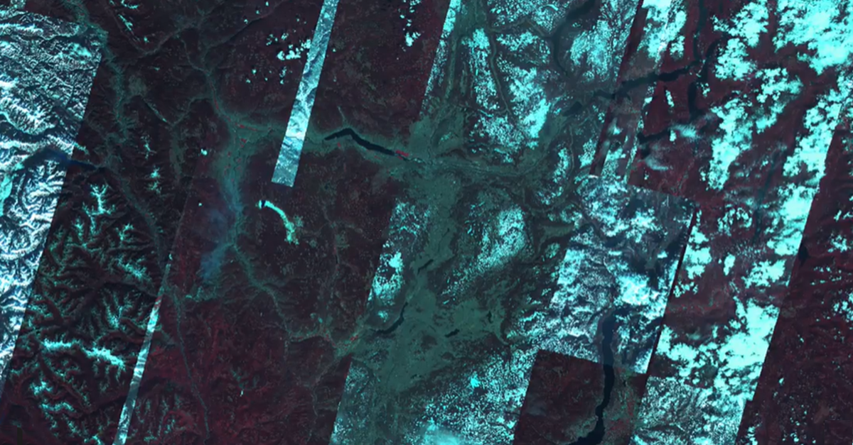
In this blog, we continue our exploration of Marigold's Workflows & Derived Products on creating...
Article category: Mining
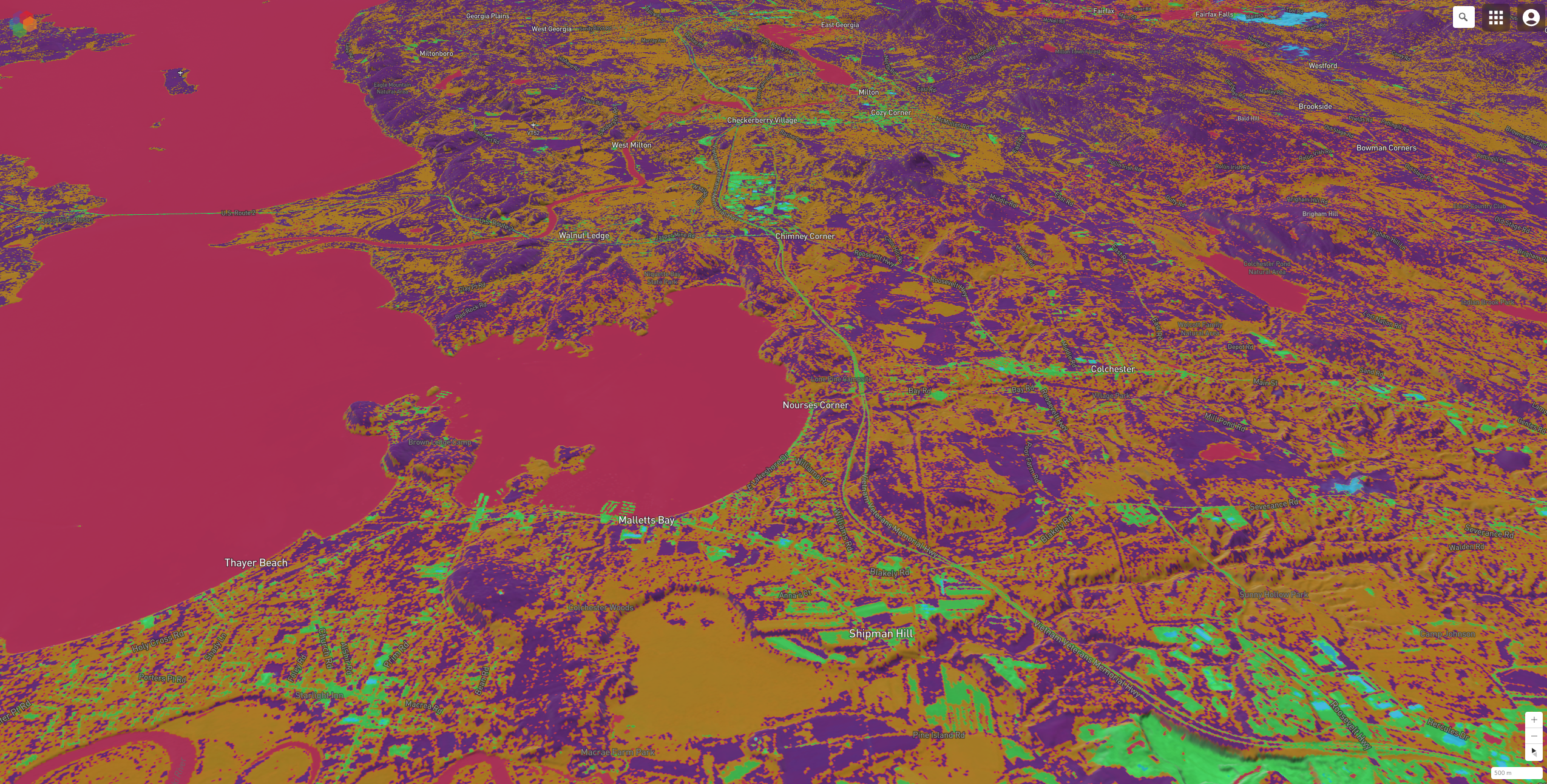
In this blog, we will walk through how to create a series of standard multispectral derived...
Article category: Mining
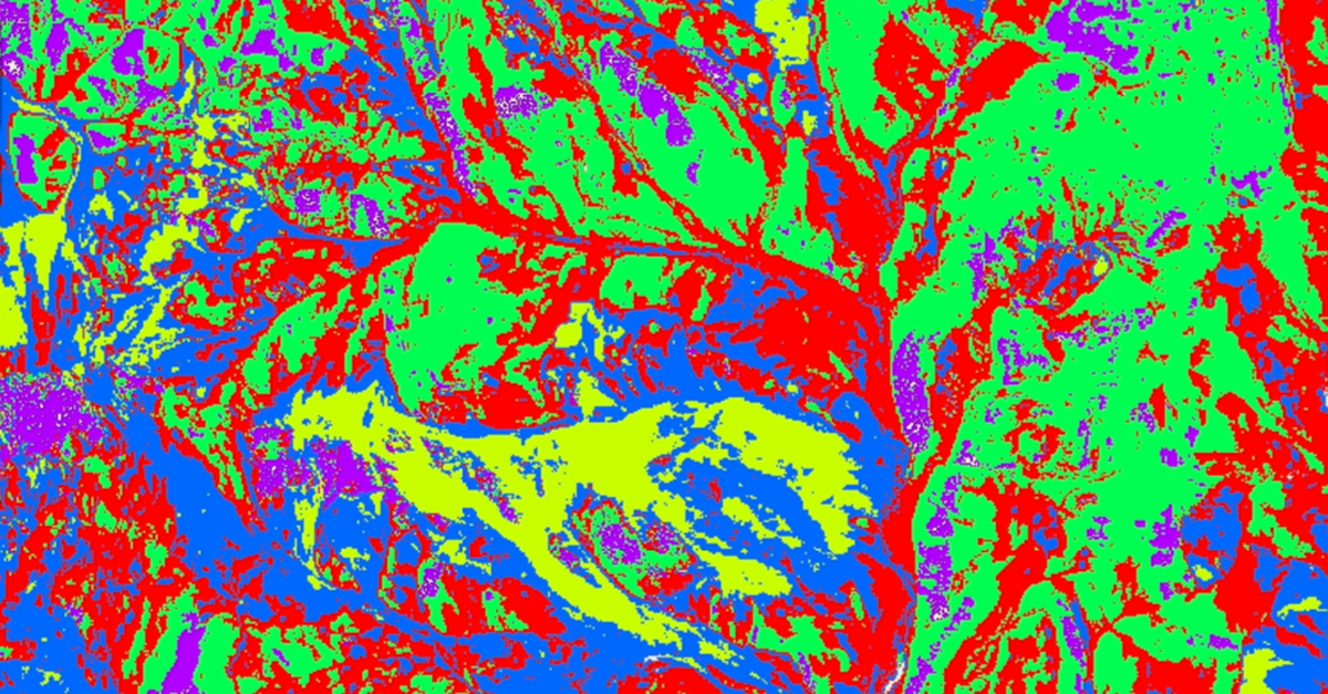
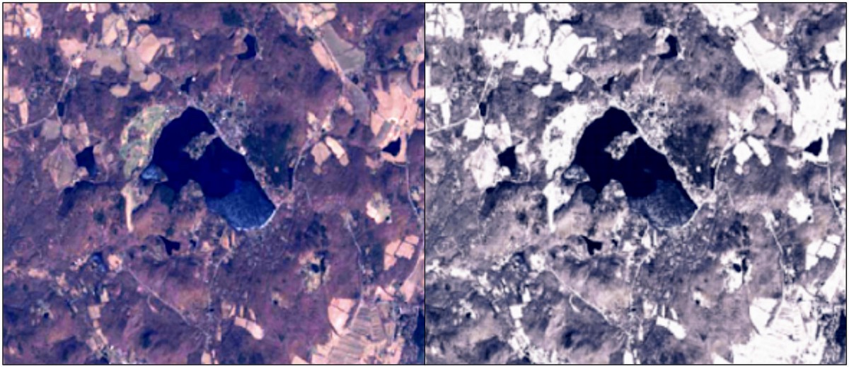
Using K-Means clustering to mask out areas you would like to remove from your imagery using the...

Article category: Consumer Goods, Science & Technology
Using advanced #geospatial intelligence, we bring you the #commodities market overview with...
Article category: Mining
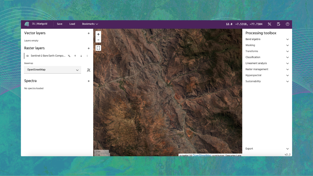
Introduction to our proprietary data sets - the Descartes Labs Bare Earth Composites
Article category: Mining
Welcome to Marigold. In these video snippets, we will provide you with an introduction and product...
Article category: Mining
In this blog, we will walk through how to create and deploy vegetation and water masks using the...

Article category: Consumer Goods, Science & Technology
Using advanced #geospatial intelligence, we bring you the #commodities market overview with...
Article category: Consumer Goods, Science & Technology
Using advanced #geospatial intelligence, we bring you the #commodities market overview with...
Article category: Mining, Science & Technology
Watch video for an engaging discussion around the advancements in remote sensing, specifically,...

Article category: Consumer Goods, Science & Technology
Using advanced #geospatial intelligence, we bring you the #commodities market overview with...
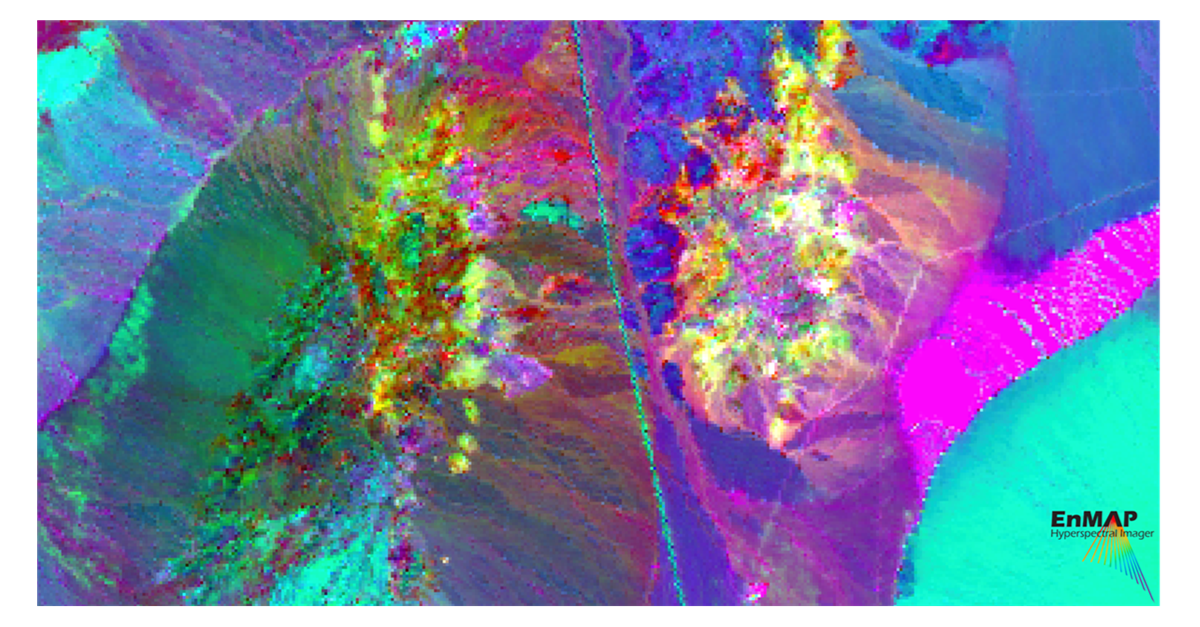
Article category: Mining, Science & Technology
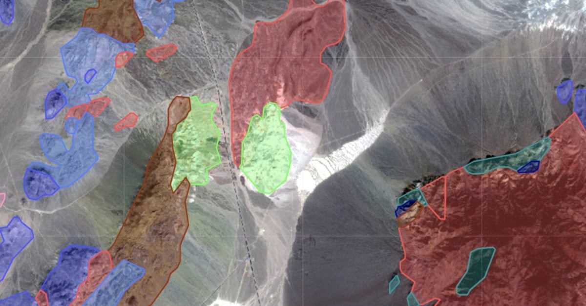
Impact on Mineral Mapping Accuracy with Increased Spatial Resolution: A Case Study of EnMap versus...
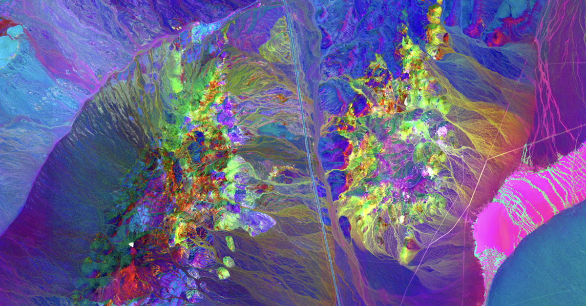
Article category: Mining, Science & Technology
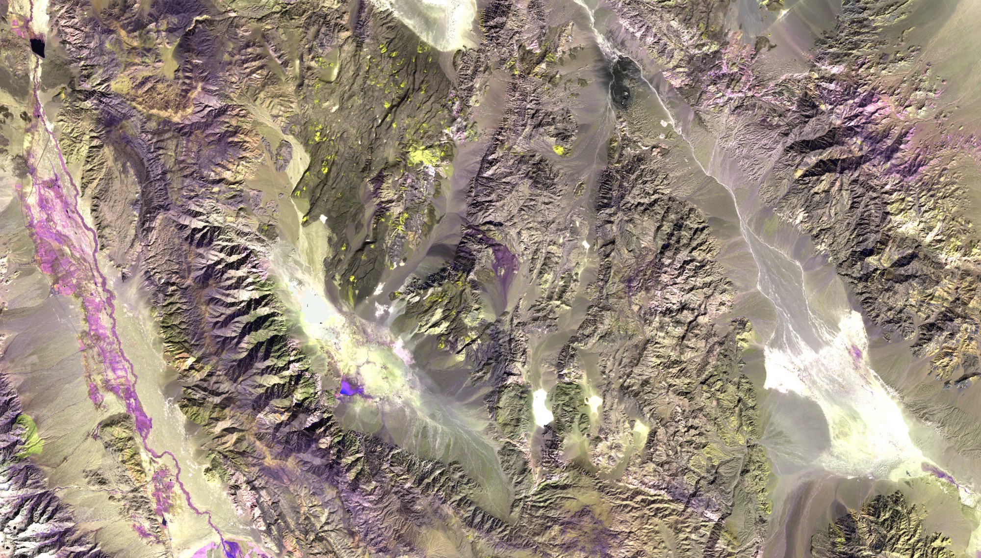
A case study over Cuprite, Nevada comparing Fused Bare Earth Composite and EnMAP Data
Article category: Consumer Goods, Science & Technology
Using advanced #geospatial intelligence, we bring you the #commodities market overview with...
Article category: Science & Technology, Company News
Descartes Labs Government selected EarthDaily Analytics as a supplier for their Earth observation...
Article category: Mining, Company News
Descartes Labs Wins Three of the 2024 Mining Technology Excellence Awards in the Innovation,...
Article category: Consumer Goods, Science & Technology
Using advanced #geospatial intelligence, we bring you the #commodities market overview with...
Article category: Consumer Goods, Science & Technology
Using advanced #geospatial intelligence, we bring you the #commodities market overview with...
Article category: Consumer Goods, Science & Technology
Using advanced #geospatial intelligence, we bring you the #commodities market overview with...
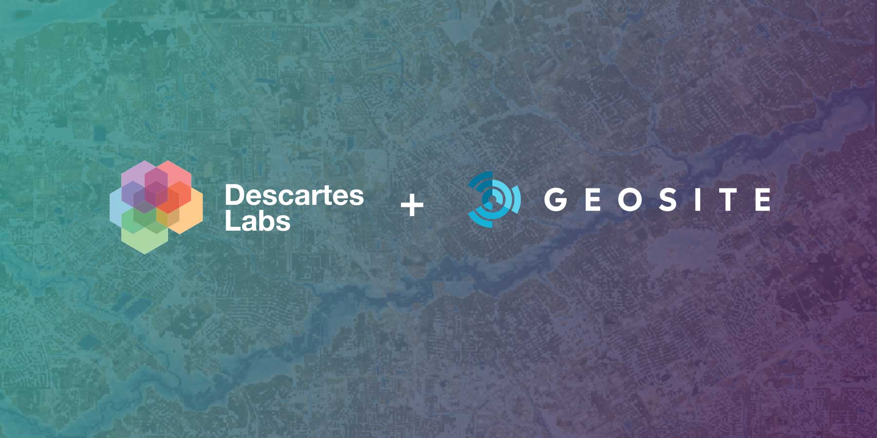
Article category: Company News
Descartes Labs acquires all of the operating assets of Geosite, a SaaS provider of geospatial...
Article category: Consumer Goods, Science & Technology
Using advanced #geospatial intelligence, we bring you the #commodities market overview with...
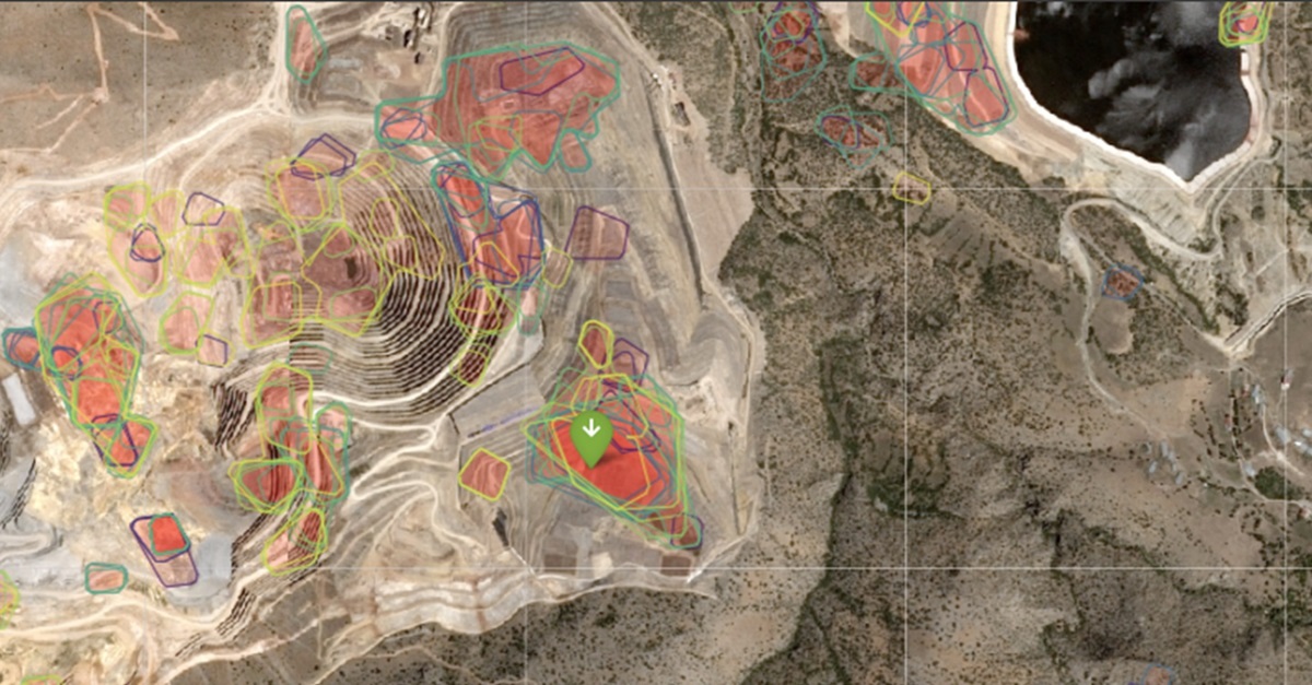
Article category: Mining, Science & Technology
A retroactive analysis of the Çöpler Mine disaster that occurred on February 13, 2024, using remote...
Article category: Consumer Goods, Science & Technology
Using advanced #geospatial intelligence, we bring you the #commodities market overview with...

Article category: Consumer Goods, Science & Technology
Using advanced #geospatial intelligence, we bring you the #commodities market overview with...
Article category: Consumer Goods, Science & Technology
Descartes Labs Market Insights for the Week of February 5, 2024.

Article category: Consumer Goods, Science & Technology
Descartes Labs Market Insights for the Week of January 22, 2024.
Article category: Science & Technology
Descartes Labs' Batch Compute, unlocks large-scale, complex geospatial workloads to quickly deploy...
Article category: Mining
This article highlights the exciting new user-requested features that are now available in the...

Article category: Consumer Goods
An ML/AI based digital twin of the globe’s cocoa supply chain to produce a highly robust series of...

Article category: Consumer Goods
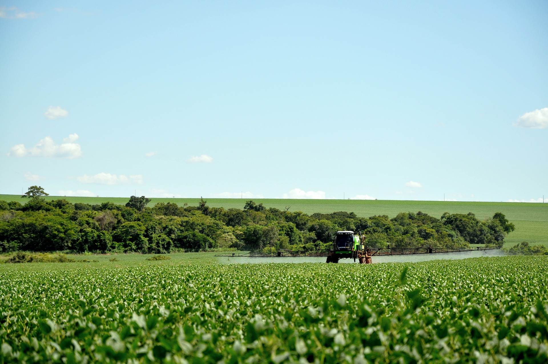
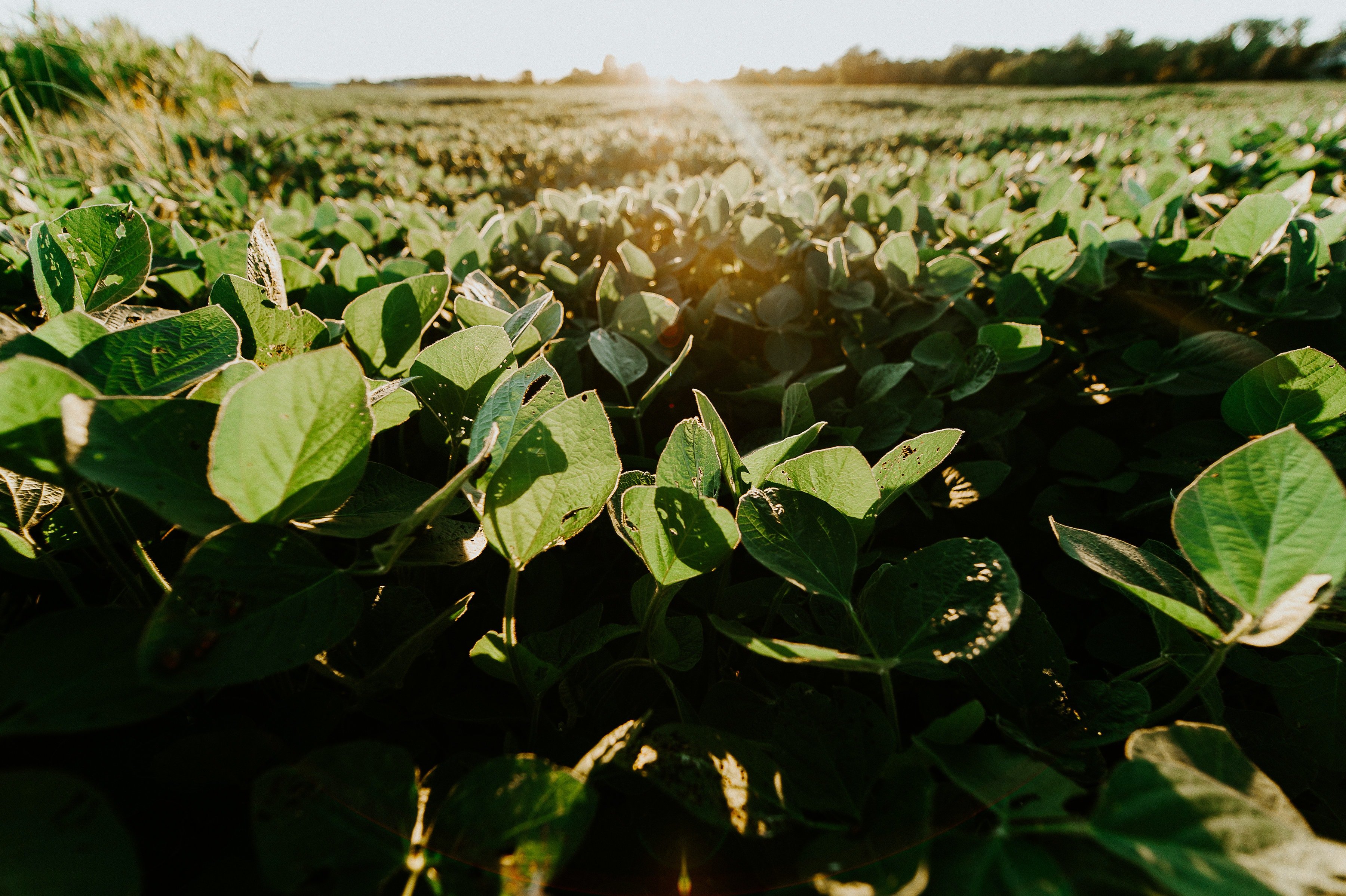
Case of soybeans: accurate weather forecasts, with machine learning, allow us to make crop...
Article category: Science & Technology
Leveraging satellite imagery for machine learning computer vision applications using the Descartes...
Article category: Company News
Descartes Labs, a new Comtech EVOKE technology member, to infuse power of AI, ML, predictive...
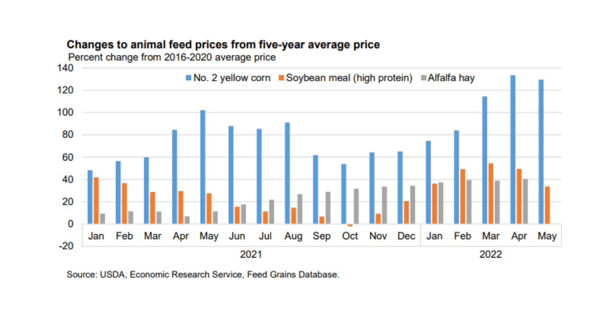
Article category: Consumer Goods
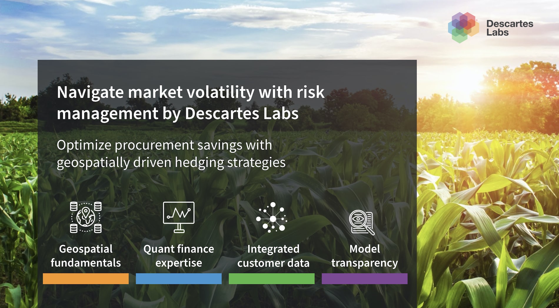
Descartes Labs can help you lower your procurement costs with our grains and feeds package.
Article category: Company News
Descartes Labs migrates to AWS infrastructure to rapidly analyze geospatial data for timely...
Article category: Consumer Goods
Descartes Labs Vegetable Oils market insights package helps procurement managers reduce input costs...
Article category: Mining, Science & Technology
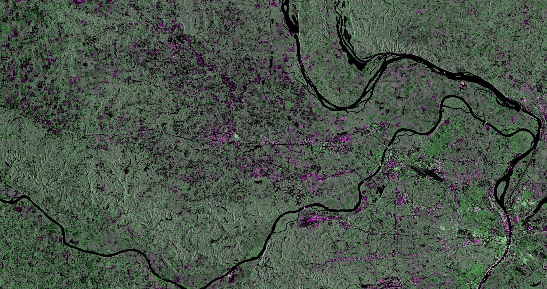
Descartes Labs combines automated Sentinel-1 satellite ingest, monitoring, and measurement using...
Article category: Mining, Science & Technology
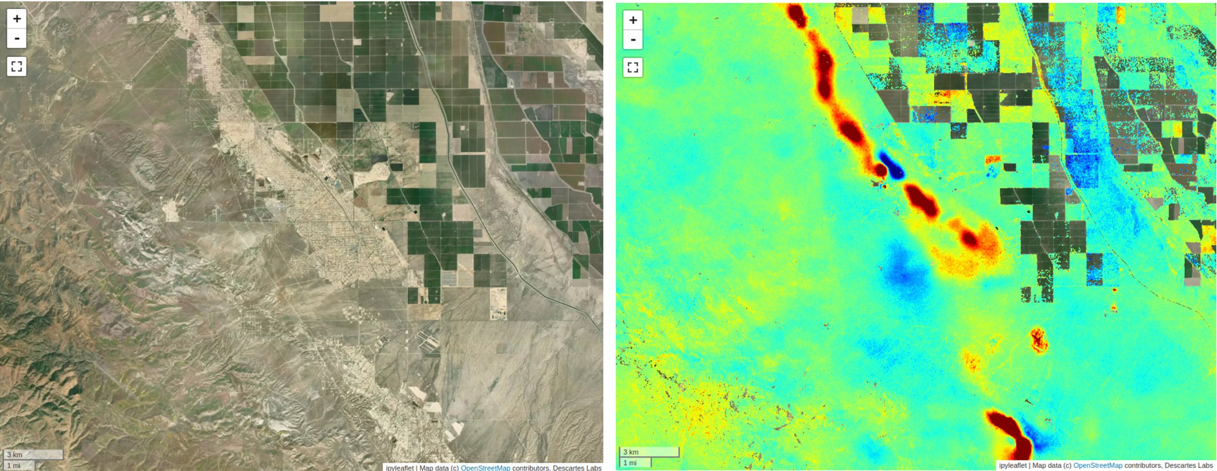
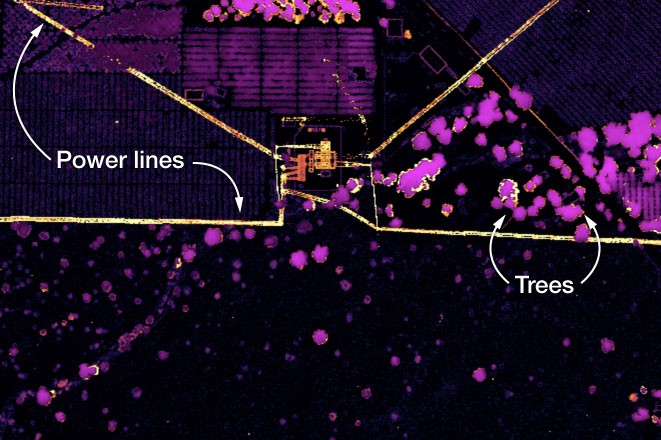
Descartes Labs uses interferometric products to a build global geospatial data product that detects...
Article category: Mining, Science & Technology
Discover salient features of our global InSAR product — ready to use for coherent change detection...
Article category: Mining, Science & Technology
In this post, we will describe Descartes Labs' SAR geocoding approach, which powers our global...
Article category: Mining, Science & Technology
Descartes Labs fast data access mechanisms for Sentinel-1 (SAR) data enable rapid global scale...
Article category: Mining, Science & Technology
Synthetic Aperture Radar (SAR) provides a valuable remote sensing tool, and this blog post will...
Article category: Consumer Goods
Learn how to use Sentinel-1 and data products within the Descartes Labs Platform for agricultural...
Article category: Consumer Goods, Company News
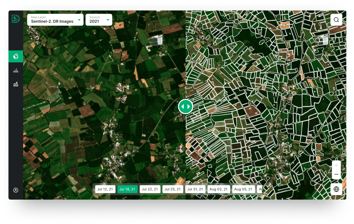
A new partnership with Digifarm, who uses neural networks & super resolved Sentinel-2 imagery to...
Article category: Consumer Goods, Climate Solutions
Descartes Labs' Applied Scientist Rose Rustowicz shares insights with members of The Sustainability...
Article category: Science & Technology, Climate Solutions
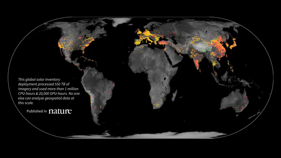
A first-of-its-kind global inventory of photovoltaic solar facilities built using satellite imagery...
Article category: Consumer Goods
Actionable price forecasts, market insights, and purchasing recommendations for London Cocoa,...
Article category: Science & Technology
The basics of understanding raster data, vector data, and coordinate systems.
Article category: Consumer Goods, Company News
We’re excited to announce a new partnership with Aspia Space to power its ClearSky product offering...
Article category: Science & Technology
In this article, we get back to the basics, to the fundamentals of remote sensing.
Article category: Science & Technology
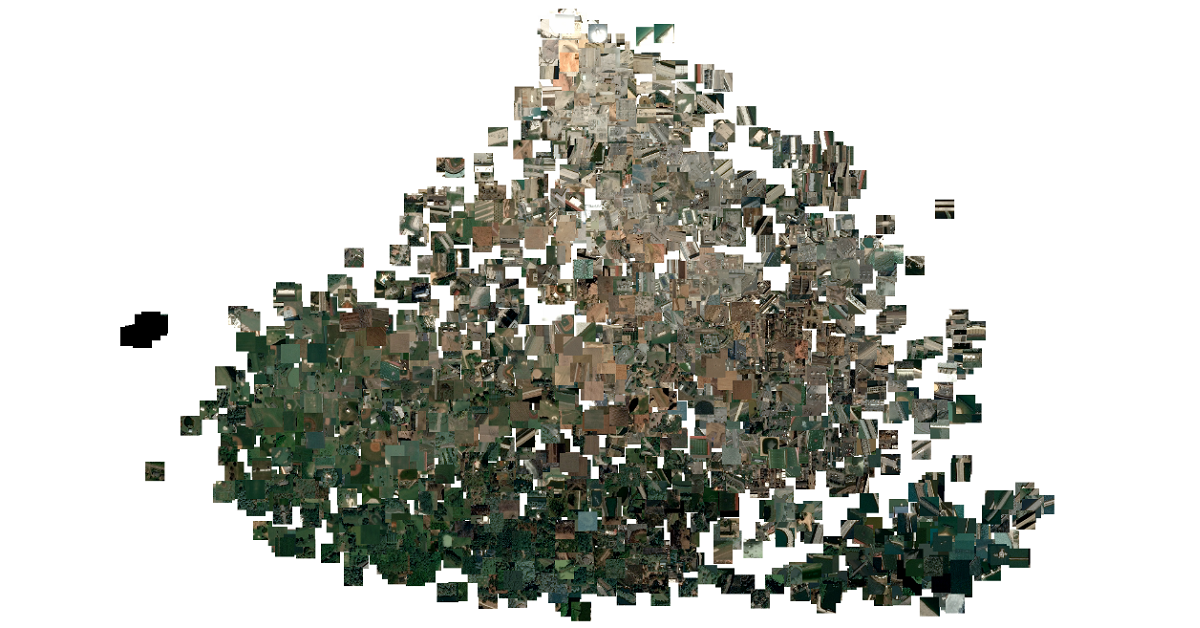
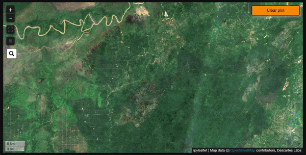
In this blog, we will show how you can go from zero data to thousands of annotated satellite images...
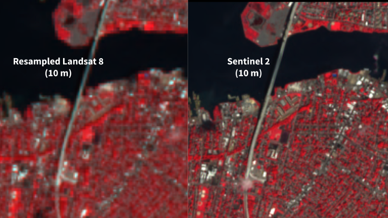
Article category: Science & Technology
We’re excited to announce a new partnership with Satellogic that brings sub-meter, high-frequency...
Article category: Consumer Goods, Climate Solutions
Presented during the AllianceBernstein ESG Conference on Biodiversity: Geospatial data can be a...
Article category: Consumer Goods, Climate Solutions
Discover how businesses with compliance rules and socially-conscious consumers & employees can...
Article category: Consumer Goods, Climate Solutions
Learn how we leverage key datasets from the Descartes Labs Platform to attribute risk from...
Article category: Climate Solutions
Descartes Labs discusses how its geospatial analytics platform creates data around sustainability...
Article category: Consumer Goods, Climate Solutions
Scaling regenerative agriculture is possible with remote sensing through a data-driven experience...
Article category: Science & Technology, Company News
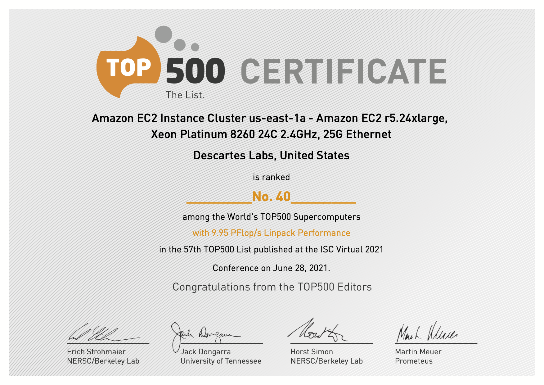
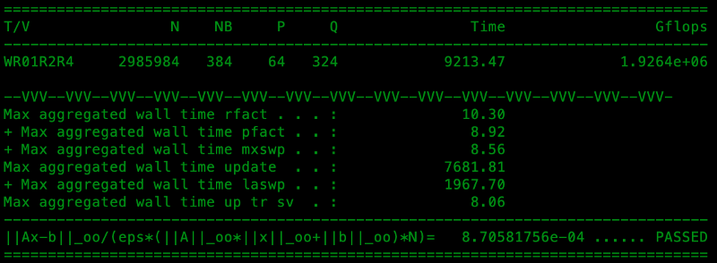
Descartes Labs Achieves #41in TOP500 with Cloud-based Supercomputing Demonstration Powered by AWS,...
Article category: Consumer Goods
Event-driven forecasting is helping to improve trading and procurement performance through...
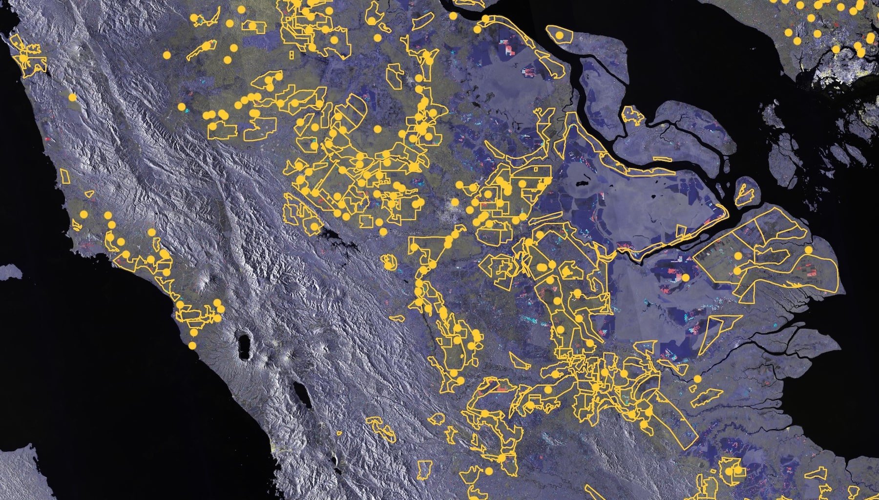
Article category: Mining
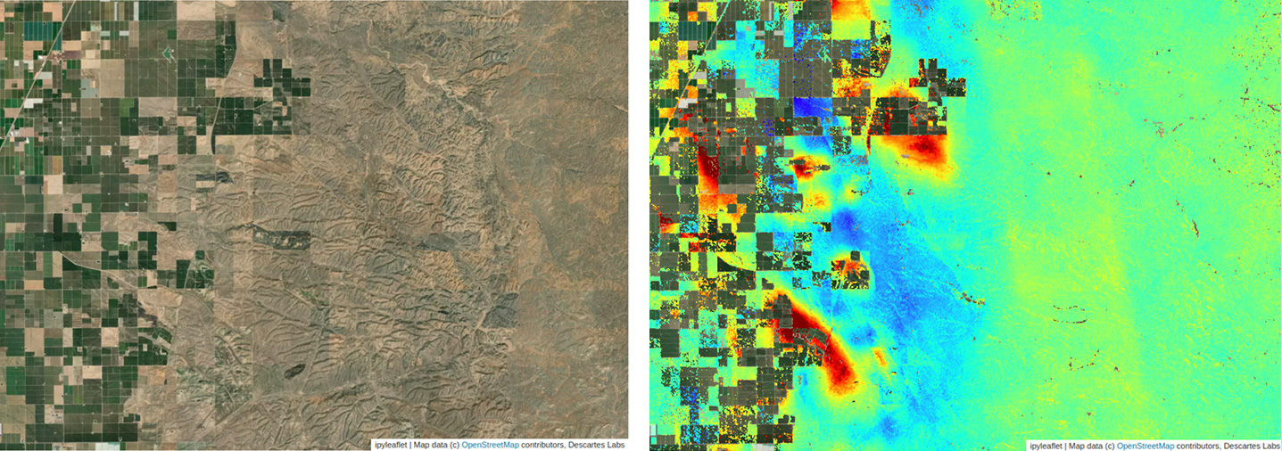
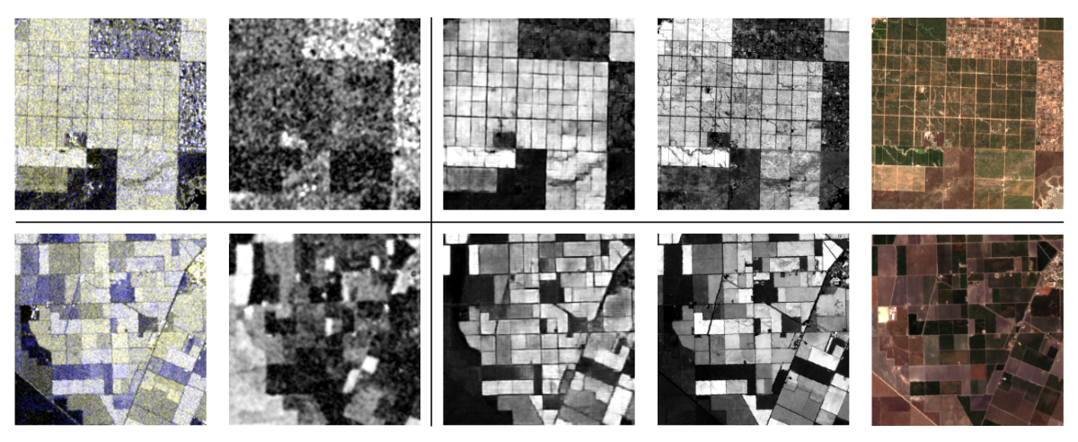
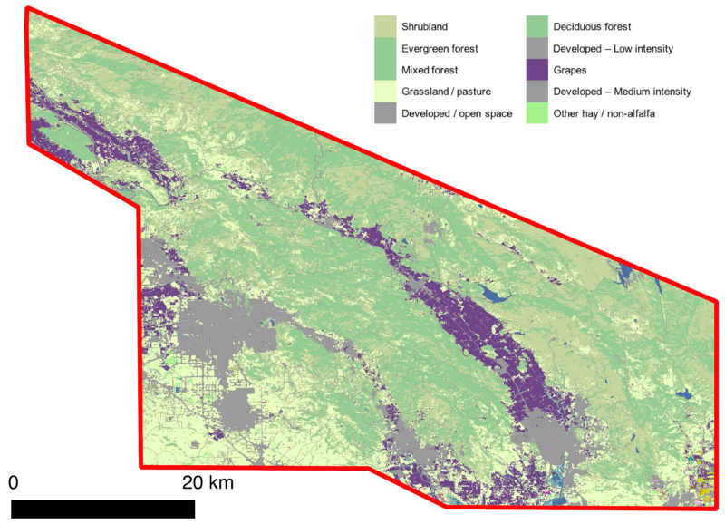
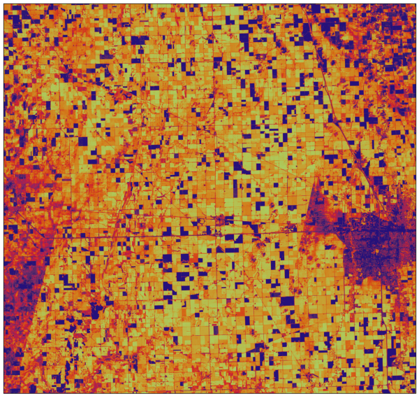
Sentinel-2 false color image of an area near Death Valley National Park, CA.Enhancing mineral...
Article category: Science & Technology, Climate Solutions
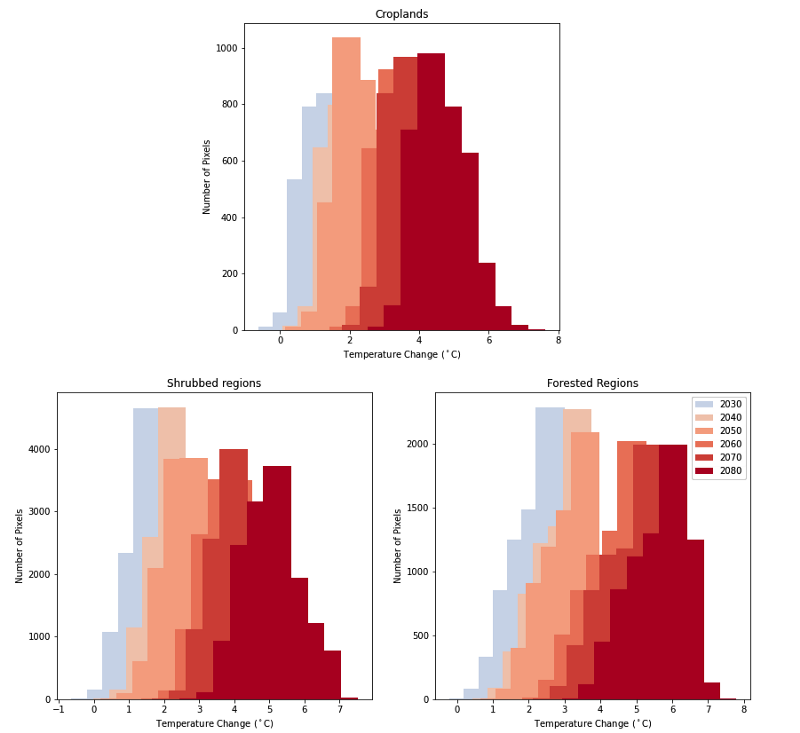
The combination of global climate models and land cover data can be used to estimate the regional...
Article category: Science & Technology
Terry completed the following work as a Descartes Labs intern this summer, where he worked with...
Article category: Science & Technology
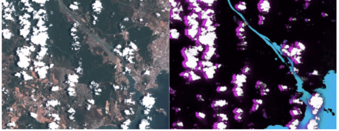
Non-snowy summertime imagery at left compared to synthetic snowy imagery over the same location at...
Article category: Consumer Goods
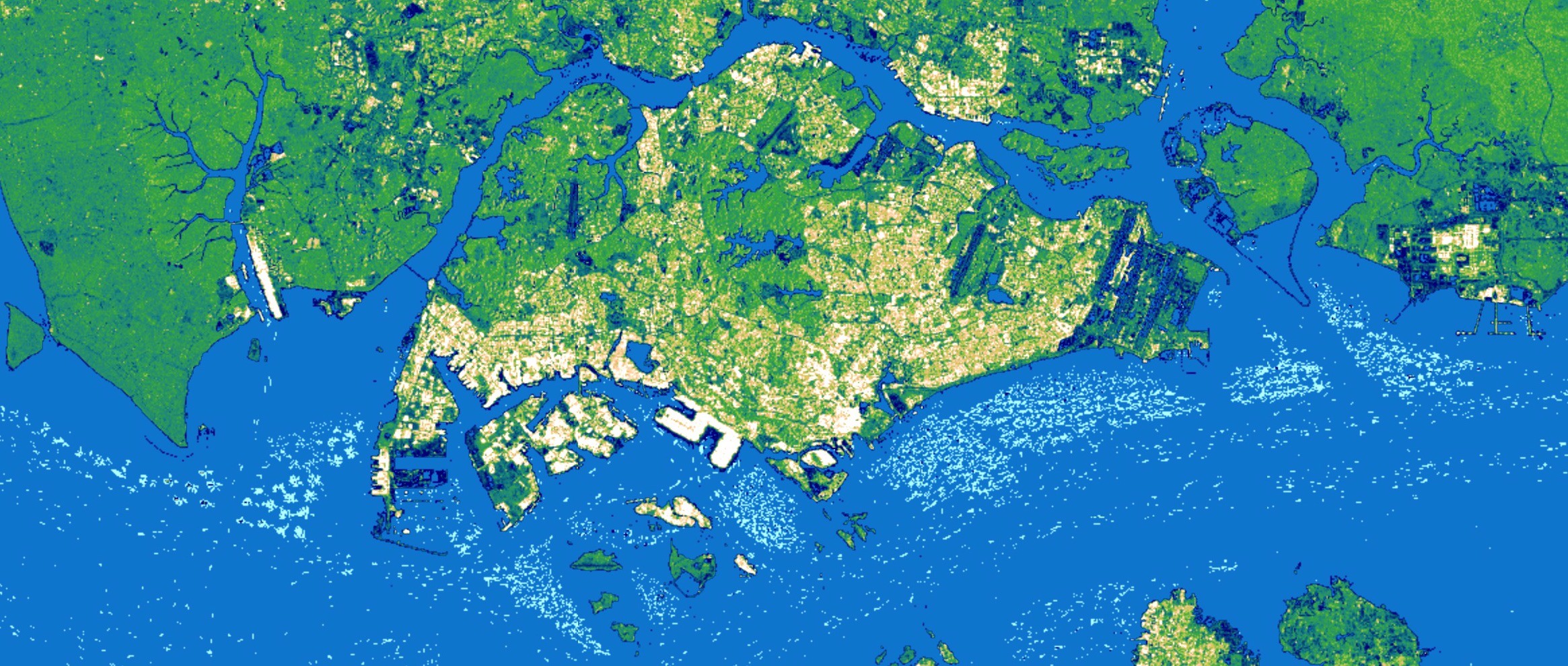
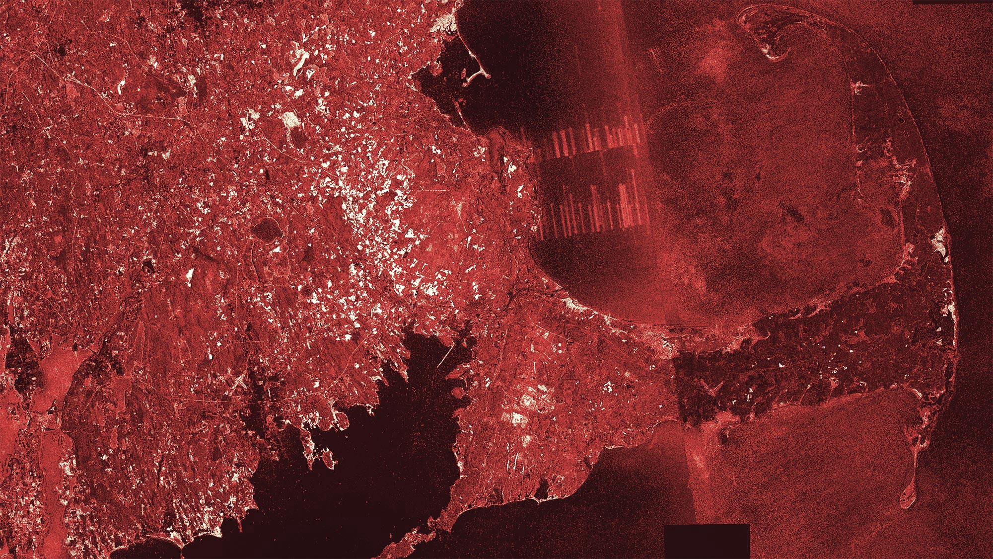
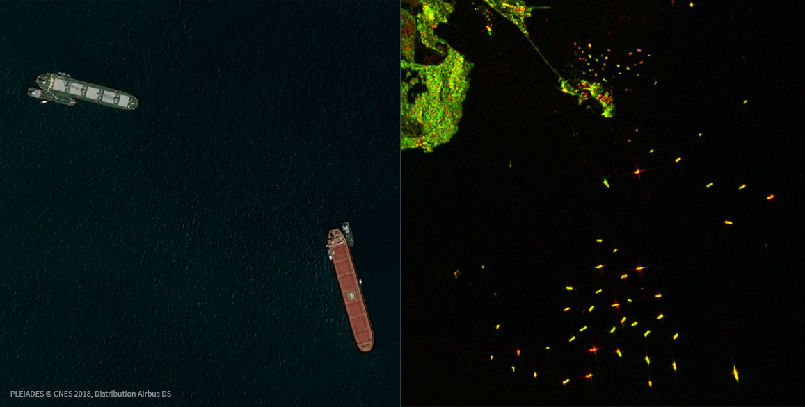
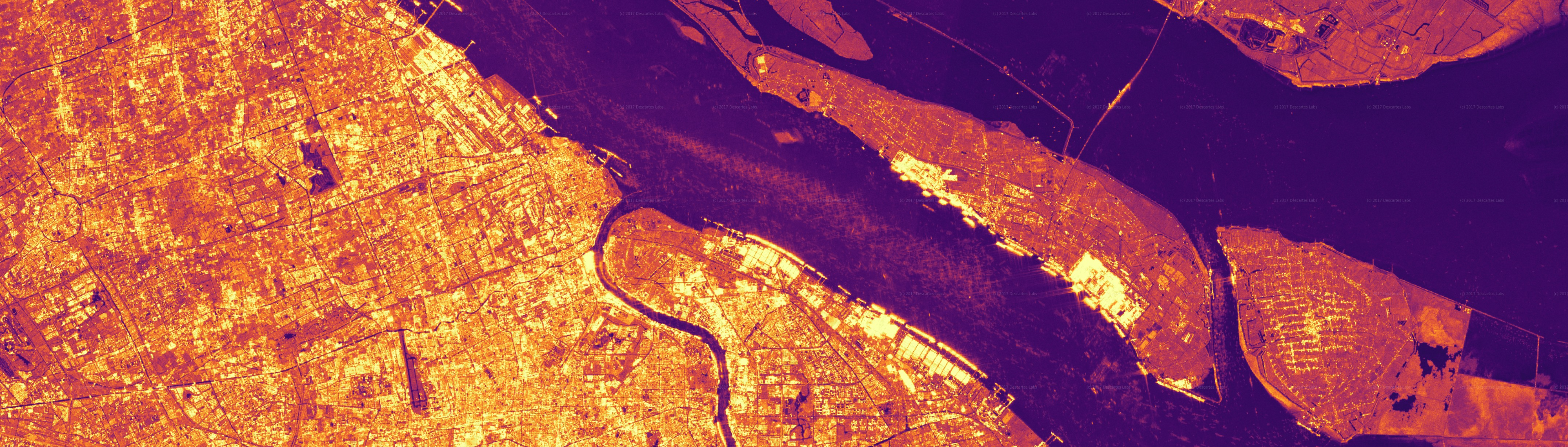
A three month Sentinel-1 SAR composite over Singapore with lighter colors capturing economic...
Article category: Science & Technology, Company News
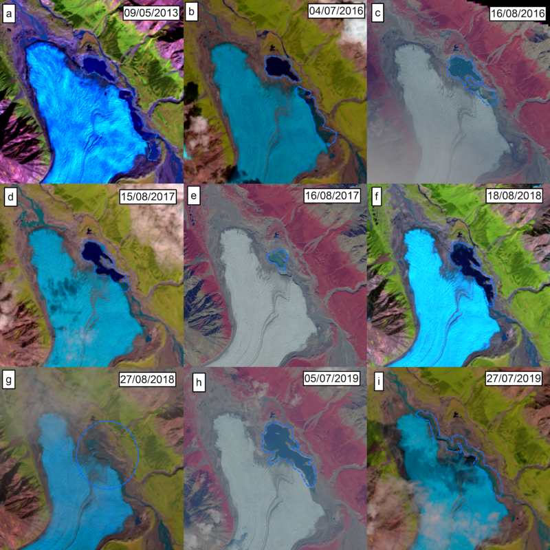
The Donjek Glacier has temporarily dammed the Donjek River multiple times during the last few...
Article category: Climate Solutions
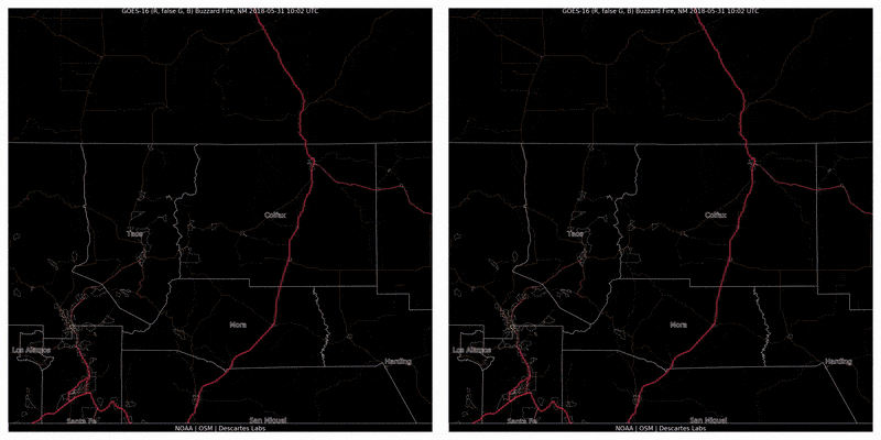
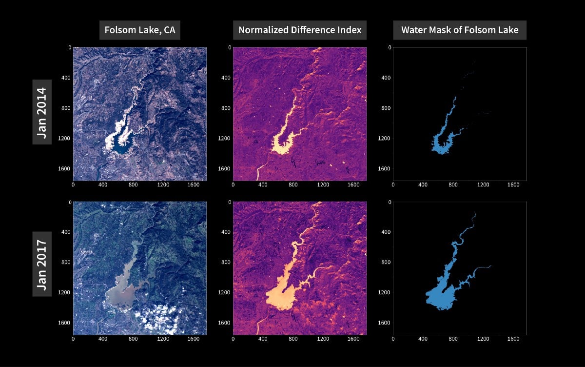
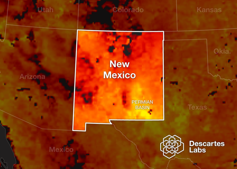
In 2018, approximately 360,500 acres burned across our headquarters’ state of New Mexico. After a...
Article category: Science & Technology
Review our aggregated mobility tracking methodology in our technical paper: Mobility Changes in...
Article category: Science & Technology
At Descartes Labs, we’ve been working at scale for years to solve some of the world’s hardest and...
Article category: Science & Technology
From a technological standpoint, the adoption of artificial intelligence (AI) into organizations’...
Article category: Science & Technology
National Geographic asked Descartes Labs if we could figure out a way to map every cranberry bog in...
Article category: Climate Solutions
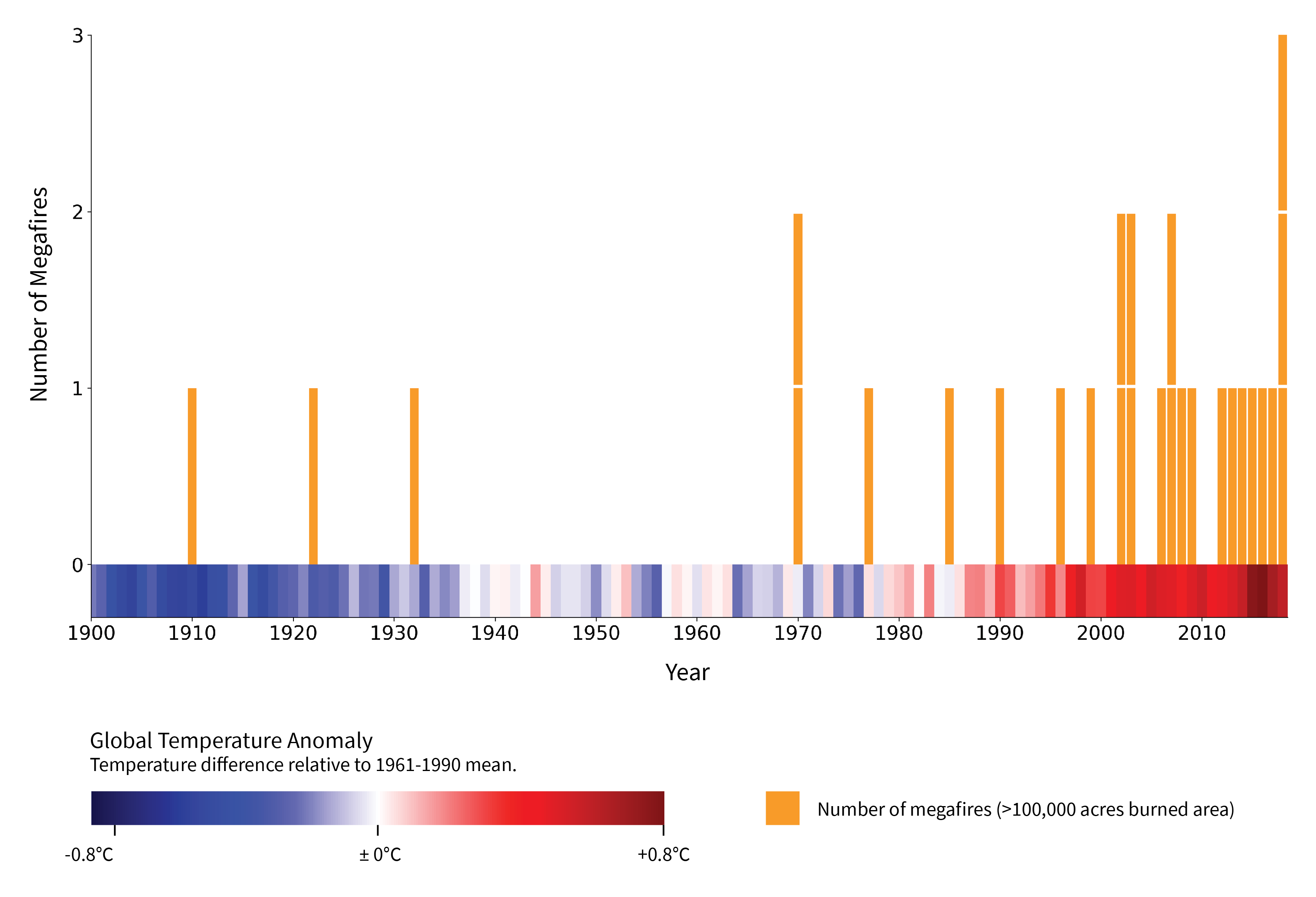
Megafires, defined by the US Forest Service as wildfires that burn over 100,000 acres, are...
Article category: Science & Technology
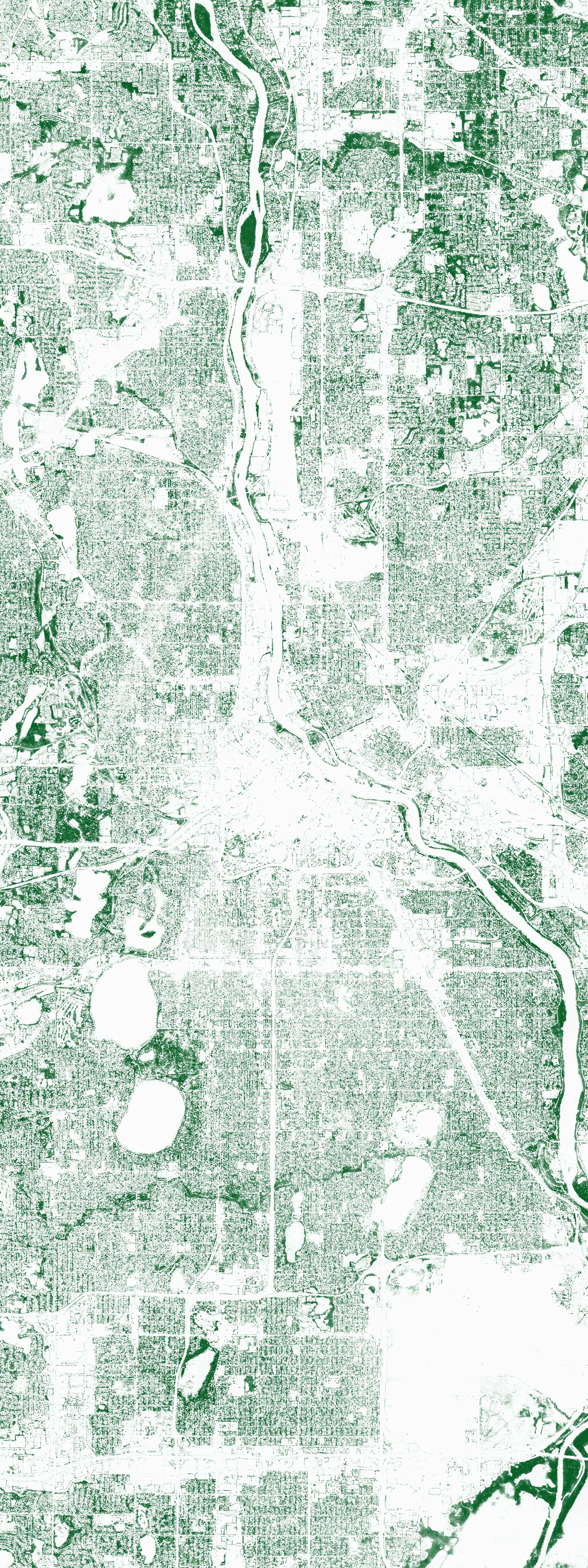
Cities across the northeast regularly experience warmer temperatures than rural areas in this MODIS...
Article category: Company News
There’s never a dull moment over here at Descartes Labs. Between hosting the 2030 Governor’s Energy...
Article category: Company News
Aside from Santa Fe's unique architecture, one of the things that sets it apart from other cities...
Article category: Climate Solutions
Today we’re excited to announce that Descartes Labs will create mapping and modeling capabilities...
Article category: Climate Solutions
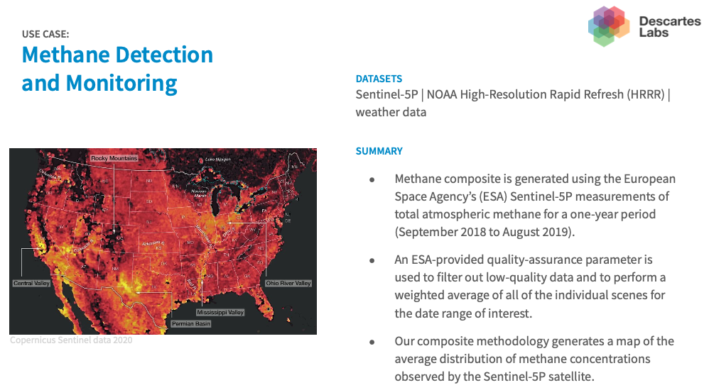
The European Space Agency’s launch of the Sentinel-5P satellite in October of 2017 ushered in a new...
Article category: Science & Technology
Descartes Labs aims to improve science around the world with free Platform API access for...
Article category: Science & Technology
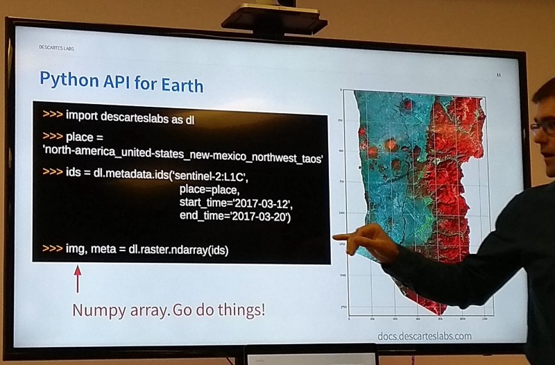
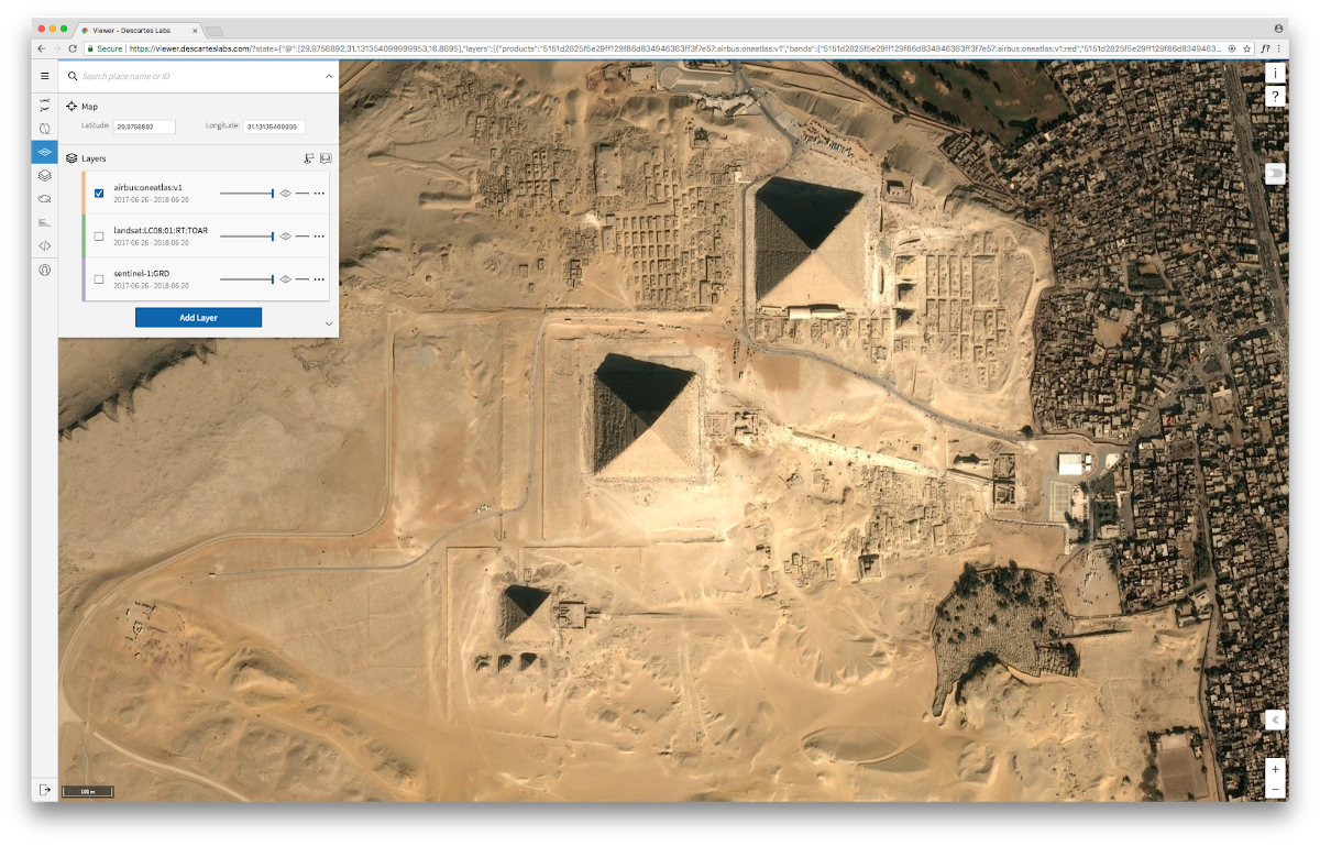
If you’ve ever gone online to find your favorite spot on a map and, upon zooming in, you were left...

Article category: Company News
We are thrilled to welcome Suzi McBride as our first independent director. Descartes Labs has an...
Article category: Company News
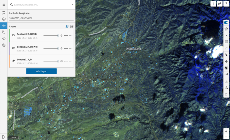
If you’ve never been to the city of Santa Fe, you still might have a loose sense of what it’s like...
Article category: Climate Solutions
Technology and risk-based modeling may soon put the world on a path to eliminate the concept of...
Article category: Science & Technology
Descartes Labs builds one of the world’s TOP500 fastest supercomputers and the first system on the...

Article category: Science & Technology, Climate Solutions
Earth as a blue marble rolling around in space, made possible with unique observations by DSCOVR...
Article category: Company News
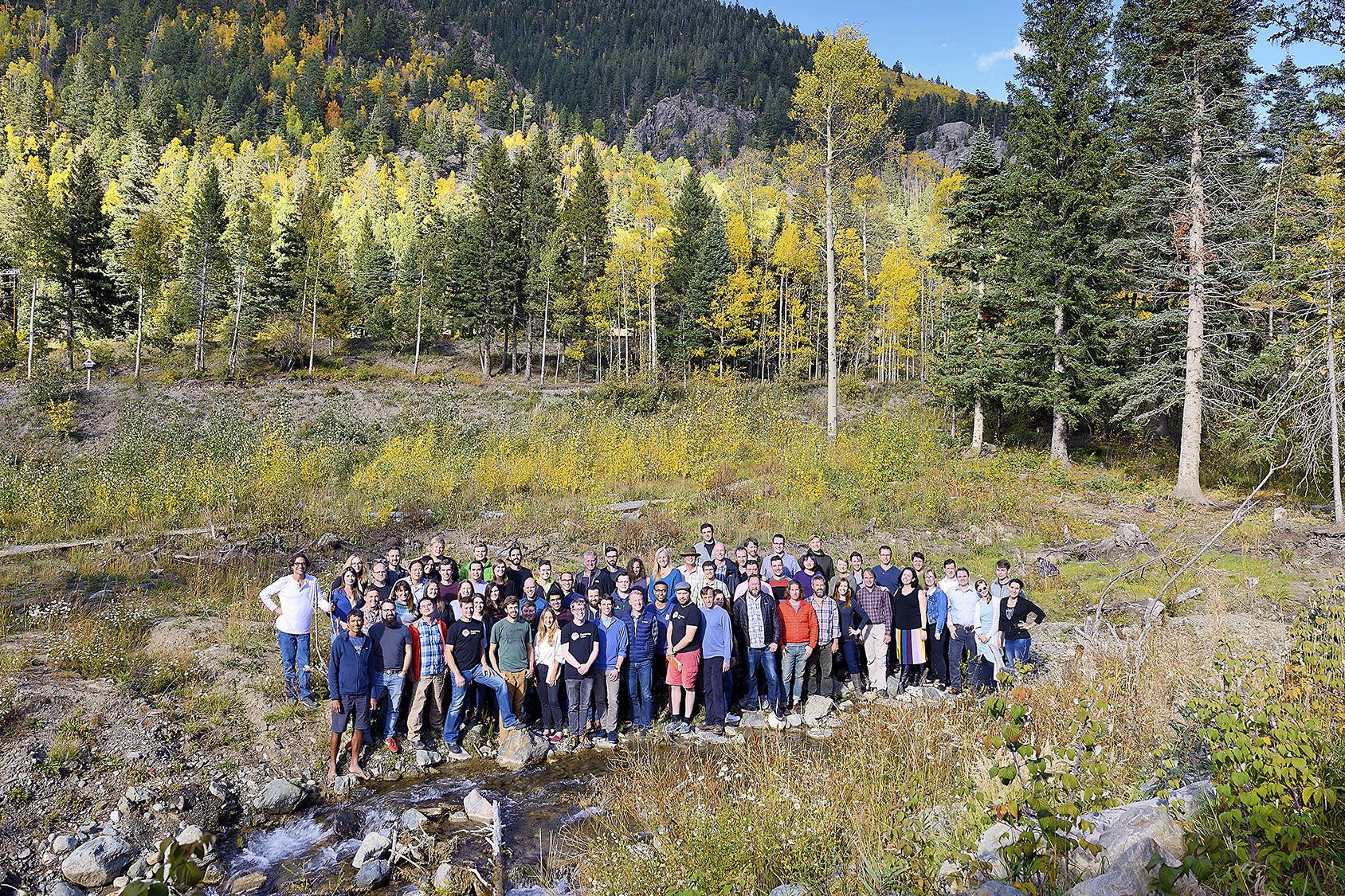
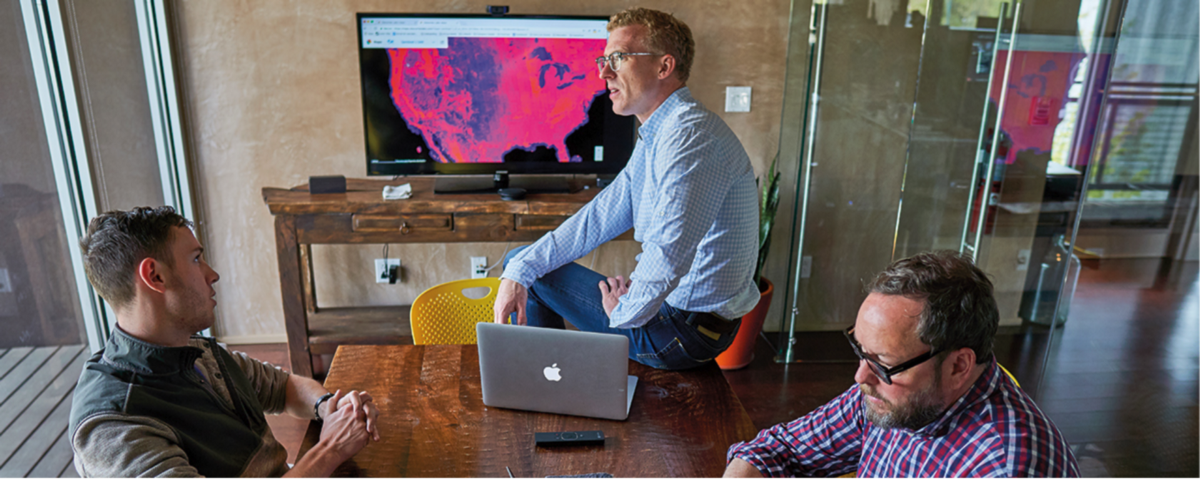
Descartes Labs teamAs Descartes Labs grows rapidly, we’re constantly adding to the executive team...
Article category: Science & Technology
The Descartes Labs Platform runs on Kubernetes and scales from hundreds to tens of thousands of...
Article category: Science & Technology
Leveraging information both visible and invisible to the naked eye, Descartes Labs is using an...
Article category: Science & Technology
Let’s cut to the chase. Artificial Intelligence (A.I.) is a buzzword that is applied to so many...
Article category: Consumer Goods
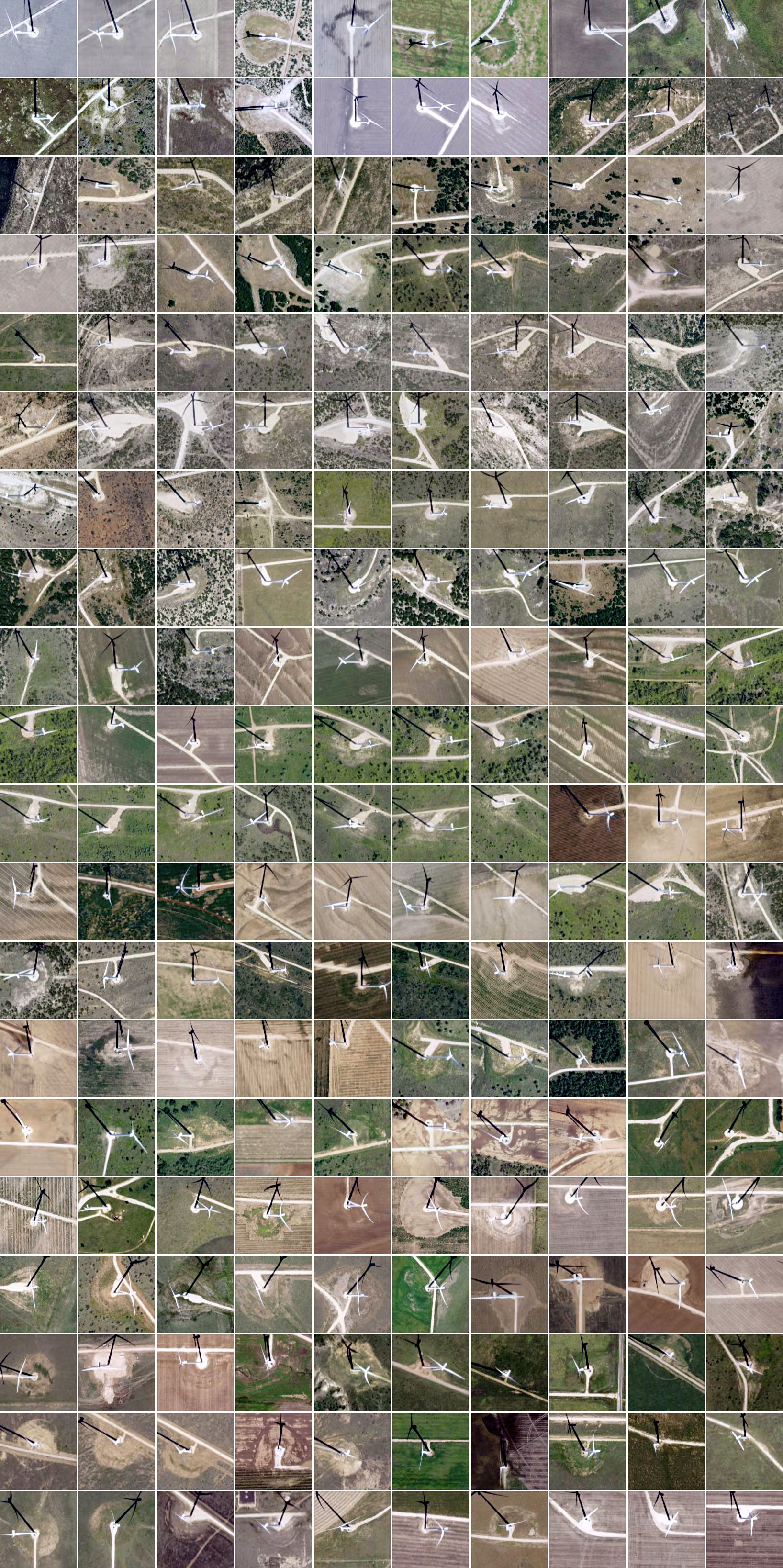
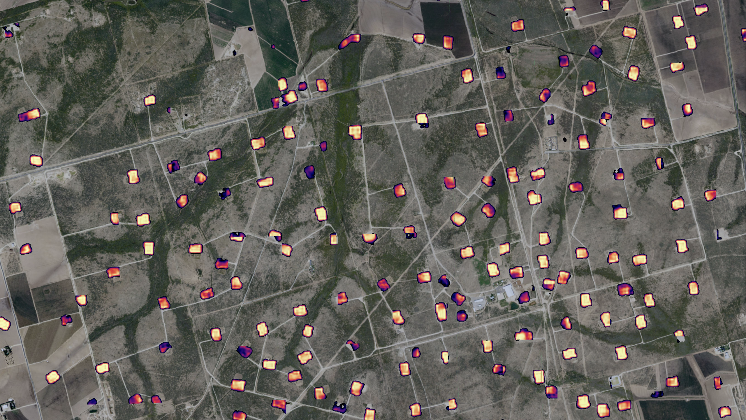
The probability output of a deep learning computer vision model which detects and segments well...
Article category: Consumer Goods
At Descartes Labs, we got our start modeling agricultural yields using data from satellites. Our...
Article category: Science & Technology, Climate Solutions
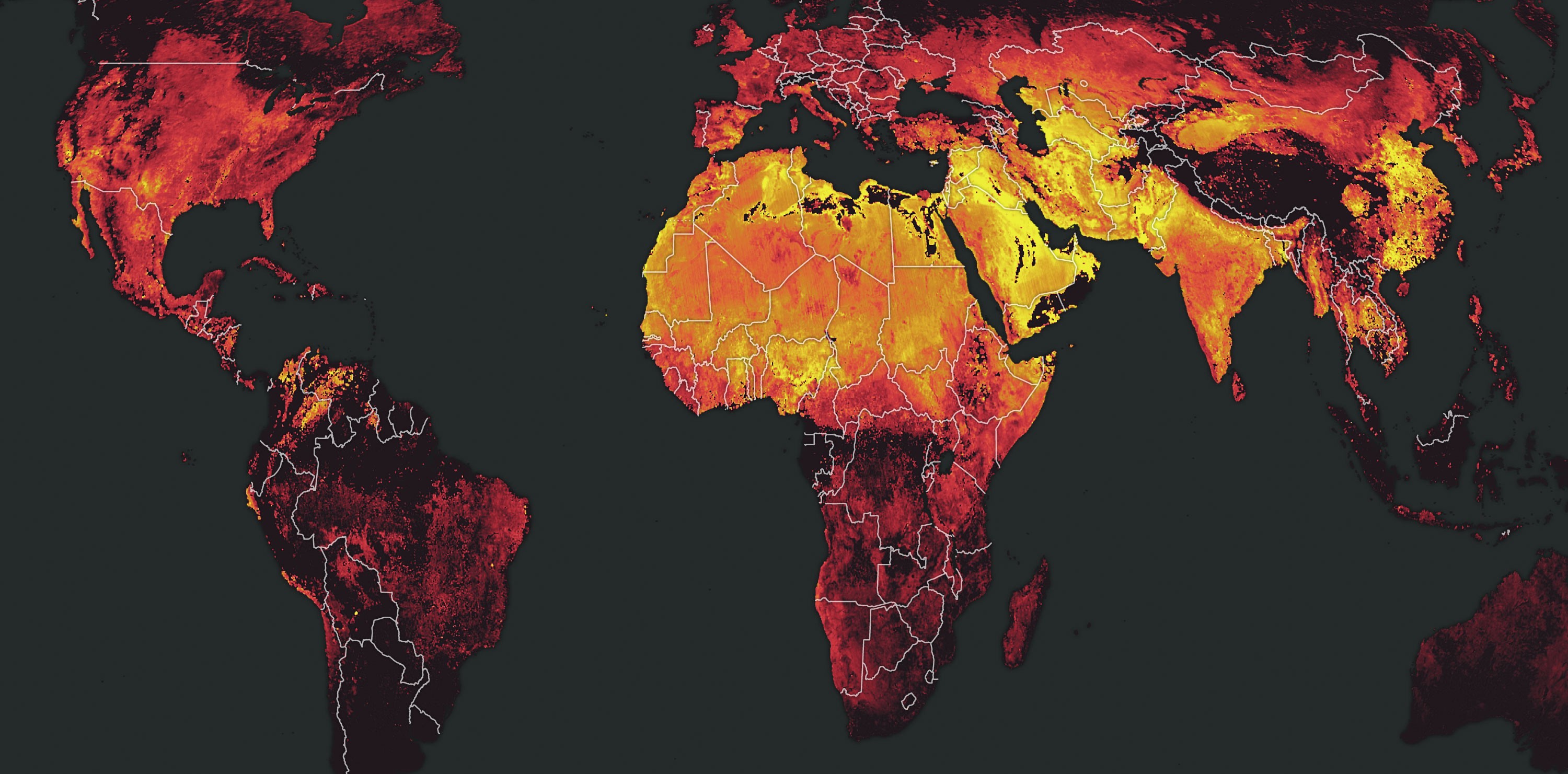
With all of the fossil fuels burned by humans, we take a look at NO2 composites around the globe...
Article category: Science & Technology, Climate Solutions
How do we fill in the gaps between official street tree census and trees in parks and on private...
Article category: Science & Technology
It is time for a Master Data Management (MDM) system for geospatial data. A platform that...
Article category: Company News
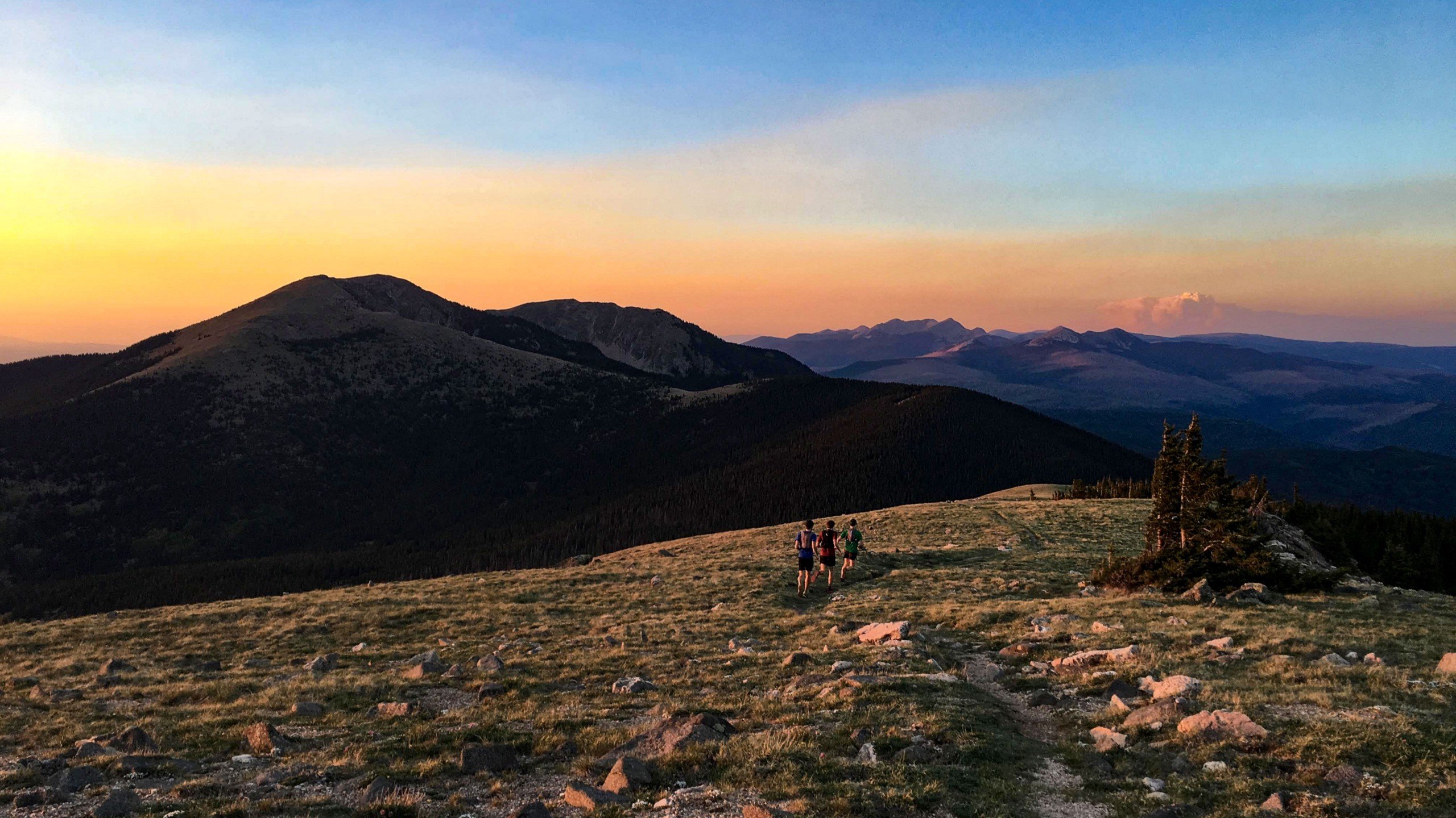
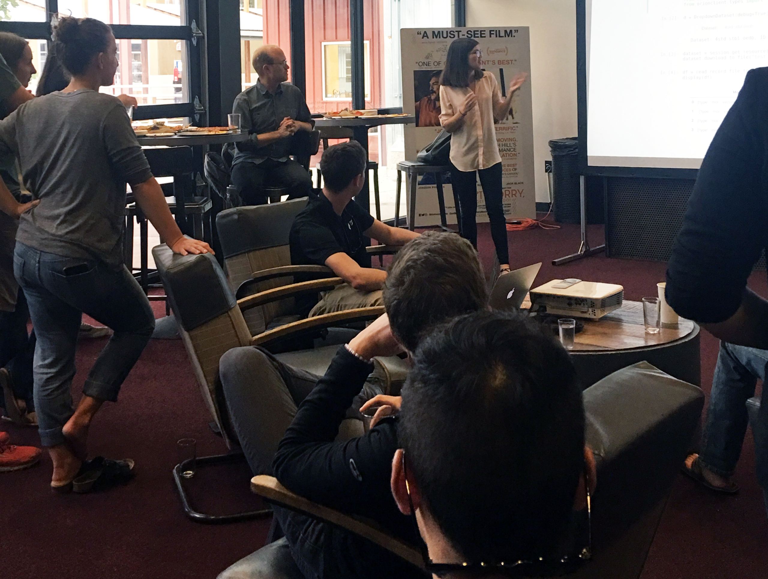
Celebrating National Intern Day on July 26th with our intern team at the Violet Crown in Santa FEWe...
Article category: Company News
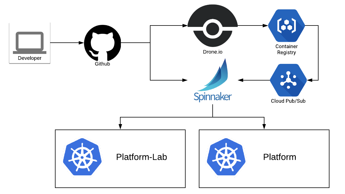
Here are Descartes Labs' key takeaways from Spinnaker Summit 2018.
Article category: Science & Technology, Company News
What brought together a 153-year-old grain trader and a tech startup in an office full of bean bag...
Article category: Company News, Government
Today we’re excited to announce that DARPA (Defense Advanced Research Projects Agency) has selected...
Article category: Science & Technology, Company News
About 15 months ago, Descartes Labs entered beta to gather feedback from customers on our progress...
Article category: Science & Technology, Climate Solutions
Our Wildfire Watch System, @WildfireSignal, went live on Twitter today. Our applied science team is...
Article category: Consumer Goods
Supply chain is an interesting term. What is it? It is the chain of events, vendors, logistics,...
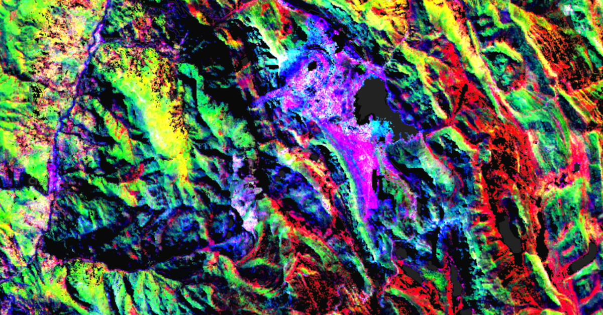
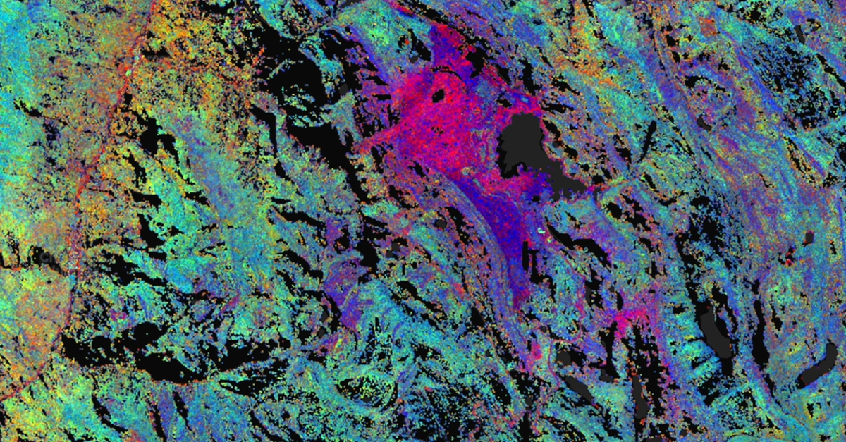
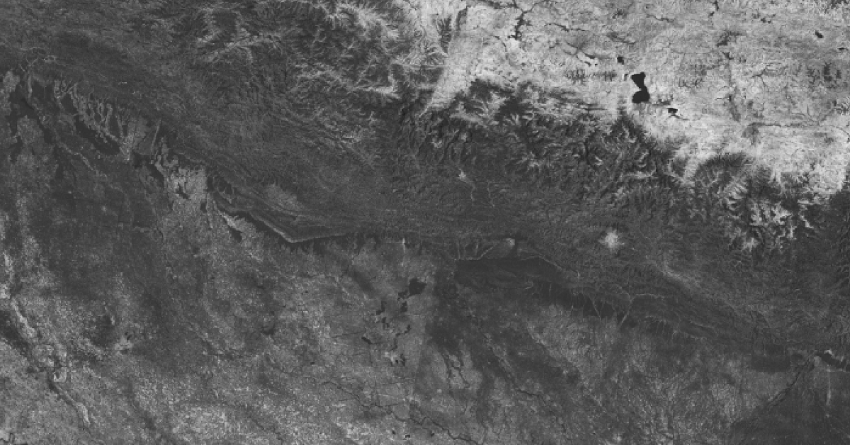
Article category: Science & Technology, Climate Solutions
Figure 1: An interferogram from a pair of collections made during descending passes. The fringes to...
Article category: Science & Technology, Climate Solutions
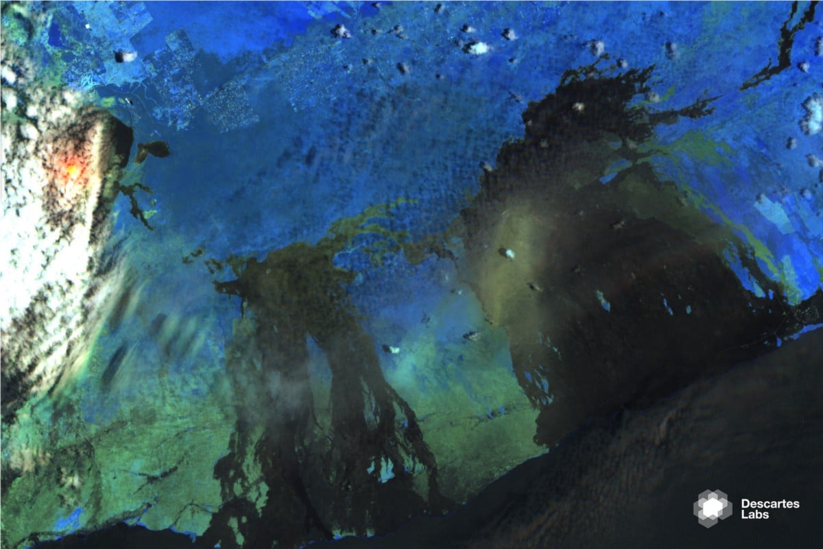
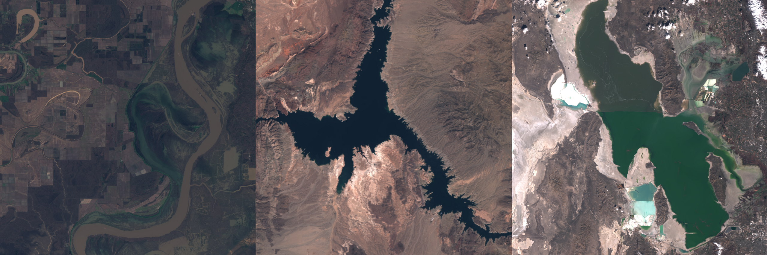
The many shapes and colors of water, from a silt-laden river in Louisiana to Lake Mead, Nevada to...
Article category: Science & Technology, Climate Solutions
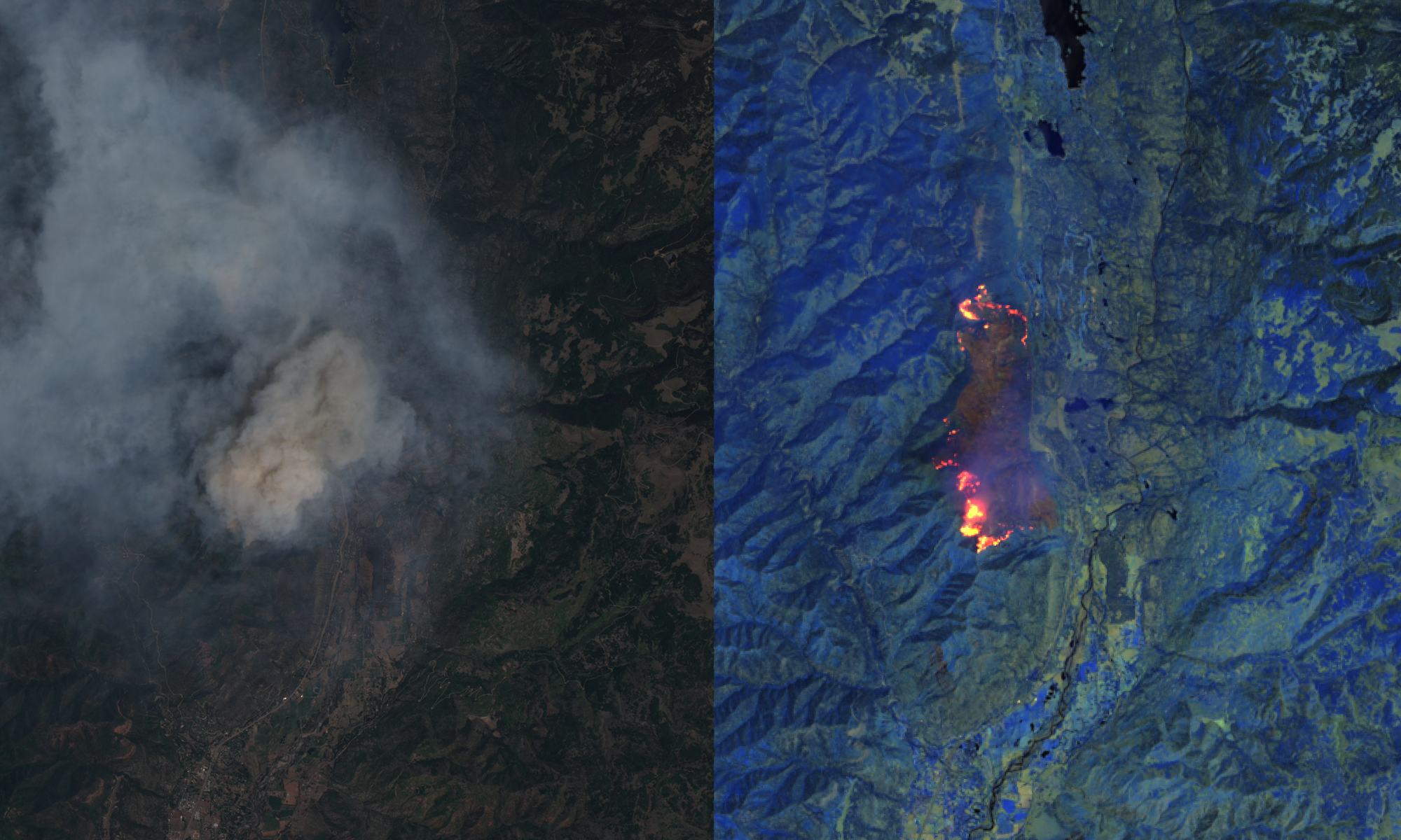
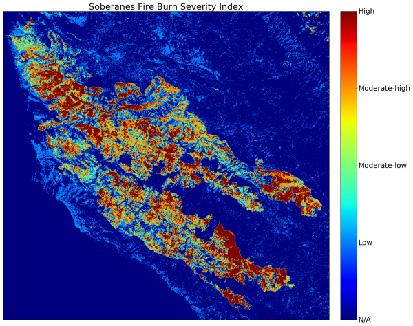
Over the past week, we’ve watched in horror as wildfires tore across Northern California. With a...
Article category: Science & Technology
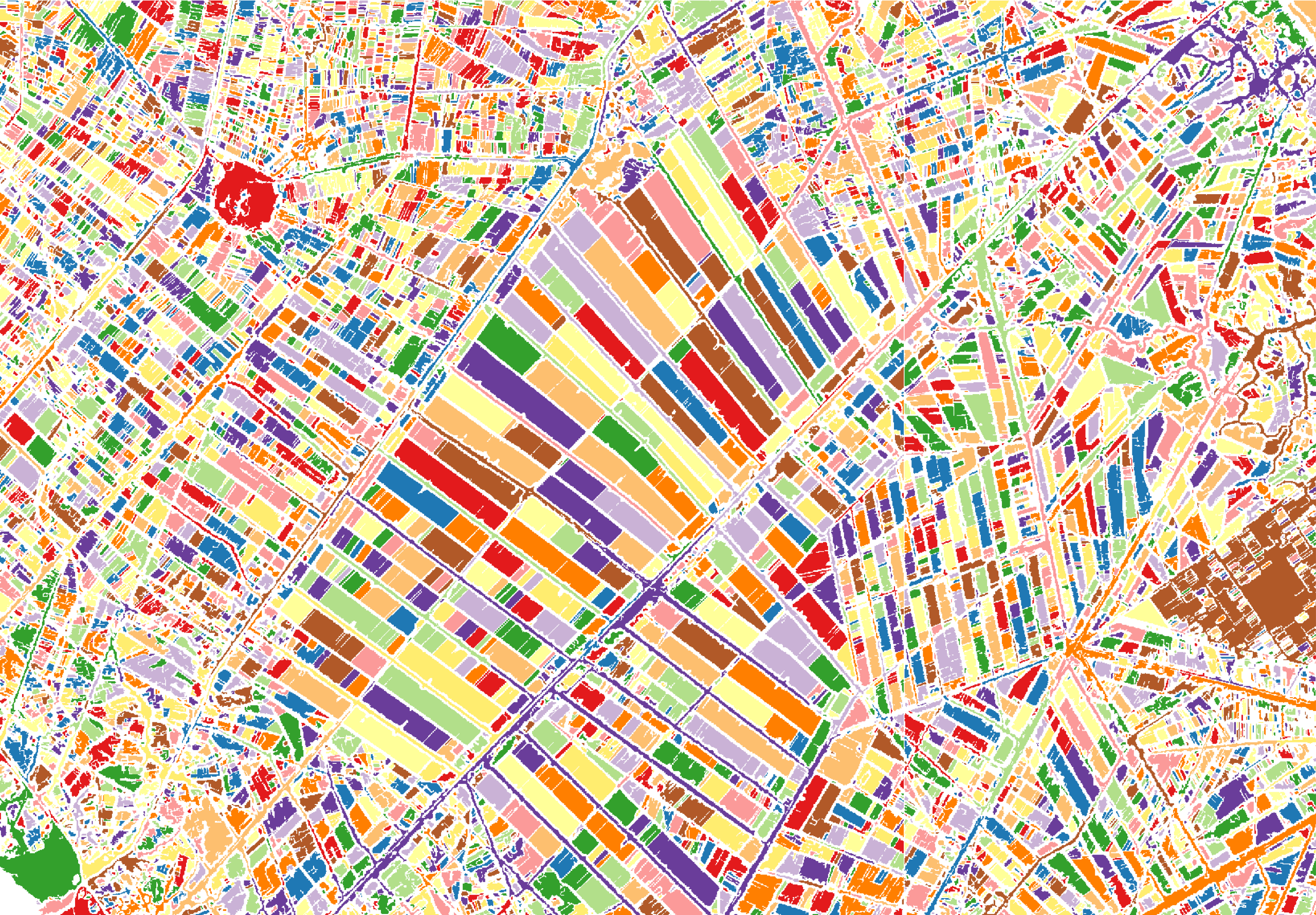
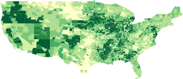
A choropleth map is a “thematic map in which areas are shaded or patterned in proportion to the...
Article category: Company News
Today, we’re excited to announce Descartes Labs $30M Series B round of financing led by March...
Article category: Science & Technology, Climate Solutions
In the wake of yet another season of significant wildfire activity across the US and in particular...
Article category: Science & Technology
There are at the very least six separate global land cover mapping efforts. The European Space...
Article category: Company News
Starting today, Descartes Labs is accepting applications for Beta access to the most advanced...
Article category: Science & Technology
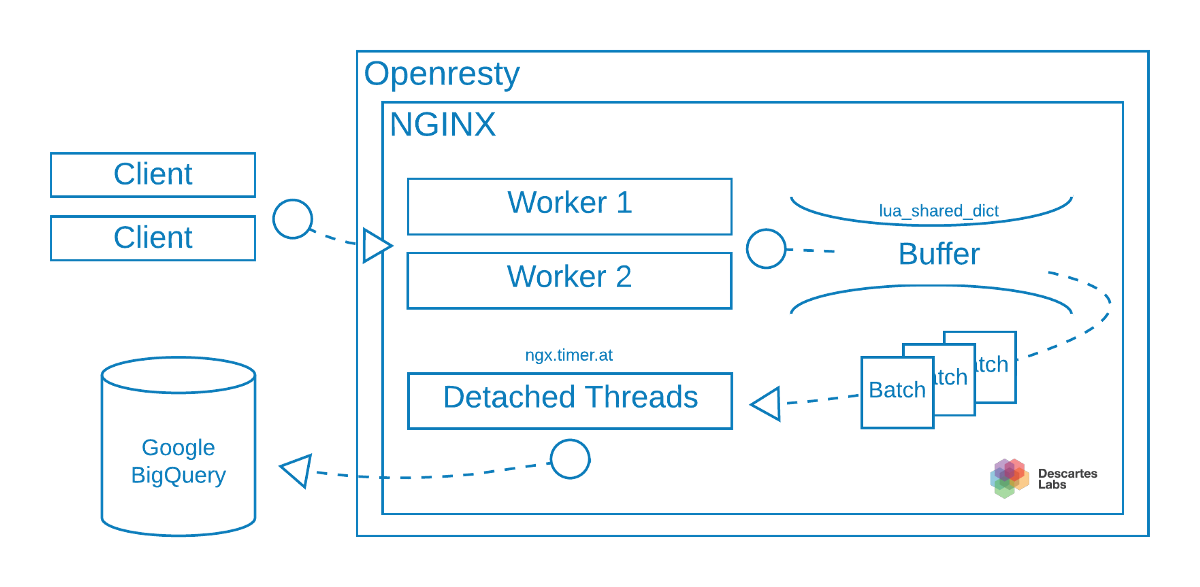
Here at Descartes Labs, we have been using the microservice architecture in building out our...
Article category: Company News, Government
Does widespread hunger caused by food shortages contribute to conditions that lead to regional...
Article category: Science & Technology
A look at the technology behind GeoVisual Search.
Article category: Science & Technology
Today, we’re unveiling a technology demonstration of machine learning at global scale, which we...
Article category: Science & Technology
View three new satellite imagery-based maps of the earth, made at Descartes Labs. These are global...
Article category: Consumer Goods
Descartes Labs’ weekly forecast for U.S. corn and soy yields. Last month, we were excited to unveil...
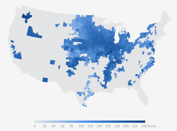
Article category: Consumer Goods
Corn yields by county, updated weekly on www.descarteslabs.comToday, Descartes Labs is releasing...